Greymouth tornado

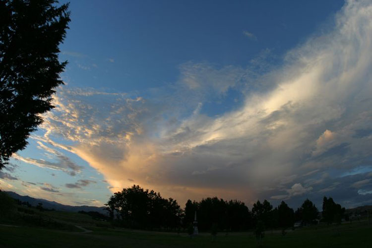
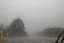
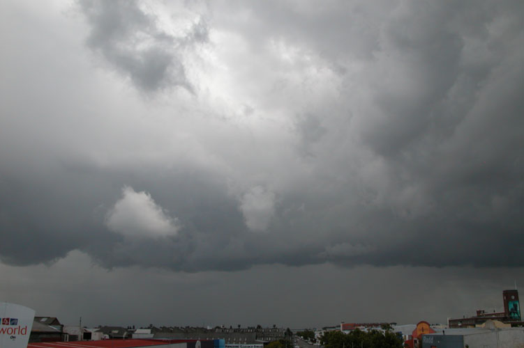
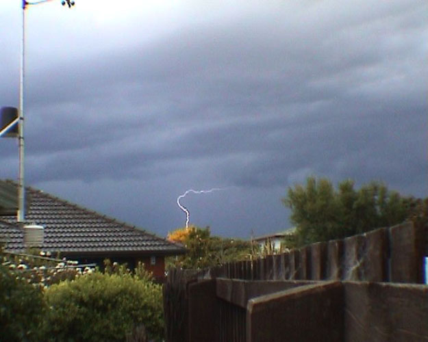
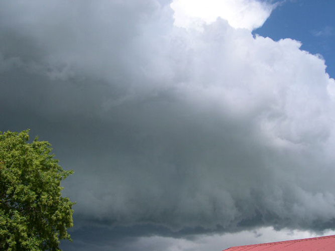
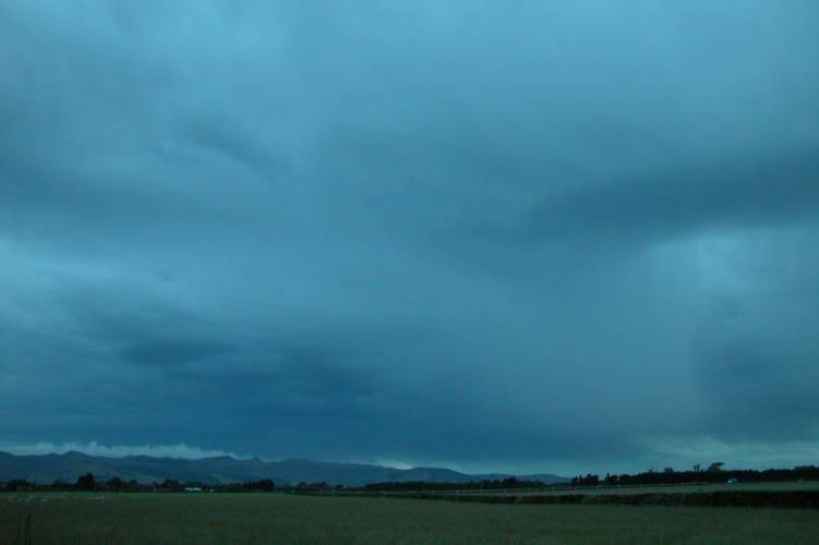
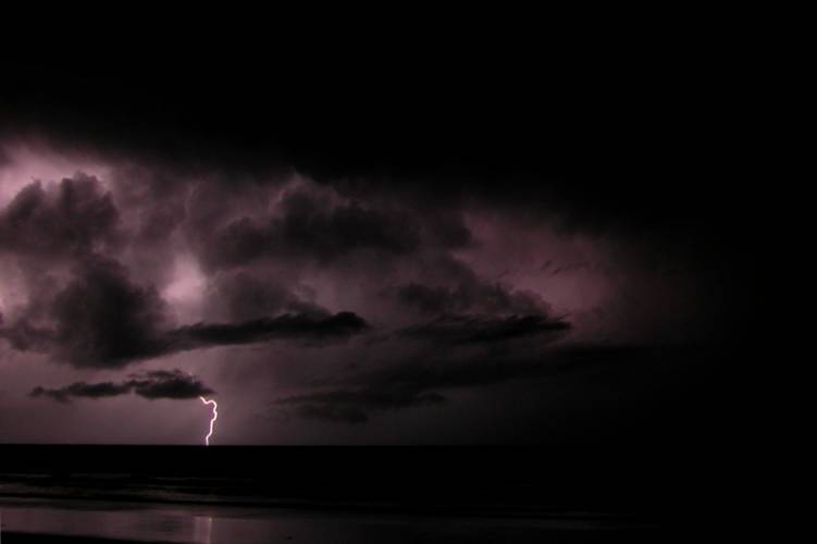
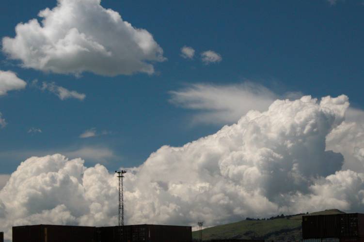
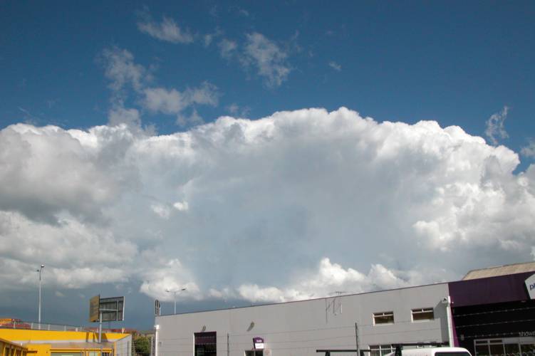
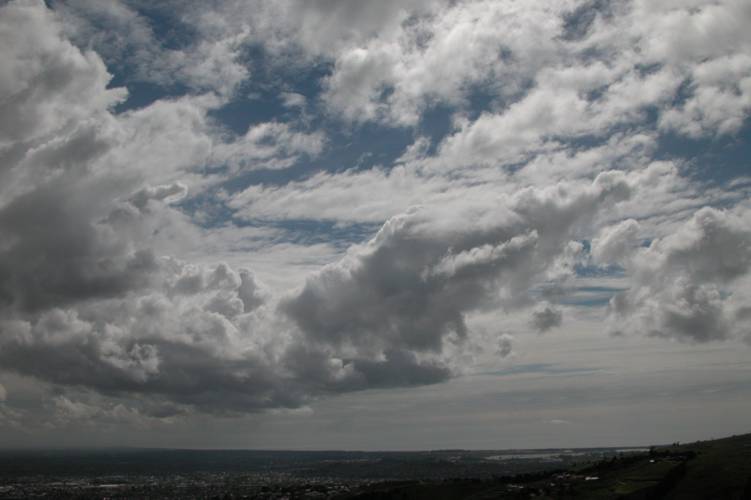
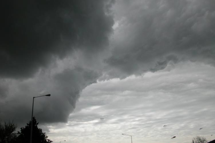
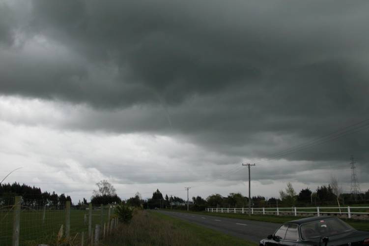
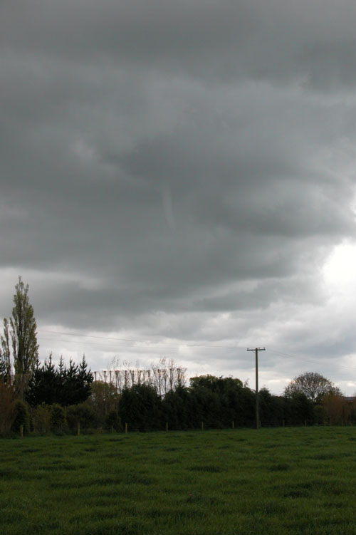
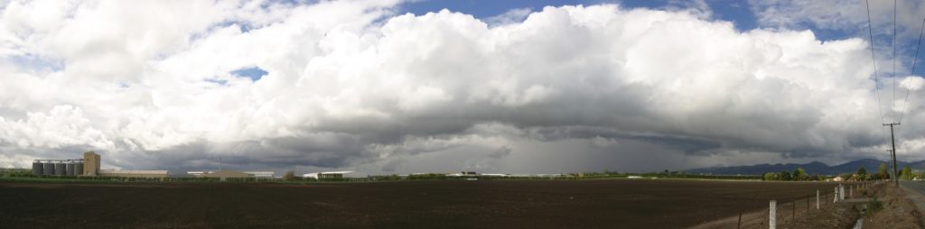
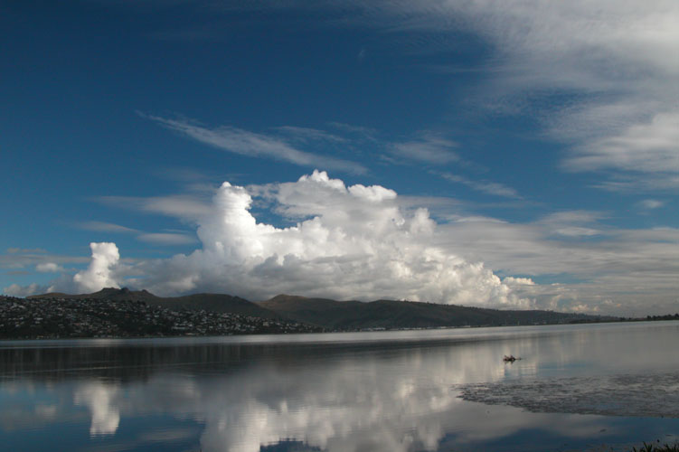
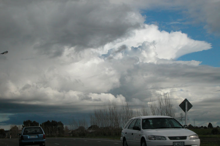
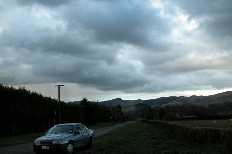
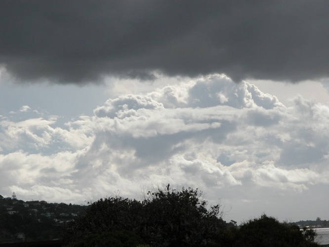
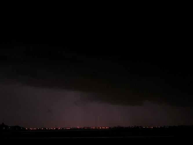
What an event this was, unfortunately I wasn’t able to be in Greymouth at the time. I probably would’ve been working which puts a stop to any storm chasing activities. Oddly enough Stephen Burrows, Steven Graham and myself went to Hokitika only a week before this happened in the search of thunderstorms which ended up being a failed trip. Managed to pick up some great carrot cake in Hokitika though so that was a bonus!

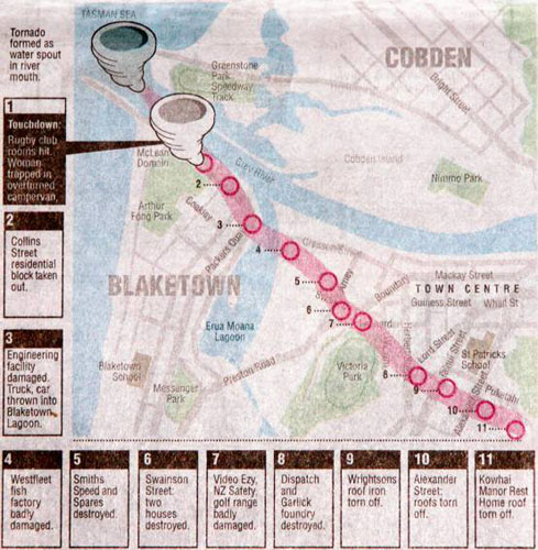
Even though I wasn’t there I thought it would be worthwhile putting up a report due to the scale of this event, below is a map that was shown in The Press the next day of the tornadoes path and news coverage that was shown in the evening on TVNZ is at the bottom of the page. The kind people from The Press have set up a gallery for me on their stuff.co.nz website showing damage from this event and a photo of the tornado itself that was taken by some tourists in the town at the time. There is also a few images showing damage from a lesser known tornado that went through Greymouth on June 16th 2003! You can view the gallery by clicking here.

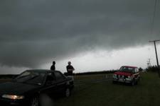
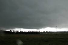
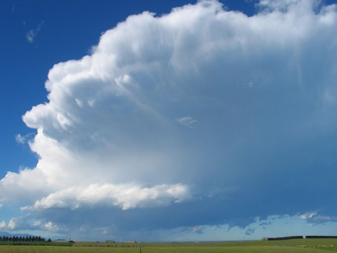
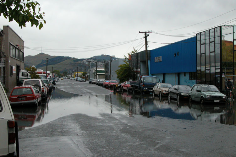
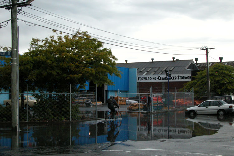
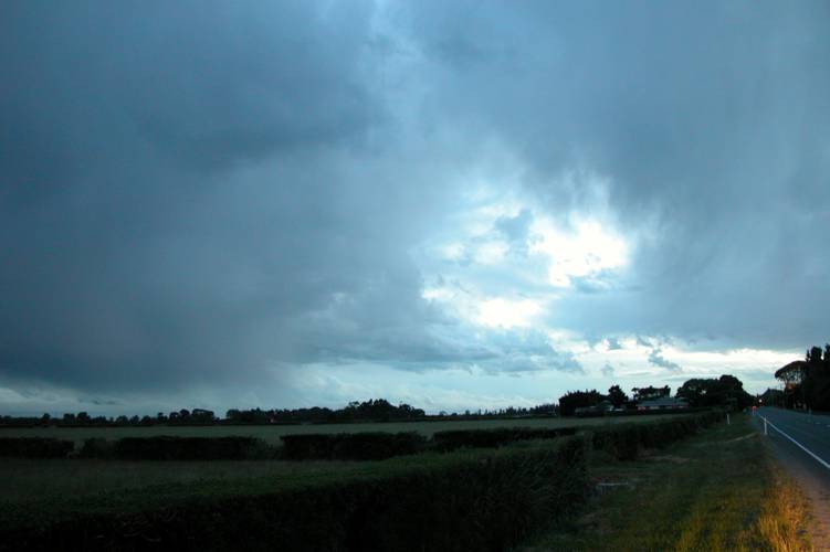
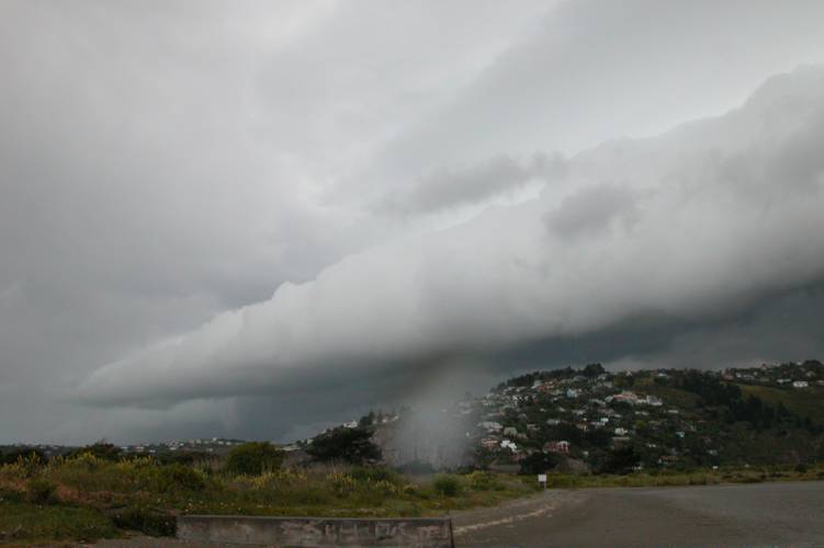
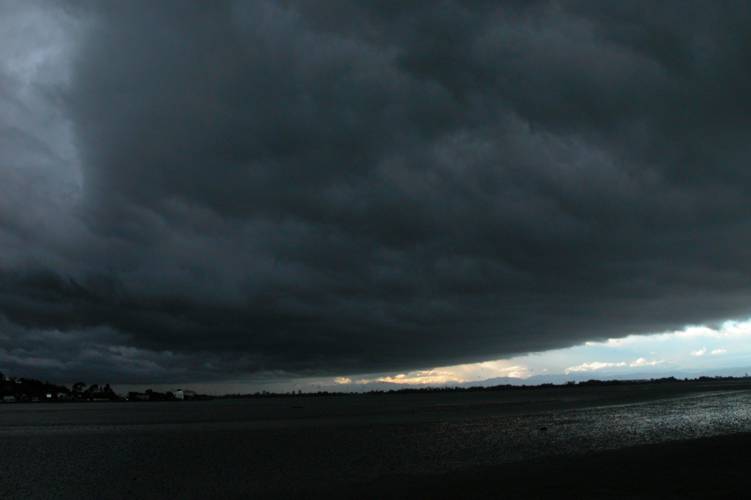
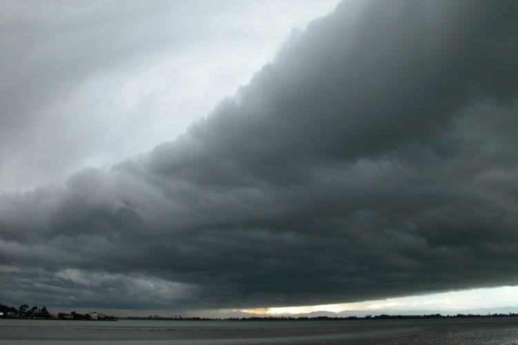
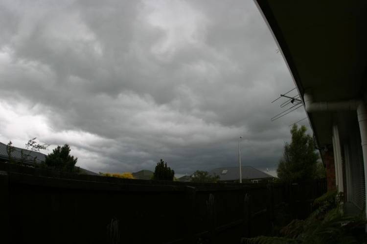
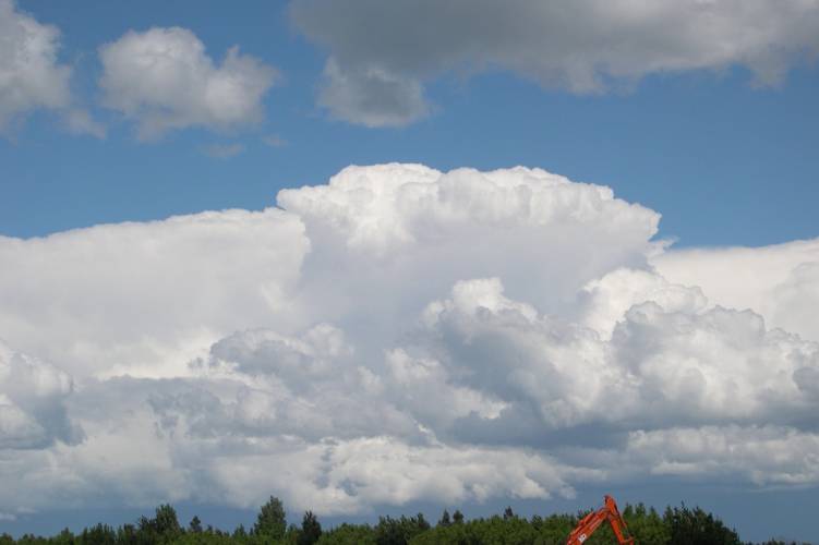
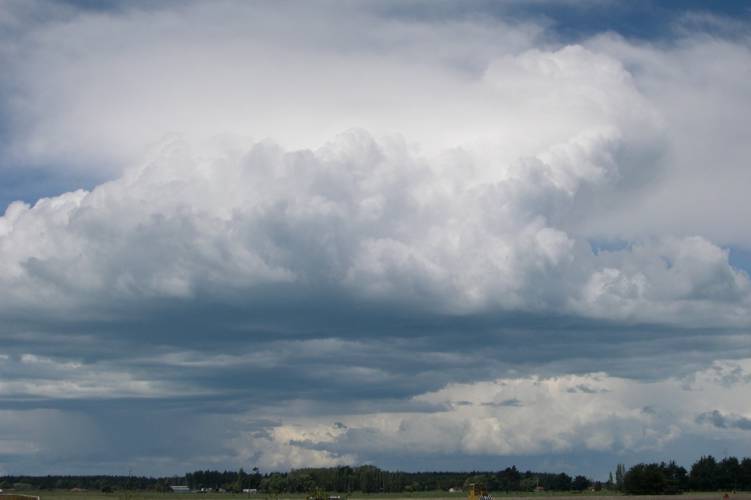
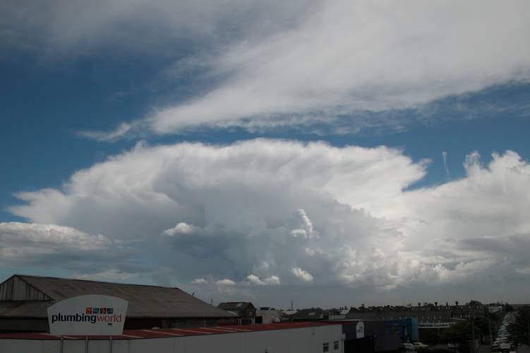
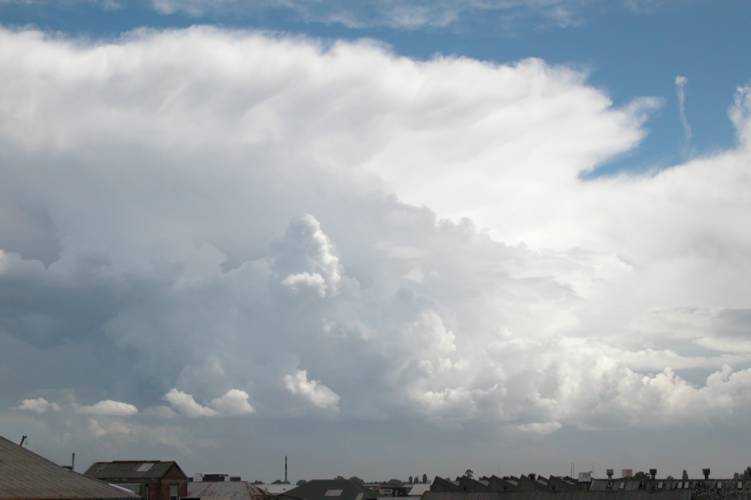
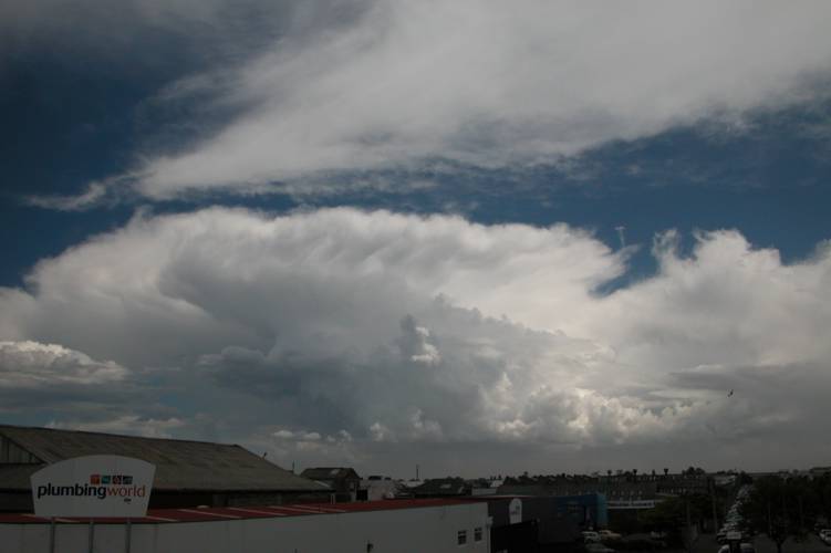
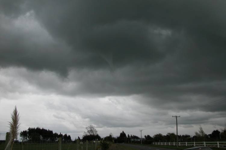
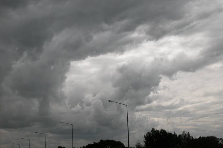
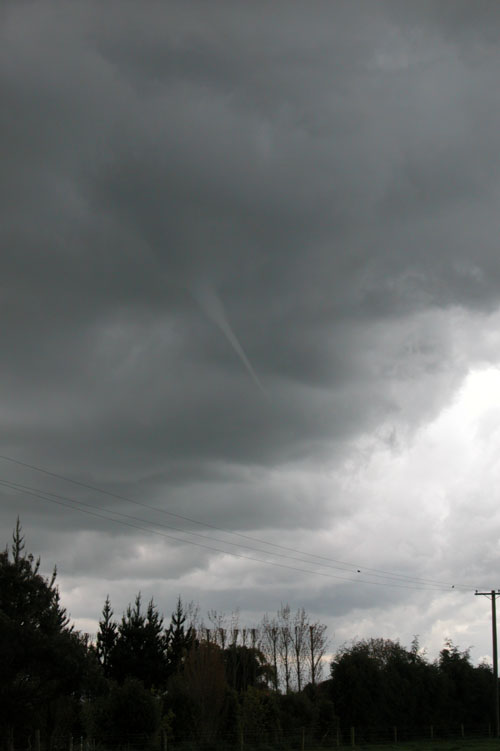
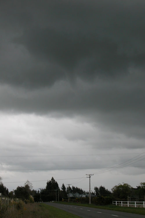
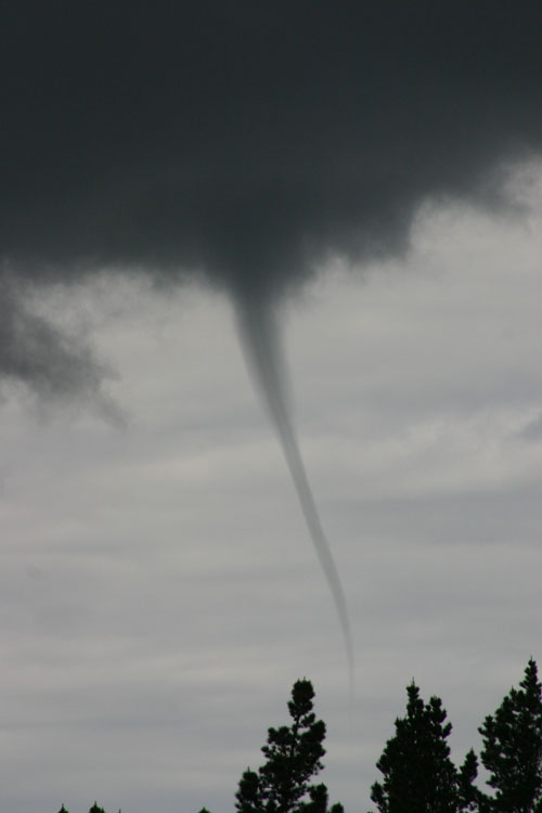
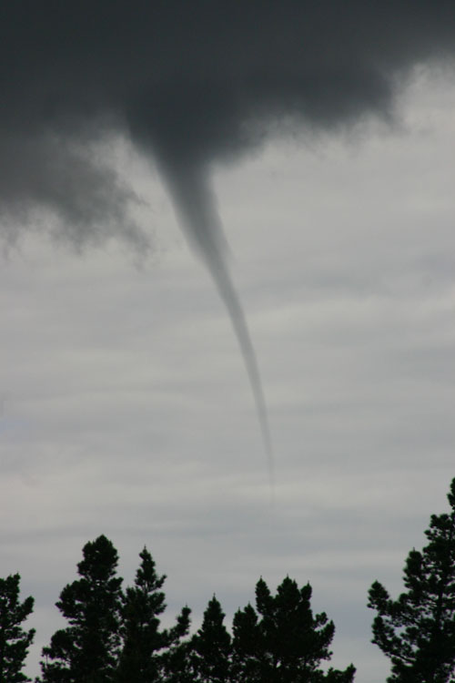
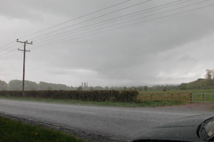
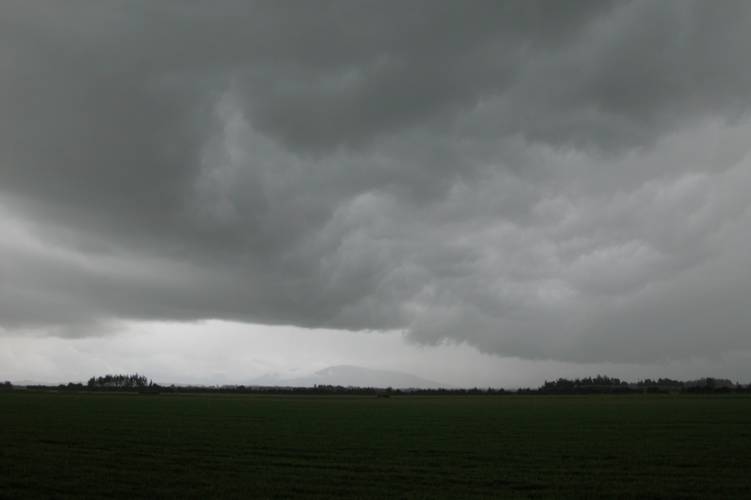
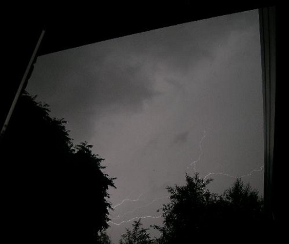
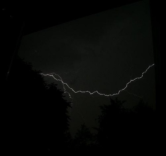
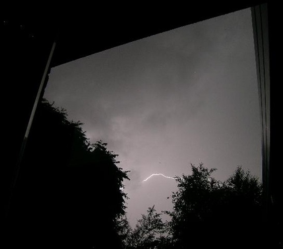
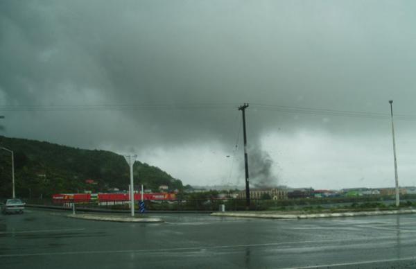
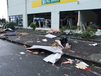
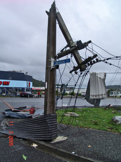
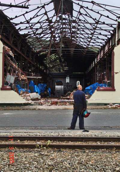
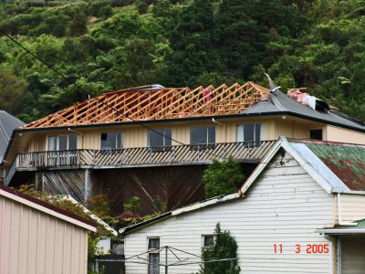
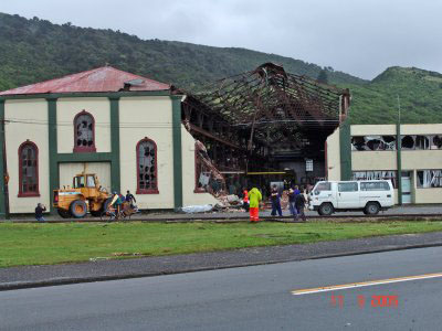
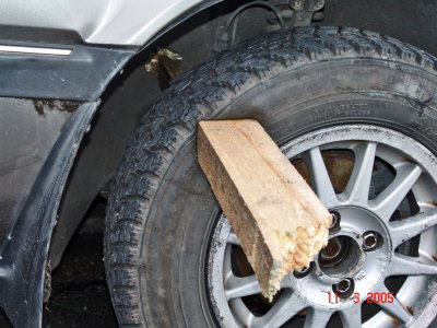
Here is a series of photographs taken by Robin Scott the next day in Greymouth, courtesy of Steven Williams.

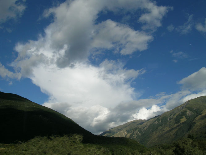
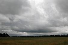
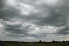
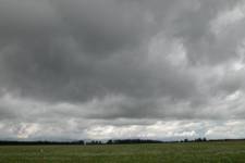
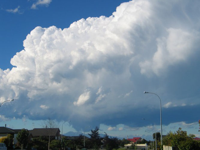
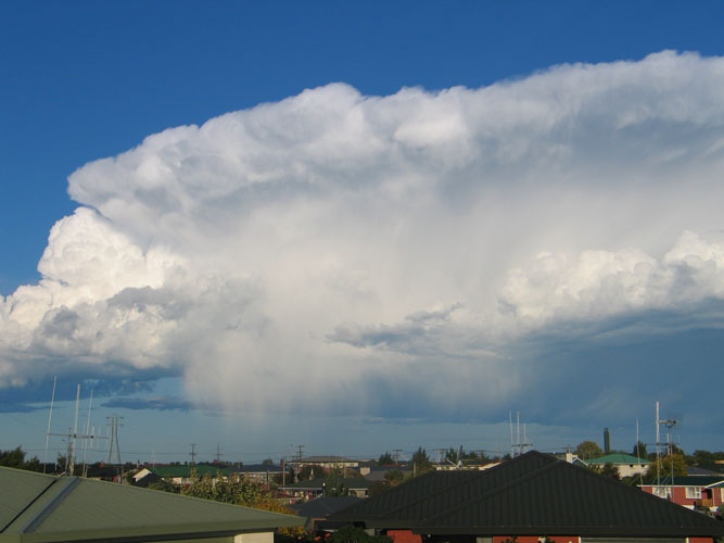
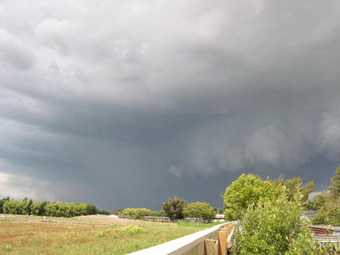
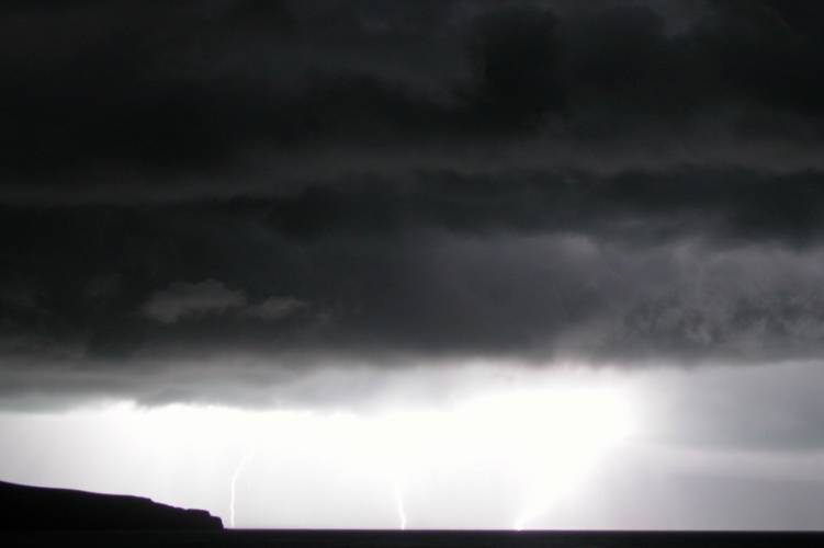
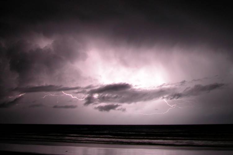
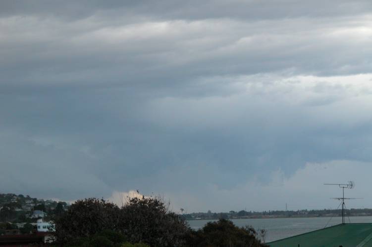
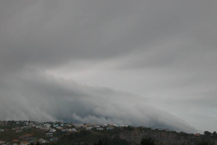
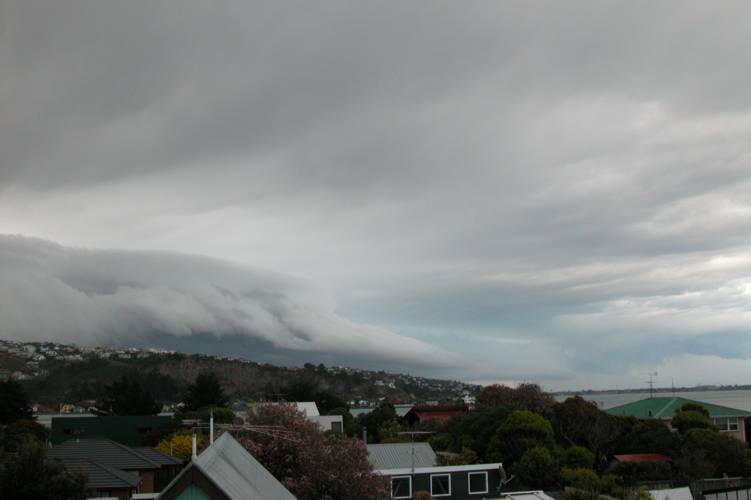
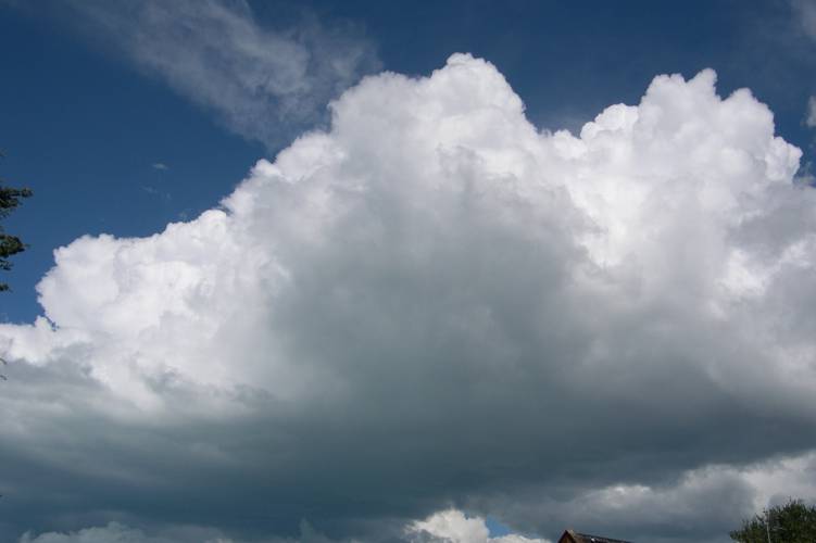
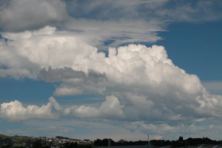
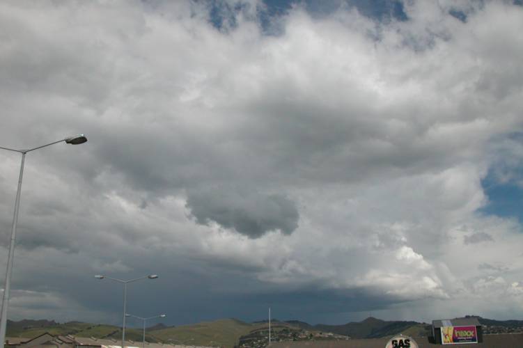
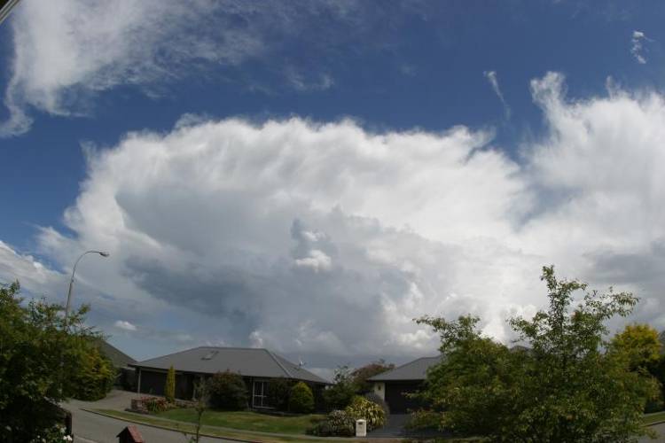
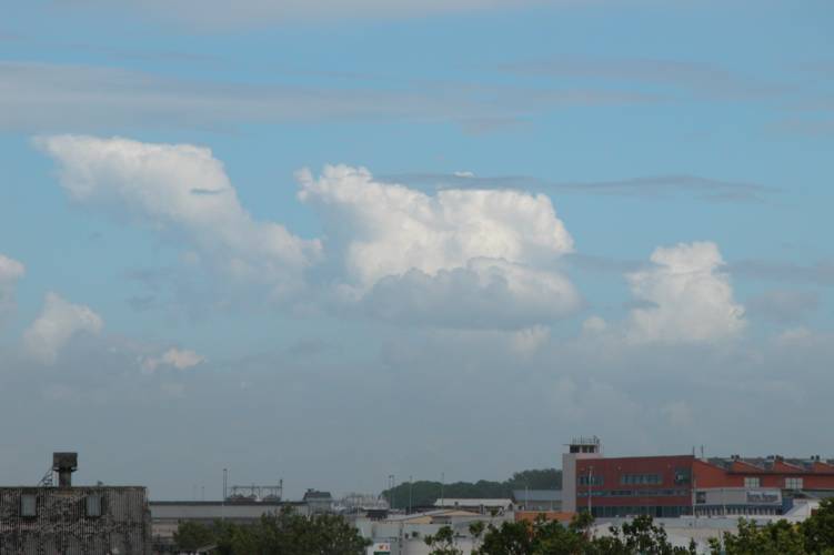
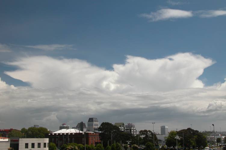
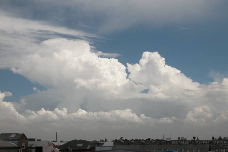
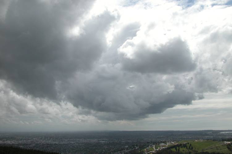
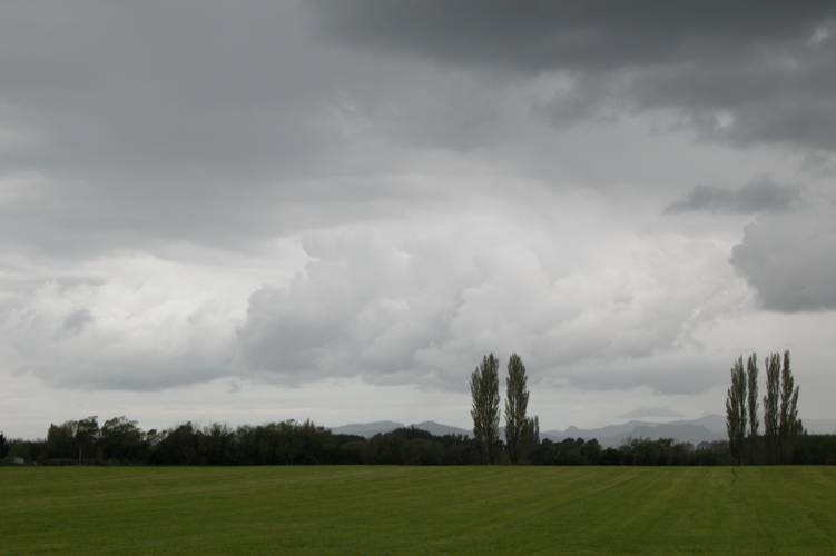
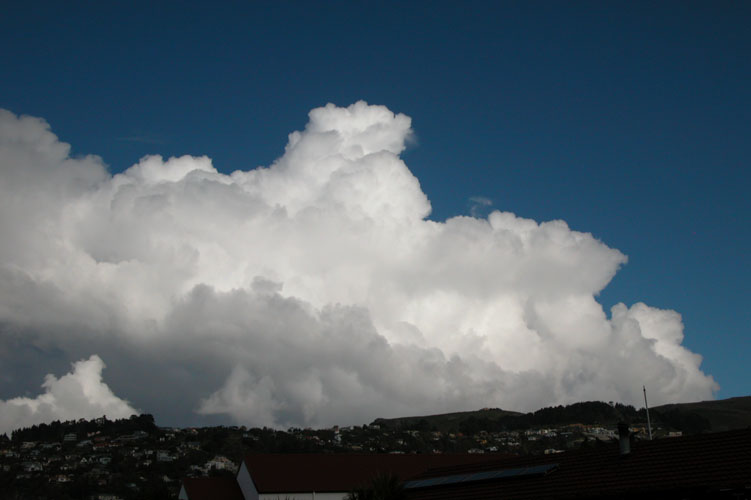
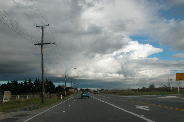
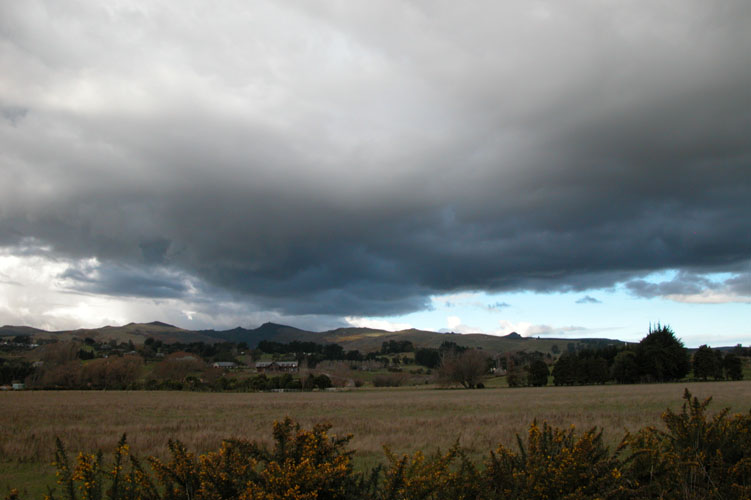
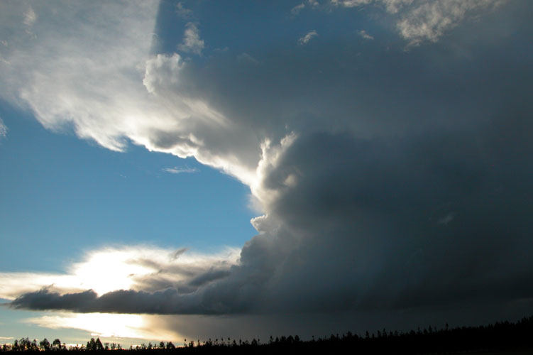
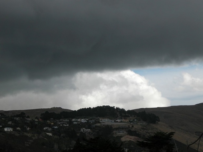
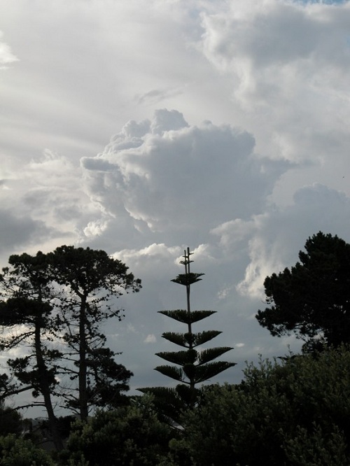
When looking over model data generally speaking there isn’t huge amounts of instability on the model in regards to the lifted index, mind you surface dewpoints would’ve been a little higher then it would’ve been working with. Surface dewpoints were around 17 degrees. The shear it shows is fantastic, this combined with the effect the southern alps has of uplifting the air and channeling the air at the surface to a northeasterly would’ve created the rotations within the cloud as John Crouch mentions in the article below. If I remember correctly there wasn’t very much lightning associated within this particular cloud at all so that is an interesting aspect. Here is an article from the NZPA that I thought was one of the more useful articles at the time.

West Coast more at risk of tornadoes than other parts of NZ – NZPA
10 March 2005

The West Coast is New Zealand’s tornado “hotspot”, meteorologists said today after one ripped through Greymouth. “The West Coast is probably the area that gets the most tornadoes,” Metservice forecaster John Crouch said today. This was partly because of the topography, which meant it got a lot of rain and thunderstorms. “We get bands of thunderstorms on the West Coast because we get the colder westerly winds coming in off the Tasman, hitting the land, and air’s getting lifted up so that it becomes quite unstable,” Mr Crouch said. The West Coast experienced a lot of tornadoes because the Southern Alps turned strong winds. “They come on shore as a northwesterly, and at low altitudes they get turned by the mountains into north to northeasterly flow at the surface. “The combination of winds turning as they come on to the mountains, combined with thunderstorms, sometimes allows the thunderstorms to start rotating”. These conditions could lead to tornadoes being spawned, he said. Mr Crouch said that there was an unstable northwesterly flow on to the West Coast at the moment. “It has been spawning thunderstorms, pretty much the length of the West Coast from Karamea down to Fiordland, and there have been several bands (of thunderstorms) moving through this morning. “Today’s tornado has obviously formed on one of these bands,” he said. In June 2003, about 20 businesses were damaged when a tornado cut a swathe through the downtown area and caused damage costing more than $300,000. The 2003 tornado swept in off the Tasman Sea at about 9.45am, wreaking havoc on the western end of the central business district, snapping concrete power poles and knocking over street lights. A similar tornado ripped through Greymouth in the early hours of March 28 2001, wrecking houses. No one was injured then, but glass shattered and iron buckled in some homes.

Hanmer thunderstorm after a hot day

A very humid northerly airflow was over the country at this time as an area of high pressure moved away slowly to the east of the country, it extended a ridge back over New Zealand bringing the hot and humid conditions. Normally anticyclones or areas of high pressure in general are not the best to have around when thunderstorms are concerned, but aslong as the surface temperature and humidity can rise enough relative to the upper air temperatures unstable conditions can develop. Often these inland type storms are slow moving also and high rainfall rates can be experienced at times where they are as the storms don’t move far or to fast.

A very nice thunderstorm had occurred over inland areas of the upper South Island the day before and chances seemed possible for further storms today in the same area, the upper air had warmed slightly but the surface dewpoints and temperature came up a little bit to by the looks of things.

I called Steven Graham to see if he was keen to have a drive up north, by this stage in our storm pursuits we had already done a few failed trips to the West Coast in the search of storms so a trip up north seemed not so bad. We headed off from Christchurch hoping to see some late afternoon / evening thunderstorms. As we got beyond Springs Junction there was nice signs of cumulus congestus about and it was very hot and humid, we stopped and measured the temperature and humidity also. Steven Graham had a portable temperature / humidity reading device with him so we used that, we kept this thing in the shade for quite a while so there was no direct sunlight on it at all. We got amazing figures, a temperature of 35 degrees with a 20 degree dewpoint, Australia anyone?

We waited north of Springs Junction for a while but unfortunately the clouds didn’t seem to be getting anywhere …. infact they were shrinking, we started to drive back and somewhere between Springs Junction and the turnoff to Hanmer we had a check of the lightning tracker as we saw a Cb anvil through the mountains! It revealed a storm just starting to develop up behind Hanmer. It wasn’t our first thoughts as to where storms might develop, not that we had bad figures where we were already….. it might’ve just been a good convergence zone there. So we headed off towards Hanmer.  

We got to an area just before Hanmer around 7.15pm, it was quite peaceful with no wind and very warm. Cicadas were in full swing chirping away. We could see the storm now sitting just behind the ranges surrounding Hanmer, visually it wasn’t much to look at but it was good to be out. We didn’t see any lightning as it was quite bright with the sun lowering in the western sky, but we did hear some distant thunder roll in from time to time. At around 8pm we took some further measurements and got 29 degrees with a 19 degree dewpoint.  

Not long after 8pm we left to go home as the storm appeared to be dying. We stopped for some fish and chips in Culverden and Steven took a photo of the Cb lit up by the setting sun, quite a nice site to see!

So in the end we probably didn’t need to go as far as we did but that’s the game were playing, as we got near Weka Pass coastal low cloud and murk rolled in.

Inland storm chase near Glentunnel

Unfortunately for this report I seem to of lost all the larger images files, I just couldn’t find them for the life of me on my hard drive…. perhaps I deleted them accidentally? A true crime when thunderstorms are involved but perhaps I did, so just the thumbnails are here to view. Of course we took video footage and I still have that so feel free to watch the clip below and enjoy!. 

This day started out nice and sunny, a good sign. Colder air aloft was encroaching eastwards over the center of the South Island, a look at the Invercargill and Paraparaumu (Wellington) soundings weren’t conclusive of too much happening but the colder air was between these areas.

I meet Steve in Town and we saw good Cu congestus to the west over or near Darfield which looked the obvious place to head for. Temps were nearish 19/20 C and dewpoints around 13 C which is pretty good with the relatively cold air aloft, it wasn’t that apetising but it would be enough. Shear wasn’t even worth thinking about as there was practically none there and directional wise wasn’t interesting either so we could count tornadoes out! lol. As we got closer to Darfield we realised the clouds were a little further west than first thought, we traveled on through to and just beyond Sheffield. We were now under these monster cauliflower clouds going up with some interesting bases around, the most interesting just southwest of us. We gave Steven Graham a txt to see if any lightning was going off and where if so. He was at home in Templeton at that point just about to leave to come out and join us. He said “Yes, to the west”, it wasn’t alot to go by but it didn’t matter as we knew it was this cloud we were staring at. Steven G left his house to go west as we went back through Sheffield to go along the foothills southwest of us. We then went inland more onto some shingle roads around the Whitecliffs area. We saw some nice bases and started to hear frequent scferics on the AM radio. It took until we passed Whitecliffs itself until we started to see some action. Steve saw some fork lightning to his right which I didn’t see although I did notice a general flash. Not very frequent lightning but enough to create some excitement!

Rain started to fall which then got heavy but no hail. There was not much visually to look at now as there was just alot of murk above us with lightning bolts striking out at times, a few of which were good! Streams were starting to form and the road was starting to get flooded by the rain with big puddles everywhere nearly covering the road at points so driving was slow.

We pulled over where we could to observe what was going on. The foothills despite being a good place to be for storms seemed a bit closed in, in that there wasn’t a big field of view. The rain plus window wipers constantly going back and forth didn’t make for exciting video as the lightning was not overly frequent at this point in time and unfortunately didn’t pick up much more for the rest of this chase although it did keep going for another hour or so.

We actually got to get out of the rain at one point and sit on the side of the road videoing without the constant noise of the window wipers, nothing much was going though. A rain core could be seen in the distance, horaay….lol. Just not the best visual type of storm but it was still great to be out there.

We got out of the shingle roads around Whitecliffs and got onto the inland scenic route where we pulled over at some monument thing where we kept vigil. Rain wasn’t that bad here and Steve videoed while I took a few snaps. Once again lightning wasn’t that frequent but we did see two or three nice bolts here, of course they had to happen just when Steve stopped recording! We also went through some nice rain cores that weren’t to heavy but looked cool before we went into them as can be seen in the pic above. I txt Steven Graham to see where he was up to, he was near Windwhistle and we were just south of Glentunnel so I suggested we meet in Glentunnel. There was quite heavy rain falling when we were there with big puddles building on the side of the road and the occasional lightning bolt still going off but thunder wasn’t all that loud. A new feature to this chase which was really handy was Steven Graham had live lightning information on the move which is awesome! Using his cellphone he can hook up to the internet with his laptop and get lightning information from his detector which is hooked up to his computer and the internet at his house. We can also look at other data but costs tend to be high doing things this way and lightning information is the most useful anyway so it works out great. We saw lightning was now leaving the area we were in at Glentunnel and heading east but not yet reaching Darfield. We got into our cars and were off.

This was probably one of the most interesting spectacles of the day. The rain as we got out of Glentunnel began to get really heavy and torrential, the heaviest rain I have experienced! Visibility was getting low and we were driving quite slowly, Steven Graham infront of us in his car was getting harder to see. Cars on the other side of the road going the other way were beginning to pull over because conditions were terrible! Very small hail also began to fall now but didn’t last long. The rain was awesome!

Finally we drove out of the heavy rain as we entered Darfield and continued through and stopped just out of the town to discuss what we just went though. You can see in the above photo the wall of rain coming down behind Steve (left) and Steven Graham (right). Some of the cloud bases looked good near us but the Cb was now dead marked by that awesome downdraft. We drove around a little still hearing big scferics on the radio but after another quick check on the tracker realised it was further to the north around Culverdon. After seeing this we decided to go home as by the time we would’ve got to the Culverdon storm it most likely would’ve been over so we went home.

A great day had by all, not the most active lightning wise but some definitely happened. Had it been a night time storm I possible would’ve been talking about all the lightning we saw.

Boxing Day storms near Timaru produce a funnel

Steven Williams was down in Timaru for Christmas 2004, while there a thunderstorm developed on Boxing Day just north of the town. Here is what he had to say:

“An interesting convergence line developed to the north of Timaru from about 5.30pm on boxing day with a dry northwest land breeze converging with a cool moist easterly sea breeze near the coast. An upper cold pool supplied sufficient instability for cb’s to form in what was quite a dry atmosphere. Funnel clouds, hail and lightning (CG’s) were observed within the line. This Canterbury storm would have produced large hail, though much of it would have fallen just off the coast. It was a dry low precip type storm, a classic hail maker”

It looks to of been quite a site with a series of such lovely isolated cumulonimbus clouds in Steven’s photographs. The first formed around 5.30pm as Steven says while a second higher based cell developed around 8pm in the same spot, both storms moving east offshore due to the upper westerly winds. Two funnels developed on the first cell which can be seen in the first and fourth photo below.

A shot here of the higher based cell, Steven saw lightning from it and suggests the precipitation seen falling will be hail.

Thunderstorm over Christchurch, I nearly got struck!

What a season 2004 had been in the summer and it just kept coming! I’m writing this in January 2012 so report details may be a little lite, the NZ Weather Forum is always great to look through the archives and remind ones self of what happened! I was at work in town however that didn’t stop a few photo opportunities and I even took a little bit of video where low and behold a lightning bolt must of gone off directly overhead as there is a big whack on the roof above me, the alarm system started going off! I remember that part quite well.

Cold air was sitting over the South Island with 500mb temperatures around -24 degrees, thank goodness for El Nino. This combined with a broad area of low pressure created a great thunderstorm right over Christchurch city in the middle of the day, the convergence zone must’ve been sitting right overhead.

I remember running out to the Waltham over bridge near where I was in town to take some photographs of dark clouds developing over the city just before midday.

Just after midday the lightning and thunder started going off and torrential rain also started to fall. I didn’t get any hail where I was but Stephen Burrows who worked near Northlands mall at the time got about 20 minutes of hail, stones were as large as 10 cent coins and it made car parking areas white! The hail blocked drains and caused the stock room where he worked to flood with 1 inch of water, he of course saw plenty of lightning aswell. The streets outside where I worked also got a little flooded and I hadn’t seen them like that before. Below shows the streets near me and Steven with some hail in his had an hour after it fell so it had melted away a bit by then.

While the thunderstorm was going off overhead with me indoors doing a video from my digital camera at the time a lightning bolt must’ve struck really close just overhead! As I was filming you hear a big “WHACK!” and it shudders me a we bit even as you can see by the movement in the video, the alarm system at work even started firing off, closest I’ve got to a lightning bolt ever and I’d rather it not get that close again! You can watch the video below, it also shows the torrential rain that was falling to with a bit of thunder at the end. I mention 30 meters away in the video but thinking about it, it could well have been much closer.

Steven Graham out in Templeton managed to video some lightning from where he was, the storm he noted was further to the east closer to the city. Here is a few lightning stills.

After this thunderstorm moved through it looked as though another might develop in the same area with dark clouds brewing again however from memory I don’t believe another storm formed of the electrical variety.

Jason Tippet watchful as always out in Kaiapoi took a few photos of dark clouds near him however unfortunately the storm just didn’t manage to come overhead where he was.

Spectacular thunderstorm!

This chase was awesome and I have my first decent go at getting lightning on camera!

Things looked promising in the morning with sun plus a good temperature (18 C) and a dewpoint of 11C with a light southwesterly wind. I had a feeling the southwesterly would die down to hopefully let in a northeasterly before the southerly arrived later in the afternoon/evening. This did happen but as the northeasterly came in it got quite strong and cooled things off more than I would’ve liked it to, low cloud was also covering the plains which wasn’t the best situation so thoughts of thunderstorms with the change would dwindle.  A line formed over Christchurch with some Cu as the northeasterly came in, interesting but it didn’t get anywhere. I think it must’ve been a small convergence between it and the dying southwesterly. What also looked like a very week Cb popped up on the plains west of me but collapsed very quickly.

The tracker had been picking up strikes off the Otago / South Canterbury Coast for quite a bit from around midday and thunderstorms developed around Dunedin at 2:30pm and 5:10pm so that held a bit more promise. It was getting late in the day and I was beginning to wonder if storms would happen, it was now 6:50pm and the temperature was slowly going down to 14C which would soon be 12C and cloud cover from the northeast was beginning to cover Christchurch. I wasn’t thinking happy thoughts. But, a break in the low cloud over Christchurch revealed something. Big Cu congests was building over Bank’s Peninsula which gave me a good surprise! The tracker was also beginning to pick up strikes over Banks Peninsula so ever faithful Steve turned up and said we better get a move on as storms looked like brewing!! Quickly I gathered my camera gear and we were off! We weren’t too sure about where we were heading, so as storms looked like they would move up the coast then offshore we headed southwest to first of all get out of Christchurch then thought we’d head east.

To my surprise again as we got inland a bit it started to clear and most inland areas were now basking in late afternoon sunlight. We also saw nice huge Cb’s off the coast going down southwards but they were a little too far off the coast at that point so we couldn’t really do much except take photo’s.

We got nearish Templeton thinking something would spring up on the plains but there was nothing at that point so while we were in the area we called past Steven Graham’s as this would provide tracker info and no doubt was a good time to say hello! Steven was home so we talked and looked at various info including the tracker and saw strikes out on the Peninsula and also coming up the coast. There was no point in traveling all the way out to the end of the Peninsula as storms would’ve moved off by then. Ben Tichbourne who frequents Akaroa though was there at the time and noted on the NZ weather forum at around 7:20pm:

“Clouded over early afternoon around Akaroa; low cloud and some drizzle at times for most of afternoon…BUT as I write, proper rain is starting to fall, and I can hear frequent THUNDER.”Ben also got heavy hail around 5mm in diameter around that time aswell.

Down went the temperature as early evening came upon us, it began to stabilise at a not so wonderful 12 degrees. As we were talking to Steven G we noted Cu building to the east not far away on his web camera that looks outside from his computer. It was around 8:30/9pm so we decided to then leave and thanked Steven for having us and went to investigate what was happening to the east of us. Over the Tai Tapu area there was a Cb with an ok but high base that looked quite thundery but didn’t manage to pop out any lightning. From what I could see I didn’t think it would do much except produce some heavy rain so we went eastwards towards Lake Ellesmere. In the low light it did look quite awesome and I hoped it would begin to spit out lightning bolts but unfortunately it didn’t.
What was that I caught out of the corner of my eye? Yep, Steve confirmed….it was lightning going off in the clouds just offshore to our east. It seemed the obvious choice as to where we would go now, but to go south or north of Lake Ellesmere which is a pretty big lake. We started to head SE but I said to Steve we should head North seen as the storms were moving north we would want to be closer to them as they moved up the coast. So we backtracked a little and then we were off to Birdlings Flat!

The closer we got lightning would go off more and more, the darker it got lightning got brighter and closer! When we arrived at the Birdlings Flat beach I franticly set up my Digital camera on my tripod and it was dark enough to take lightning photo’s. In the distance I could see dark bases slightly lit from behind in the twilight which had swung around onshore which marked the oncoming southerly front I believe. I say I believe because I’m not totally sure, it was totally dark when the southerly arrived so I’m presuming the Cb’s coming ashore to the south could’ve been it.

Yahoo! My first shot of lightning on camera that I knew 100% was lightning. A few flashes had gone off before but I had set the aperture too closed and the lightning didn’t register on the camera at first but once corrected it showed up nicely. No fancy bolts but it was something! That’s one thing about digital camera’s is you can check the shots to see if you got them or not and make corrections if need be. One of the annoying disadvantages is the noise reduction process the (mine anyway) camera does after each photo has been taken due to a long exposure whereas with a film camera you could keep flicking shots off and not have that problem, but then you can’t check your shots strait away either. So there’s advantages and disadvantages to both in this situation.

The lightning continued and got closer as the night went on, the line to the south was also becoming active and moving up the coast. At times I would miss shots due to bad timing but I managed to get some shots. The wind began to pick up all of a sudden and got very strong from the south, it was hard to stand still and you could almost lean into the wind and let it hold you there. I can’t remember what time this was but it was dark. It also began to rain and then hail the size of peas started to fall to, my eyes were watering and rain was getting on my lens so I wouldn’t be able to take photo’s anymore. I had to get in the car, not to mention the lightning as I didn’t want to get struck. We saw some awesome big cg’s and cc’s quite close just off the beach before we left in the car, what a bugger I couldn’t get them on camera because of the rain. We managed to stay out there for quite a bit but I have no idea of the time this was, at a guess it was probably an hour. Steve also had his video camera which he used but he forgot to charge the batteries the night before for it so he only got about 7 minutes footage and we got no in car footage which I’ll explain about later! I’ll let the lightning photo’s talk for themselves now.

Not the best but ok for my first really good shot at it! The middle one in the 3 above would’ve been a great shot but the three cg’s coming down made things over exposed. I got quite a few others but the ones above are the better of them.

As this hail and rain started to pour down we wondered what we would do. If we could find shelter there was still a great chance to do some lightning photography but we didn’t know where to look as it was dark and there was no one either of us knew around Birdlings Flat. I said to Steve we should leave and head West, as we did it really began to pour and hail was falling up to 1cm in diameter pinging off the car, it was really cool! Lightning was also now going off overhead turning night literally into day with incredible blasts of light and then awesome thunder! Going down the highway Steve spotted a turnoff to the left going to some golf club (we didn’t have any maps!) so we turned down there hoping for shelter to do some photography, no luck. Lightning was now getting more frequent overhead and hail was falling everywhere, marvelous cg’s to our right and left were coming down….just awesome! I said we should turn back as the shingle road we were on wasn’t going anywhere. The storm seemed to be heading NNE at this point so a trip was in order back around the Port Hills and through town and then to New Brighton. As we got onto the highway flashes weren’t as frequent but were still great when they went off, some pulsating and lighting up cloud structure for a few seconds at a time, and some lighting up the surrounding area turning it into day. One particular strike was so close and bright my eye’s couldn’t adjust and all I could see was white for a few seconds after the lightning had happened.

Just before we arrived in Tai Tapu the roads were white from hail apart form the tracks of cars going through them, it wasn’t hugely deep and the hail wouldn’t of gone past 1cm in size but I hadn’t seen anything like it before. The lightning had piratically stopped by this point as it was going off just over Christchurch and off the coast where we couldn’t see it because of the Port Hills. As we got closer to Christchurch lightning began to make it’s presence felt again lighting up the skies just east of the city on the coast. A quick fuel up was in order then off to New Brighton! The Cb’s were offshore when we got there and I quickly set up my camera on the tripod while Steve stood there with his digital camera using it’s movie mode. I managed to get two ok shots from New Brighton of lightning, although there was some annoying low cloud in frame as you’ll see below! There were other awesome strikes that went off but bad timing meant my camera was doing noise reduction from a previous frame. Neither Steve or me heard any loud thunder from the beach but some was able to be heard as the storm moved northwards.

Then all of a sudden it was over. I waited and did 5 more exposures but nothing was happening and nothing continued to, our night was over. My last photo I left the shutter open for a while to show the Cb’s faintly lit up by the moonlight (actually I’m not sure if the moon was up that night) or the light that was there as they moved up the coast. You can sort of make them out in the photo below.

Steve and me quickly reviewed the video from Steve’s DV camera back at my place and looked at the pics I had taken. Not bad I thought for my first go at getting lightning on camera. The video was dam funny, with my going sh#t every time a lightning bolt went off or if I missed a shot. One particular scene on the video has me going “Holly Sh#t” while Steve says the the “F” word while I say “Sh#t”, it sounds really funny and we cracked up laughing when we saw it! Well, to be honest I’m not sure if Steve says the “F” word as such, it more or less sounds like “Holly Fa!”. You’ll see what I mean when you watch it! It’s a bugger the DV camera ran out of power during the time we were just coming out of Birdlings Flat and going around that area and then as we came into Tai Tapu, there was some awesome action around that time.

Strong southerly buster!

I was aware that thunderstorms could develop on this particular Thursday and the morning looked promising …….however, a cloud band moved over the South Island keeping things pretty dim and not thundery looking at all. I could see in various models and satellite pictures the cloud band moving north but I wasn’t sure how long after the cloud band moved over that a southerly forecast was due. Lucky when the cloud band moved off there was a nearly two hour period of sun which made the temp go over the morning’s max so things began to look good. The rain that fell from the band that moved over the SI provided some needed moisture from evaporation as the sun was in the western sky (dewpoint went from 5/6C to 8C when the sun came out). I was getting excited at around 6:45pm as I spotted the edge of a large roll cloud south of Christchurch, something had to happen!!! The models weren’t showing any negative LI’s and CAPE was zero! It just shows that sometimes they don’t get it right but they can be of use on other days. I find upper temps tend to be fairly accurate though with models.

Despite the surface temp only getting to around 14.8 C in the afternoon it was just enough as the upper air was quite cold, this with a northeasterly before the change provided a nice afternoon of storms.

On the way home I took a photo near the Avon river mouth so I could get a record of this beast of a roll cloud I could see in the distance, I couldn’t see it in it’s completeness due to other cloud but I knew it was big. Back in the car again and off home. When I got home I quickly went to check the tracker and saw numerous strikes just south of Chch, it wasn’t hugely intense but no doubt there would’ve been some nice strikes out there. Dam excited I rang Steve to see what he was doing, he was in Tai Tapu!! I said “What are you doing there?, and what do I hear next! “Aaron, I saw a funnel cloud!”, trying not to pop, “What!! Holy molly” is all I can say. Unfortunately he couldn’t photograph it as it disappeared quite quickly. Where I was didn’t really turn out to be that bad after all, pretty good infact. Winds were pretty uniform throughout the atmosphere going SW pretty much all the way up to 300mb, shear was good and storms would move at a good pace. The funnel Steve saw would’ve been a localised type development and not part of a mesocylcone.
I jumped up on the roof and took some photos before running down to the estuary to take more photographs. The base of the cloud over Christchurch was looking quite turbulent and lumpy.

Donning my jersey and jacket and with all my camera gear under my arms I ran off towards the estuary. On arrival things looked impressive and organised with the front peeling over the top of the Port Hills in an arc over towards Christchurch and onto the Canterbury Plains. I was too close to be able to do a panorama but I got some ok shots. I got a drop or two on the lens at one point which is always a worry and can ruin a good shot, this happened to a couple of my photo’s and one of the ones you’ll see up on here. I figured it still looks good so is worthy of being on the site!

As this structure came over it got dark and very windy but no rain was falling as of yet. The underneath of the roll cloud was quite messy looking and not as nice as the front of it, I still hadn’t seen any lightning or heard any thunder. I couldn’t see any rotations of funnel cloud type matter so it was unlikely anything would happen in that department where I was and nothing did. The roll cloud as it steamed off looked quite impressive though, it looked very much disconnected from the Cb itself but was a great feature visually of the storm!

Steven Graham in Templeton got a few shots and did notice twirling motions in the clouds and took some photos and managed a lightning strike on his digital SLR camera, here’s a description from Steven.

“When the lightning was overhead, I noticed there was a bright stroke in one direction often followed by another going the other way.  It was just luck that I was quick enough on the shutter release cable to capture this one after a number of attempts 🙂 I used ISO100 setting and f8 to increase the exposure time to 1/5 second which helped.” Here’s what he had to say on the NZ weather forum:

“Started seeing distant lightning and hearing thunder to the SW at about 7:15 but then it died out. After that several lines of cloud started to develop overhead. There had been a moderate ENE-E wind most of the afternoon and the southerly had just arrived. There were quite a few potential funnel clouds with the bases of the cloud lines starting to rotate and descend but nothing got too far before the gusty southerly wiped it out. I recorded some footage on video and you can kinda see what I mean from the first photo. The thunderstorm then developed with lots of long ICs running back and forth across the sky – no wonder the Boltek was confused.”

The Boltek Steven mentions is his lightning detector which you can view here.

As the roll cloud moved further north Jason Tippet was ready to have his turn for some photo’s of the roll cloud. Meanwhile I quickly ran home as it was beginning to rain but when I got home it sort of stopped with only a few spits hear and there so I ran back to the estuary again. As the Cb situated itself over Christchurch with no base visible probably due to rain things didn’t look great at all. I waited and then “Strike!”, I could see a nice Cg come down to the west of the city or perhaps somewhere in it? I then waited and some nice thunder came across, it wasn’t very loud as it was far away but sounded great. Lightning ended up not being that frequent with myself only seeing 5 or 6 strikes all up, the main lightning activity seemed to be just SW of Chch in a line from SE to NW. Only infrequent strikes really made it more further north.Where I was I didn’t get any hail but some was bound to fall somewhere.

There was hail out near Rangiora where Pam Johnson was driving home to Sefton when she had a big hail shower and saw lots of lightning:

“I left a job in Rangiora about 8.15pm and it was just starting to rain, then there was a really good hailstorm with quite large stones about the size of large peas, I stopped to see if there was going to be a photo opportunity but it was too wet and cold and I wasn’t dressed for the weather.  The hail was the loudest I have heard on my car, I did think it would dent it.  Then when I got to Sefton I ran into hail again.”

The last lightning bolt I saw was probably only a kilometer or two away from me, it was very bright and thunder sounded within a second or two very loudly which made the ground shake and me think it’s time to go! The wind was very strong and gusty with it getting cold, rain was also beginning to fall harder than before. I didn’t go along the estuary front not to be too exposed and didn’t want to get struck so just went through the scrub and tress behind me, my feet and pants got soaked but that didn’t worry me. That was actually the last bolt I heard or saw for this storm in the end.

As Steve was chasing the storm north he didn’t see all that much lightning either and got to around New Brighton from where he was in Templeton when he decided to go north. So he came over to my house and we reviewed the evening and looked at some photos I took.

As the storm moved north Jason Tippet got some nice shots from Kaiapoi.

It’s been quite a stormy period lately, so cool! Two funnel clouds sighted so far this season in Canterbury, awesome!!

Canterbury storm outbreak, Part 2

After the storms on the 15th November storms fired again the next day this time more along the coast. I was meant to write a report at the time many moons ago when this happened however I unfortunately never got around to it, I didn’t get to go out and chase these storms however I took some pictures from work in town. I remember seeing some cloud to ground lightning strikes above the port hills on this day. I went back and had a read over the archived NZ Weather Forum posts and it did refresh my memory somewhat, I do remember the dew point being rather low, makes sense with the storms being quite coastal which can be seen clearly on the modis satellite picture. Still have the pictures I took from the day so here they are for all to see, not amazing by any means but we take what we can get in New Zealand thunderstorm wise. Would’ve been better if I was out of the city and nearer the coast south of the peninsula for these storms but surely enough they will happen again.

Jason Tippet in Kaiapoi also took some photos this day.

Canterbury storm outbreak, Part 1

What an awesome storm this was! Absolutely loads of lightning going by the trackers and some great structure.

Pity I couldn’t get in the thick of it as I was in town at work.

An upper cold pool of air ( -22C 500mb ) was moving down from the north rather than the typical up from the south track. It did originate from down south however as I remember it, it sort’ve came up through the Tasman Sea then stalled moving eastwards slightly and then drifted southwards which was a bit unusual. As it came over sunny skies and good early morning temps (18C) and dewpoints (12 to 13C) initiated development early with towers going up on the plains with no cap to inhibit convection. Soon some of these went to Cb and a few towers to the northwest begun to produce lightning but nothing intense. Shear wasn’t very good with weak winds throughout the wind shear profile, this meant storms that formed early wouldn’t really go anywhere and would collapse after their mature phase pretty quickly which they did.

Some nice instability began to form again which looked to be helped by a NE / S convergence, only light at this stage but it kept things alive until a southerly change came through. An area just southwest of Christchurch was to be where the main storm system for today would form near me, there was a larger area of storms in South Canterbury for this day however at the time I didn’t realise. After having taken a few pictures of this new development I went back to the office and then after a while went back outside again and saw nice big Cu congestus go to Cb around NZDT 3:00pm. No lightning was happening yet but this Cb would grow to become quite big aided by the convergence.

So back to the office I went (such fun!) and then I went out for another walk when things were getting dark at around NZDT 4:00pm. By now lots of strikes were beginning to happen in the area SW of Chch (look at the tracker screen capture!). I couldn’t see anything yet (lightning that is) from where I was but it was dark on the plains. And unfortunately I wasn’t to see much! As the darkness came over I got to see some nice Cg’s and Ic lightning but no more than 10 strikes all up. I had to go back to the office as it began to rain.

The wind shifted to the southwest and then the Cb began to move on through. As it did I saw some nice vertical structure through the murk that looked impressive, it gave off one more rumble then it was heavy rain as the Cb moved off to the northeast which it then soon dissipated. It’s a bugger I can’t give a more action packed report but had I been southwest of Christchurch there would’ve been loads to tell I’m sure!

Of course there were other storm enthused buddies out there that got some photos to which is great!

Steven Graham in Templeton got some nice shots of the main developing Cb. As you can notice it shows similar things to my Cb photo’s, just from a different angle.

Clarkville funnel cloud

My favourite situation came upon New Zealand on Saturday with a complex area of low pressure sitting on us that moved slowly. Infact, as I write this (Monday 18th Oct) it’s sitting over the North Island still (2 days later) and thunderstorms should happen up there today like they did yesterday in areas.

Dewpoints were sitting around the 7 to 8 degree mark during this day, so they were just on a threshold to give some interesting weather, possibly just not high enough though to create a good thunderstorm which didn’t happen like on the 8th of August (Early start to season chase) but something else caught our eye! Temperatures were not the best at 13 C possibly 14 C in other areas but the pressure was low around 1000mb so that helped. The upper air was reasonable cold at around -26 degrees celsius (500mb) so this also helped aswell, the cold upper air also helped produce an awesome hail shower that me and Steve got caught in. Read on!

Steve who I had turned into a storm chaser by this stage came over around 10am on the morning in question as we knew something was going to happen that day but we weren’t to sure when. We were going to install a car stereo into his car but things started to develop a bit quicker than anticipated so we were off! Biggish cumulus possibly at a congestus state was building to the SW of us but by the time we got into town it had died down a bit and things didn’t look as exciting to the south anymore. We headed into my work to have a look a various satellite images etc to see what was up, we couldn’t deduce much from what we saw so I suggested we go up to Victoria Park on top of the Port Hills to get a better view of what was going on. The sun had actually broken through at this point and I noticed small Cu starting to develop just to the north from where I was in town. So up we went to Victoria Park, we stayed there for about 1/2 an hour and saw those small little Cu clouds build into good Cu congestus to the NNE out over what looked like the Waimak river mouth. Other Cu was staring to developing to the east and behind us aswell but to us it didn’t seem to have as much potential as the clouds to the north. We decided to leave and headed towards the NNE.

After stopping to fuel up, getting a bite to eat and a drink we headed through town and onto State Highway 1 going north. We got to an area just south of the Waimak main road bridge and turned right down a road called Dickies Road and drove down it a bit but not too far. We pulled over to the side of the road and sat there for a bit, I photographed and Steve filmed the dark bases. I also noted a nice line of Cu towering up through a mid layer of cloud to the north. After observing what was going on we decided what to do. No lightning was happening and only sporadic drops of large rain was falling plus some very small hail. We thought it would be a good bet to stay on the north side of the Waimak river so we drove back down Dickies Rd and then onto the highway. Let alone did we know this dark based cloud we were just looking at was about to produce something!

When over the Waimak bridge we took a left down a road called Tram Road and then through a small settlement called Clarkville, just out of Clarkville to our right guess what we saw!!! Steve shouted, “Funnel Cloud!!” It must’ve just come down but we didn’t see it as it came down. We pulled over immediately and jumped a paddock fence to video and photograph the funnel (it was now about NZDT 12:30pm), I was shaking like a leaf! It’s the first one him and me have ever seen!! So, a first for us today! We couldn’t believe it, it was only about 500m away (maybe less). A lady who must own the paddock we were on was coming down a drive next to the paddock, and I was thinking “Oh bugger”, but Steve pointed to the funnel we were looking at and she nodded and smiled as if to say, “that’s all right” so we were ok. Steve recommended we go after it but I was a little weary as I thought it would disappear soon thinking that these NZ events are quite short lasting. I thought we’re not going to get much closer to it here so we went after it. Ducking and diving down through the various roads in the area which I can’t remember we drove to within about 150m from it, it had gone into the cloud a bit more but it was fatter looking. We then followed it more and got right underneath the spiraling cloud mass above us, no funnel was coming down at this point though. When it got about 100m from us the funnel came back again and we photographed and filmed it. It never touched the ground but it was cool to watch! The rotating base when it went just infront of us was great to watch. You could see winds / cloud coming in from the south on the west side of it and then on our side you could see the winds coming in from the north spiraling into a circle where the funnel was. You could see two nice clearish sort of slots showing the rotation which you can see in the pics but it looked much better with our own eyes of course! The cloud above us was definitely cork-screwing, I could see a band of cumulus through the murk up above me twisting around and up. Initially when we first saw it, it was about 2/3 of the way to the ground but went up a bit by the time we got out of the car to photograph it. The spinning base of the cloud persisted for about 1/2 an hour or maybe slightly longer which is quite amazing!, the funnel came in and out at times but when it went in it was never for that long, it was out of the cloud most of the time. Heavy rain and then hail (5-6mm in diameter) began to fall and that’s when the funnel disappeared. The hail falling down was quite hard and loud when we got in the car . I think I may have seen a flash during this period but apart from that we never saw any lightning which was unfortunate but the funnel cloud sure made up for that!

I got in touch with a photographer Pam Johnson as I heard a funnel photo had appeard in the Northern Outlook from this day, she had taken a few photos of the funnel looking east while in the Clarkville area, you get a good clear view of it. Thankyou Pam for sharing these images!

We were in this hail shaft for about 6 or 7 minutes driving slowly as it was hard to see, we drove out of the heavy rain and hail as the cloud was dissipating and couldn’t give us much more than that so I told Steve to drive to other interesting looking bases to the west which unfortunately ended up producing only rain.

The following day saw a few more convergences happened over Christchurch with some good rain and a bit of hail was reported by John Gaul at his place in Somerfeild. Steven Graham out in Templeton took a great panorama of one of these convergences showing the rain core situated over Christchurch city which gave the hail to John.

After looking at maps etc when I got home I figured we must’ve travelled from just out of Clarkville in a NNW direction (the funnel took this path) to an area west of Rangiora on John’s Road. This means the funnel travelled for about 10 to 12 km in a strait line. That’s quite far!!

By the time those bases to the west were above us we were near Cust, Steve had to pick up something from his brothers in Oxford so we went there and then through the Waimak Gorge over the bridge and then down the Old West Coast Road back home to Christchurch. All up, 250km done! It was worth it! Once near my place a big feed of Fish and Chips was in order after a days chasing, once at home we had tea and waited to see if my picture of the funnel cloud would appear on One News after the weather as I sent one off to them around 5:00pm which was the time we got back. They didn’t show it or mention it…. Oh well, bugger!

When we got back to my place a convergence line was developing over Christchurch with some ok looking Cu congestus that went up high but it unfortunately died down as something was lacking just like most of the day hence no good thunderstorms developed.

Early start to season

There seemed to be not much unusual about today. I saw it was sunny with bits of high cloud about in the morning but didn’t expect anything. I got on the net to do my usual analysis runs to see if anything was likely, nope…I couldn’t find much that indicated storms. The pressure was low at 988 hpa with a broad area of low pressure of the east coast of the South Island but being early August I thought it was to early in the year for things like this to start happening, hence the title of this report. I saw the outside temp was at 12 degrees and the dewpoint was at about 7 degrees which is a bit higher than usual (the dewpoint that is) for Christchurch but it still wasn’t high enough (in my mind anyway, the atmosphere had other plans).

So I continued doing whatever it was that I did and did notice small Cu towers going up to my right over Banks Peninsula around 1:50pm but wasn’t sure at that point as to do anything. I went on the net to make sure, and by criky! there was a nice formation of Cb’s on the Canterbury Plains initially starting from Cheviot (North Canterbury) going in a sort of curved pattern all the way down through Darfeild with one of their anvils or the storm themselves still going up over the Southern Alps and ending over on the West coast just south of Hokitika! The Modis satellite picture for this day shows you exactly what I mean! I went outside onto the roof and noticed the Cu towers had gotten slightly bigger and saw there was some more Cu brewing to the south, I wacked a polorising filter onto the camera so I could bring those clouds out more.

I just haven’t had the experiance to have that gut instinct feeling if anything was going to happen, John Gaul (NZTS President) on the other hand does and noted on the forum he knew something was up. One way to tell if the atmosphere is unstable is the sign of castellanus clouds about which John had told me about but which I forgot to note earlier in the day. Castellanus clouds are pratically Altocumulus in the mid layer of the atmosphere with small turret like forms on them, hence their name castellanus becasue they resemble in places the battlements of a castle. On with the report!

So I gave my freind Stephen Burrows a call and him being the storm enthusiast he is, woundered if he was ok for a chase. He was up for it so he came round to my place in Southshore and we had a look at the Cu developing near my place into a congestus state which it then went to Cumulonimbus. It looked good but we couldn’t really follow it as it was going to drift offshore soon. We then got in the car and traveled north down the road a bit and took a few more shots eastury side and then decided to leave that cloud alone to focus on the clouds developing to the south. We were off!

We traveled down Dyres Rd and went towards Chistchurch city our main goal being to get to the Halswell / Taitapu area as that looked to be where this cloud was sitting over. As we got closer the base came into view showing no precipitation, it was quite high but looked good, this cloud can be clearly seen on the modis satellite picture lying from the Halswell / Tai Tapu area through to about Leeston. There was another big blob of cloud right behind this one extending through to and slightly beyond the Rakaia river but we couldn’t see it due to us being in a car and not being able to see everyting going on. That’s where satellite pictures can come in real handy becasue you can see what clouds are forming and where they’re going so you can chase them. A laptop setup in the car would be a great thing to have but for the meanwhile I’ll just have to use my eyes and general knowledge on what’s likely to happen. 

It was now just past 3pm and this cloud had gone to Cb which we could see towering up infront of us as we traveled towards it in out car. We got under the base which was pretty dark and mean looking but alas it didn’t seem to be doing much in terms of lightning and hail so we got some footage of it and ventured out onto the plains more after other fodder.

Just out of Tai Tapu we saw dark bases to the west with rain swathes coming out of them so we decided to head for there, it was in a sense still part of the same line that we photographed at Tai Tapu except a different Cb cell. We looked back towards where we just came from and then continued westwards. As we got closer the cumulonimbus’s base came into view and we observed it for quite a bit but unfortunately there was no lightning to note which I was surprised at as everything looked great

We traveled on past Burnham and then through Charing Cross and got out to have a look around at 4:00pm, the wind was pretty calm as it was for most of the day. There was dark cloud even further to the west which we had our eye on and also noted the Cb that we first looked at earlier on was beginning to precipitate and move over Chch. John Gaul later told me he had some good rain and small wintery type hail about 5mm in size at the most, nothing too note worthy. There was also no lightning observed either from the Chch Cb although at home later on in the day I could see some very distant flashes from this Cb way out in Pegusas Bay as it went off towards Cape Palliser (lower North Island) and then later intensefied. So, we saw this dark cloud to our west and went for it but just before hitting Darfiled the decision was made to turn back as the cloud looked to be raining quite a bit so it was all downdraft, besides, it was getting late in the day and the prospects that other clouds could pop up closer to Chch seemed good so we need not go any further. It did though produce some lightning strikes near the foothills but it was to far away and we were probably at Tai Tapu when that happened.

So turn around we did back towards Chch but the day wasn’t over yet! More towering cumulus had formed behind the line that was going through and looked good. The dissapearing line looked good aswell, you could see nice big bubbley Cu congestus going up into wispery anvils forming the various Cb’s along it. Very nice indeed it was! We constantly kept pulling over to the side of the road when a photo opportunity arised, it was quite funny. Luckily there were not many motorists about as they would’ve thought we were quite bizzare!

New areas of cumulonimbus were building now to the south behind the dissapearing line which looked fantastic, they weren’t huge and they weren’t active but it looked good. Now being around 5:15pm we decided to head back towards Chirstchurch because there didn’t look like there was going to be any night time shows of lightning. We pulled over some more on the way back to snap off some pics of the earlier line as it dissapeared out into Pegusus Bay, quite a sight with it’s fiberous top. The photos don’t give it much justice but it’ll give you an idea of what it was like. There was even some more Cu building into a Cb much further to the SW but it was to far away, by the looks of things it did nothing anyway.

So off we went home via State Highway 1 back through Burnham and then through Templeton to Christchurch. A good day had with 100 and something kilometers done, didn’t seem like much, I guess that’s what happens when your having fun! When Steve dropped me off at home we saw Cu (maybe weak Cb) trying to do something just out west beyond Chch but the day had finished for us, it did nothing anyway!

Awesome nighttime show!

What an exciting day this was, and disappointing as far as one of my first night time lightning storms to try and photograph. (EDIT, December 2011: Camera technology has improved since regarding noise reduction, infact I don’t need to use it these days. This was written from a 2004 perspective)

Low pressure systems were on either side of New Zealand so something interesting had to happen somewhere and something did. About 4pm I noticed some good Cu congestus out on the Canterbury Plains to the west beyond Christchurch city, I went onto the roof where I live at Southshore and took some photos. I had been hearing sferics on the radio earlier so I suspected something was up. The weird thing was that after about a minute and a half of being on the roof a big Cb in the distance just sort of came into vision! I honestly didn’t see at first and then thought, “What the heck!”. In the second picture below I’m sure it looks clearly obvious to were the Cb is but for some reason I just didn’t see it. Things were also beginning to look gloomy overhead but unfortunately things didn’t heat up right at this point in time.

After about an hour I went back onto the roof and had a look about, a nice big tower of Cu congestus had grown out on the Plains into an impressive looking structure which then slowly collapsed, it probably never become active but it was cool looking.

Things calmed down a little bit with not much happening. At about 6:30pm I then went down to the estuary near my place as I saw some dark cloud towards the alps on the plains, there was nothing photogenic to take anything of but I was hoping to use my video function on my digital camera to see if I could capture a lightning bolt or two. I saw about 4 or 5 bolts go off in a period of about an hour for which I was down there, for some reason the bolts just weren’t being recorded on the camera, I’m putting this down to the low frame rate at which digital cameras record at plus the lightning wasn’t very bright. I couldn’t try to photograph the lightning as it wasn’t dark enough yet and the flashes were so sparse. I then went home frustrated and grumbling to myself when at about 8:00pm I got a call from my friend saying “Aaron, there’s lots of lightning going off outside!!”, I was like “What! I just came form outside only half an hour ago and saw nothing!”. Sure enough I go onto the roof and a front is moving up the plains with nice frequent flashes of fork and sheet lightning going off, I quickly gathered my photography gear and I ran to the estuary where I had a front row seat to all this incredible action!! It was getting dark now so night time lightning photography was a definite possibility, this was probably my second shot at trying to get lightning on camera so I was excited as my attempt before hand was a failure. This was to become an infuriating experience and I still cringe at the fact I hardly got anything on camera. I set the camera up on the tripod and was ready to go. It went like this, some digital cameras have a thing called noise reduction that they have to go through after each photo is taken to get rid of “hot” pixels that burn onto the CCD in the camera since it’s open for a period of 30 milliseconds (my camera anyway) or more (in this case I was typically leaving the shutter open for about 15 seconds each time). I’m not a digital camera expert but I believe what I’ve described is what happens. Anyway, so each time you take a picture with the bulb setting the noise reduction comes on and takes the same amount of time as the picture you’ve just taken, so opening the shutter for 15 seconds than takes an additional 15 seconds until you can move onto the next shot. The amount of times that lightning went off during that noise reduction period was many and bl&%dy annoying!! Sometimes I also waited a little bit between strikes so I wouldn’t overexpose the next shot I would take, and would you know it the lightning would go off during that little waiting period almost every time! It was just such an unfortunate night for me but if anything it taught me a few things in terms of the amount of time to leave the shutter open for plus what f stops to use. Another thing though is that night time lightning storms don’t happen that often in Christchurch. I did manage to get two flashes in the end albeit not very good ones, they were only sheet lightning and one is hard to pick out but I’ll put them up.

Luckily some of us in the Christchurch area weren’t all having bad luck, Steven Graham out in Templeton (a small town just out of Christchurch to the west) got some cool looking shots from his window. He used a setup with his Nikon 5400 where it shot 16 individual frames at 8 seconds each continuously giving him in theory an open shutter time of about 2 minutes which worked well. The second shot from left to right is what some discussion on the NZ weather forum lead to believe it was (is) beaded lightning.

Ian Kelly took a fantastic shot from up on the Port Hills overlooking Christchurch. It appeared on the front page of The Press the following Monday.

After I had run out of battery power at the estuary it had begun to rain so it looked like it was time for me to go besides when rain is near and your in a storm lightning is very close by! I quickly ran home because there’s me in a very open area with lightning going off overhead and I have a tripod in my hand, I’m practically a lightning rod!! I probably wont be that stupid again though as lightning can kill and yes it has stuck and killed people before in Christchurch. Be very careful if trying to photograph lightning!! After I got home I tried with my film camera to get a few shots of lightning but by now it was sparse and things were petering out so that marked the end of that day. Probably the best storm we’ve had all season but a very annoying one to (for me anyway!!).