Spectacular thunderstorm!

This chase was awesome and I have my first decent go at getting lightning on camera!

Things looked promising in the morning with sun plus a good temperature (18 C) and a dewpoint of 11C with a light southwesterly wind. I had a feeling the southwesterly would die down to hopefully let in a northeasterly before the southerly arrived later in the afternoon/evening. This did happen but as the northeasterly came in it got quite strong and cooled things off more than I would’ve liked it to, low cloud was also covering the plains which wasn’t the best situation so thoughts of thunderstorms with the change would dwindle.  A 
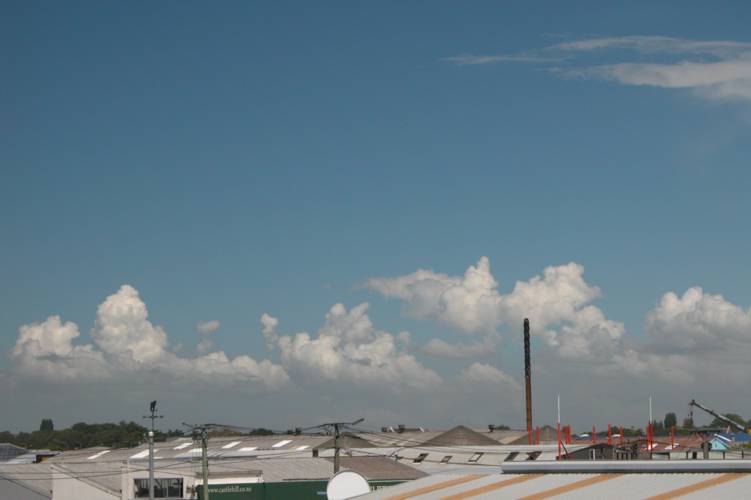
line formed over Christchurch with some Cu as the northeasterly came in, interesting but it didn’t get anywhere. I think it must’ve been a small convergence between it and the dying southwesterly. What also 
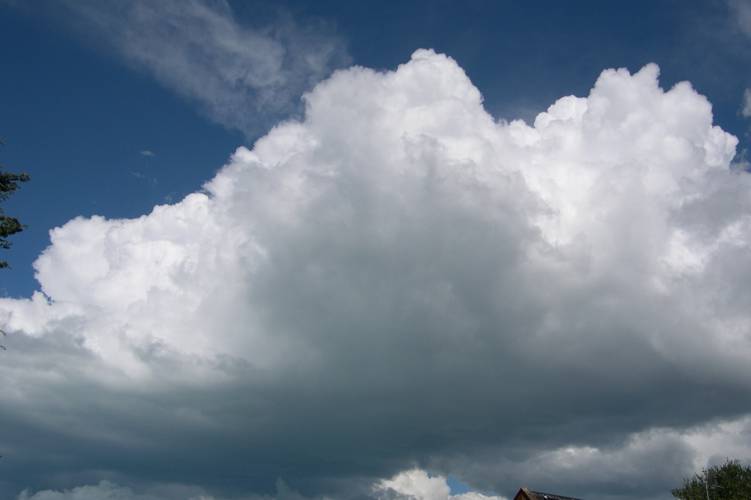
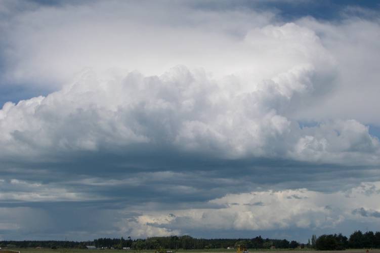
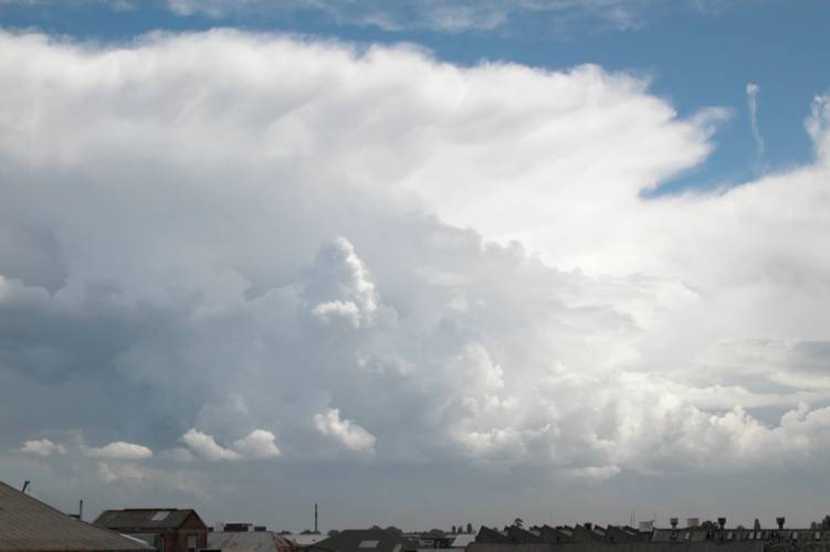
looked like a very week Cb popped up on the plains west of me but collapsed very quickly.

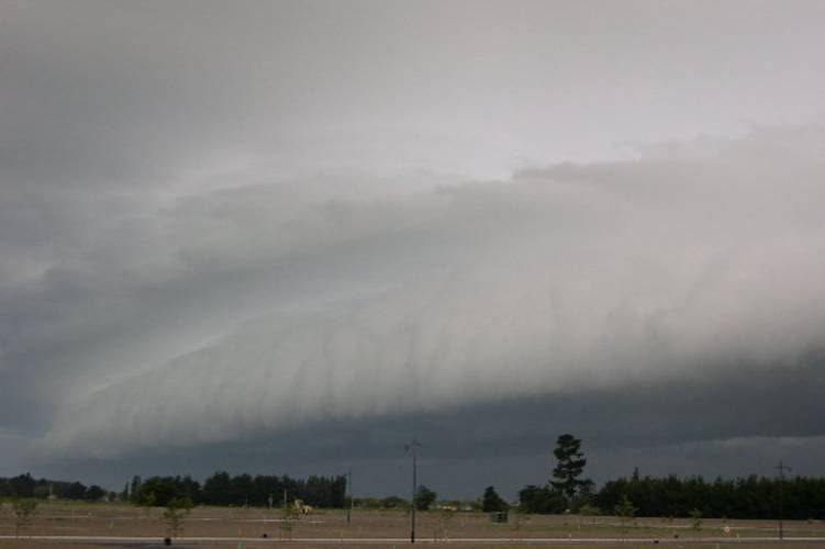
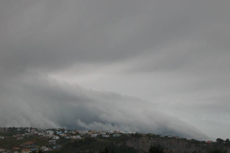
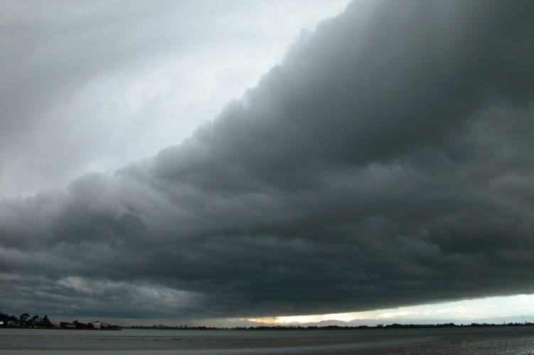
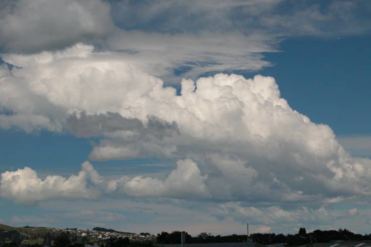
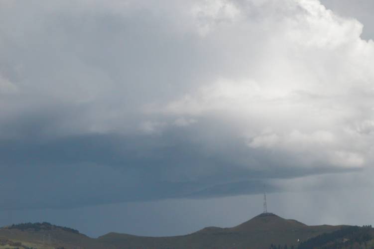
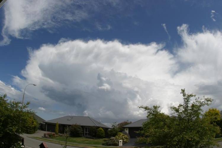
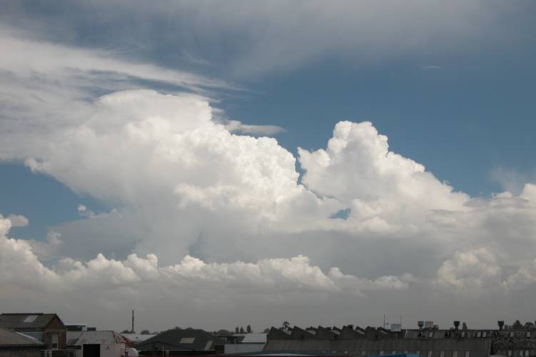
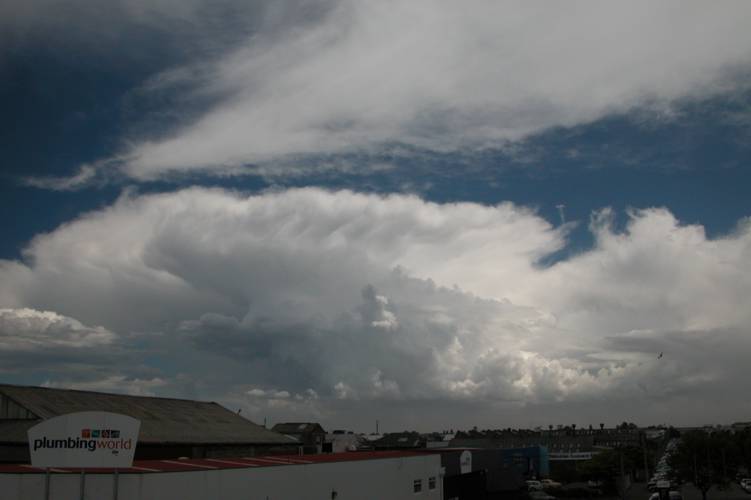
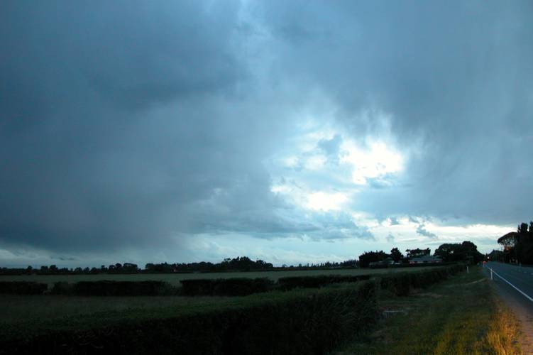
The tracker had been picking up strikes off the Otago / South Canterbury Coast for quite a bit from around midday and thunderstorms developed around Dunedin at 2:30pm and 5:10pm so that held a bit more promise. It was getting late in the day and I was beginning to wonder if storms would happen, it was now 6:50pm and the temperature was slowly going down to 14C which would soon be 12C and cloud cover from the northeast was beginning to cover Christchurch. I wasn’t thinking happy thoughts. But, a break in the low cloud over Christchurch revealed something. Big Cu congests was building over Bank’s Peninsula which gave me a good surprise! The tracker was also beginning to pick up strikes over Banks Peninsula so ever faithful Steve turned up and said we better get a move on as storms looked like brewing!! Quickly I gathered my camera gear and we were off! We weren’t too sure about where we were heading, so as storms looked like they would move up the coast then offshore we headed southwest to first of all get out of Christchurch then thought we’d head east.

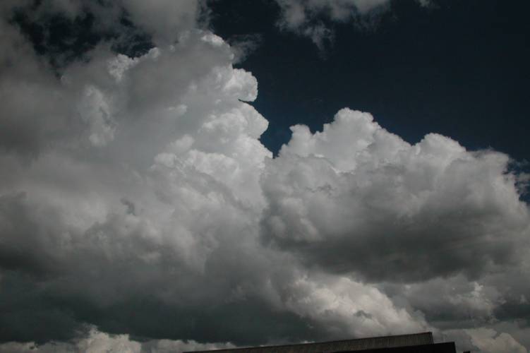
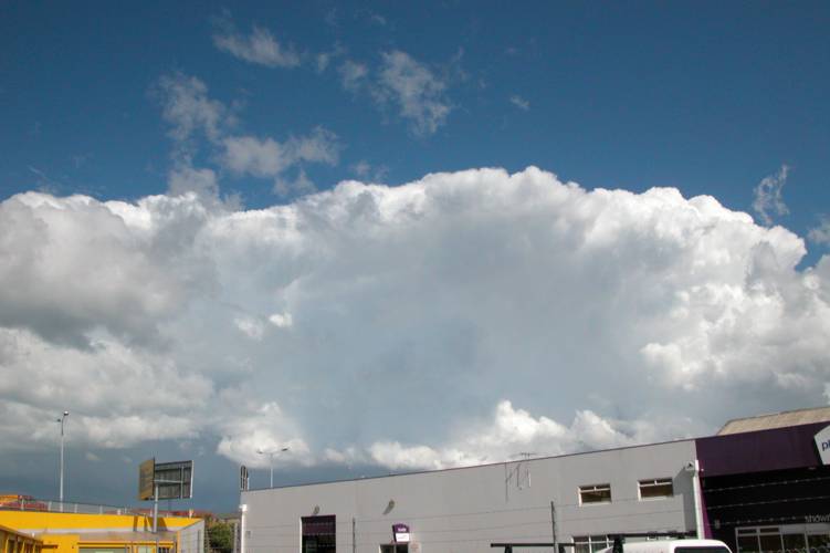
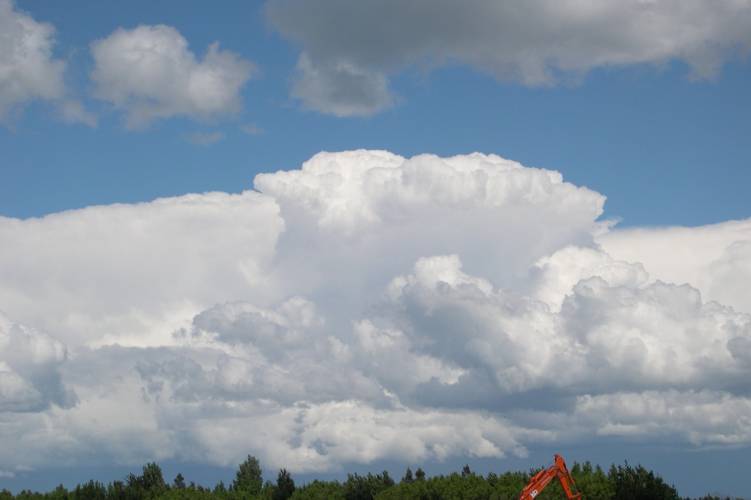
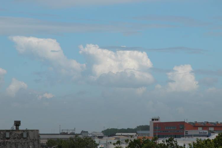
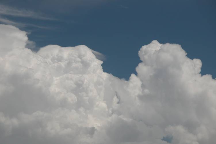
To my surprise again as we got inland a bit it started to clear and most inland areas were now basking in late afternoon sunlight. We also saw nice huge Cb’s off the coast going down southwards but they were a little too far off the coast at that point so we couldn’t really do much except take photo’s.

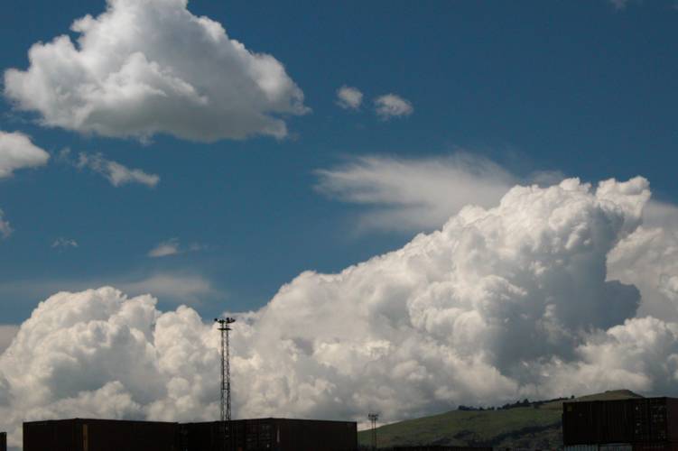
We got nearish Templeton thinking something would spring up on the plains but there was nothing at that point so while we were in the area we called past Steven Graham’s as this would provide tracker info and no doubt was a good time to say hello! Steven was home so we talked and looked at various info including the tracker and saw strikes out on the Peninsula and also coming up the coast. There was no point in traveling all the way out to the end of the Peninsula as storms would’ve moved off by then. Ben Tichbourne who frequents Akaroa though was there at the time and noted on the NZ weather forum at around 7:20pm:

“Clouded over early afternoon around Akaroa; low cloud and some drizzle at times for most of afternoon…BUT as I write, proper rain is starting to fall, and I can hear frequent THUNDER.”Ben also got heavy hail around 5mm in diameter around that time aswell.

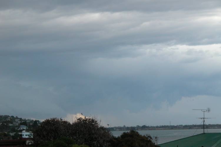
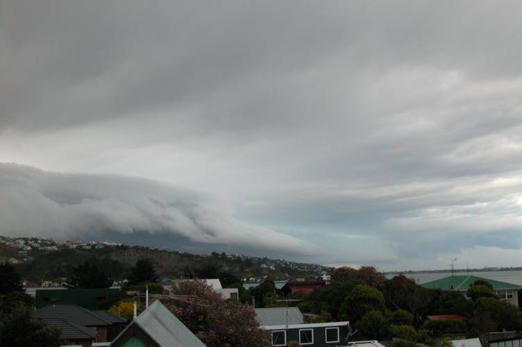
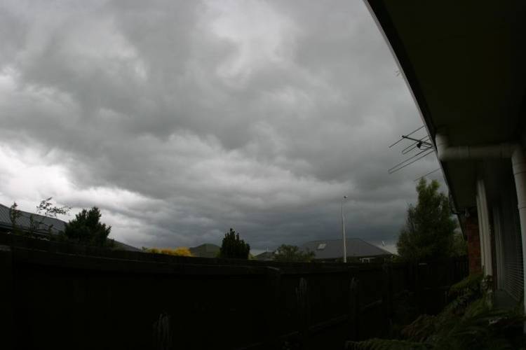
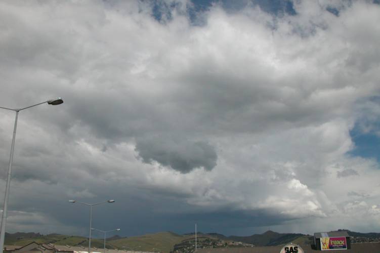
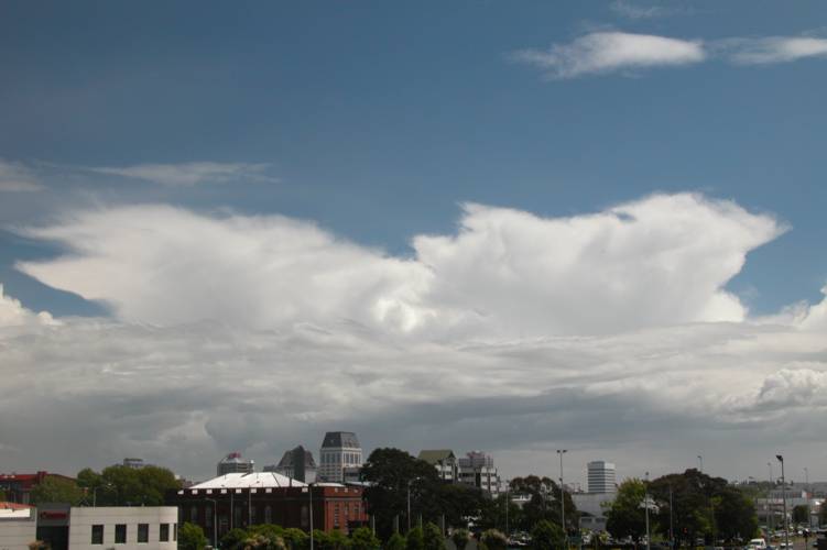
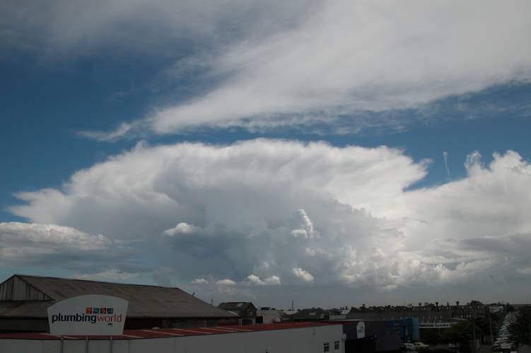
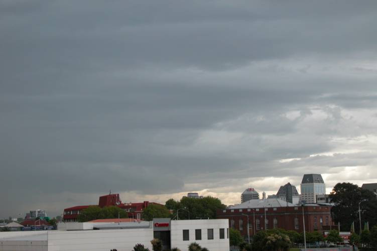
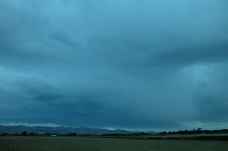
Down went the temperature as early evening came upon us, it began to stabilise at a not so wonderful 12 degrees. As we were talking to Steven G we noted Cu building to the east not far away on his web camera that looks outside from his computer. It was around 8:30/9pm so we decided to then leave and thanked Steven for having us and went to investigate what was happening to the east of us. Over the Tai Tapu area there was a Cb with an ok but high base that looked quite thundery but didn’t manage to pop out any lightning. From what I could see I didn’t think it would do much except produce some heavy rain so we went eastwards towards Lake Ellesmere. In the low light it did look quite awesome and I hoped it would begin to spit out lightning bolts but unfortunately it didn’t.
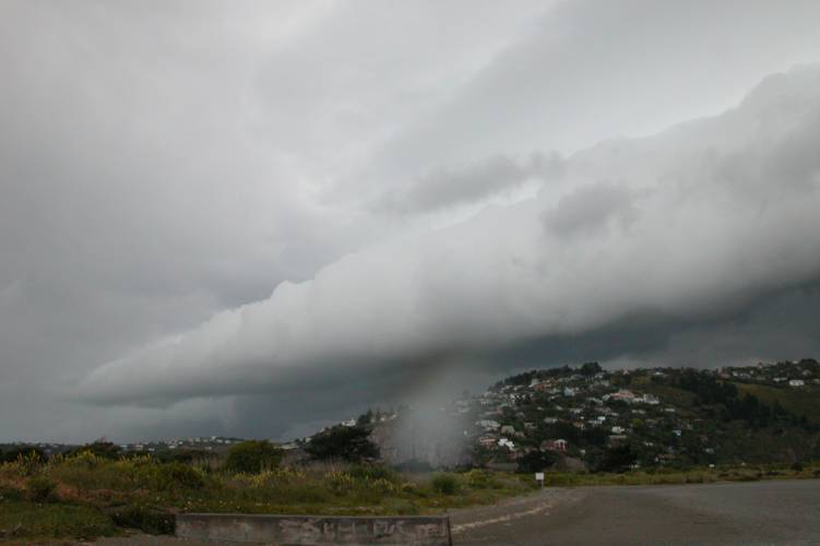
What was that I caught out of the corner of my eye? Yep, Steve confirmed….it was lightning going off in the clouds just offshore to our east. It seemed the obvious choice as to where we would go now, but to go south or north of Lake Ellesmere which is a pretty big lake. We started to head SE but I said to Steve we should head North seen as the storms were moving north we would want to be closer to them as they moved up the coast. So we backtracked a little and then we were off to Birdlings Flat!

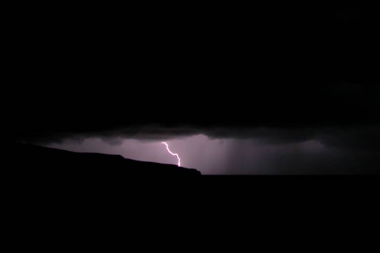
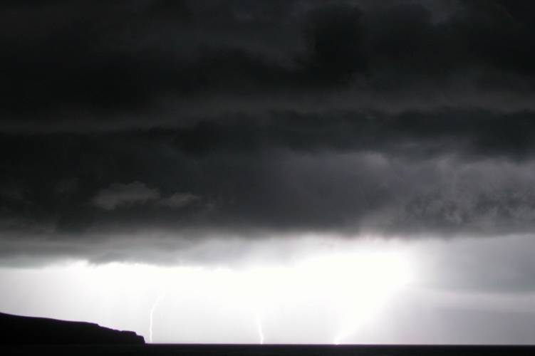
The closer we got lightning would go off more and more, the darker it got lightning got brighter and closer! When we arrived at the Birdlings Flat beach I franticly set up my Digital camera on my tripod and it was dark enough to take lightning photo’s. In the distance I could see dark bases slightly lit from behind in the twilight which had swung around onshore which marked the oncoming southerly front I believe. I say I believe because I’m not totally sure, it was totally dark when the southerly arrived so I’m presuming the Cb’s coming ashore to the south could’ve been it.

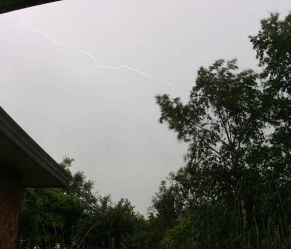
Yahoo! My first shot of lightning on camera that I knew 100% was lightning. A few flashes had gone off before but I had set the aperture too closed and the lightning didn’t register on the camera at first but once corrected it showed up nicely. No fancy bolts but it was something! That’s one thing about digital camera’s is you can check the shots to see if you got them or not and make corrections if need be. One of the annoying disadvantages is the noise reduction process the (mine anyway) camera does after each photo has been taken due to a long exposure whereas with a film camera you could keep flicking shots off and not have that problem, but then you can’t check your shots strait away either. So there’s advantages and disadvantages to both in this situation.

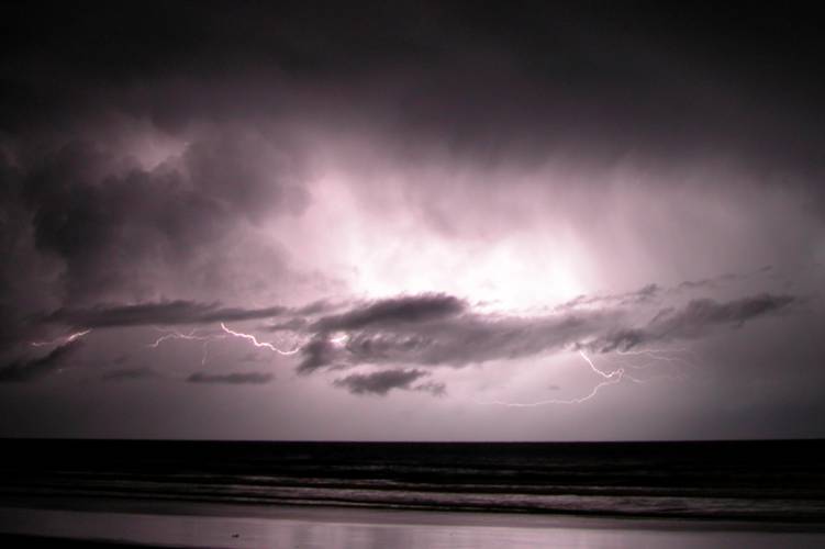
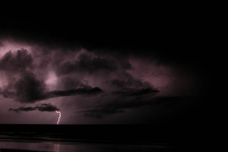
The lightning continued and got closer as the night went on, the line to the south was also becoming active and moving up the coast. At times I would miss shots due to bad timing but I managed to get some shots. The wind began to pick up all of a sudden and got very strong from the south, it was hard to stand still and you could almost lean into the wind and let it hold you there. I can’t remember what time this was but it was dark. It also began to rain and then hail the size of peas started to fall to, my eyes were watering and rain was getting on my lens so I wouldn’t be able to take photo’s anymore. I had to get in the car, not to mention the lightning as I didn’t want to get struck. We saw some awesome big cg’s and cc’s quite close just off the beach before we left in the car, what a bugger I couldn’t get them on camera because of the rain. We managed to stay out there for quite a bit but I have no idea of the time this was, at a guess it was probably an hour. Steve also had his video camera which he used but he forgot to charge the batteries the night before for it so he only got about 7 minutes footage and we got no in car footage which I’ll explain about later! I’ll let the lightning photo’s talk for themselves now.

Not the best but ok for my first really good shot at it! The middle one in the 3 above would’ve been a great shot but the three cg’s coming down made things over exposed. I got quite a few others but the ones above are the better of them.

As this hail and rain started to pour down we wondered what we would do. If we could find shelter there was still a great chance to do some lightning photography but we didn’t know where to look as it was dark and there was no one either of us knew around Birdlings Flat. I said to Steve we should leave and head West, as we did it really began to pour and hail was falling up to 1cm in diameter pinging off the car, it was really cool! Lightning was also now going off overhead turning night literally into day with incredible blasts of light and then awesome thunder! Going down the highway Steve spotted a turnoff to the left going to some golf club (we didn’t have any maps!) so we turned down there hoping for shelter to do some photography, no luck. Lightning was now getting more frequent overhead and hail was falling everywhere, marvelous cg’s to our right and left were coming down….just awesome! I said we should turn back as the shingle road we were on wasn’t going anywhere. The storm seemed to be heading NNE at this point so a trip was in order back around the Port Hills and through town and then to New Brighton. As we got onto the highway flashes weren’t as frequent but were still great when they went off, some pulsating and lighting up cloud structure for a few seconds at a time, and some lighting up the surrounding area turning it into day. One particular strike was so close and bright my eye’s couldn’t adjust and all I could see was white for a few seconds after the lightning had happened.

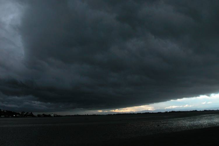
Just before we arrived in Tai Tapu the roads were white from hail apart form the tracks of cars going through them, it wasn’t hugely deep and the hail wouldn’t of gone past 1cm in size but I hadn’t seen anything like it before. The lightning had piratically stopped by this point as it was going off just over Christchurch and off the coast where we couldn’t see it because of the Port Hills. As we got closer to Christchurch lightning began to make it’s presence felt again lighting up the skies just east of the city on the coast. A quick fuel up was in order then off to New Brighton! The Cb’s were offshore when we got there and I quickly set up my camera on the tripod while Steve stood there with his digital camera using it’s movie mode. I managed to get two ok shots from New Brighton of lightning, although there was some annoying low cloud in frame as you’ll see below! There were other awesome strikes that went off but bad timing meant my camera was doing noise reduction from a previous frame. Neither Steve or me heard any loud thunder from the beach but some was able to be heard as the storm moved northwards.

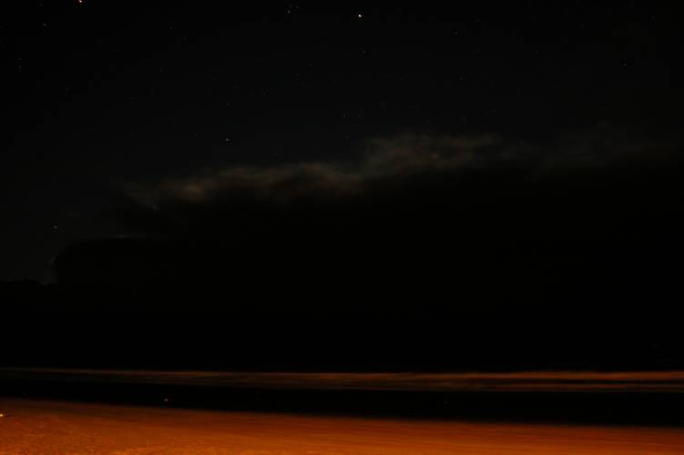
Then all of a sudden it was over. I waited and did 5 more exposures but nothing was happening and nothing continued to, our night was over. My last photo I left the shutter open for a while to show the Cb’s faintly lit up by the moonlight (actually I’m not sure if the moon was up that night) or the light that was there as they moved up the coast. You can sort of make them out in the photo below.

Steve and me quickly reviewed the video from Steve’s DV camera back at my place and looked at the pics I had taken. Not bad I thought for my first go at getting lightning on camera. The video was dam funny, with my going sh#t every time a lightning bolt went off or if I missed a shot. One particular scene on the video has me going “Holly Sh#t” while Steve says the the “F” word while I say “Sh#t”, it sounds really funny and we cracked up laughing when we saw it! Well, to be honest I’m not sure if Steve says the “F” word as such, it more or less sounds like “Holly Fa!”. You’ll see what I mean when you watch it! It’s a bugger the DV camera ran out of power during the time we were just coming out of Birdlings Flat and going around that area and then as we came into Tai Tapu, there was some awesome action around that time.

Strong southerly buster!

I was aware that thunderstorms could develop on this particular Thursday and the morning looked promising …….however, a cloud band moved over the South Island keeping things pretty dim and not thundery looking at all. I could see in various models and satellite pictures the cloud band moving north but I wasn’t sure how long after the cloud band moved over that a southerly forecast was due. Lucky when the cloud band moved off there was a nearly two hour period of sun which made the temp go over the morning’s max so things began to look good. The rain that fell from the band that moved over the SI provided some needed moisture from evaporation as the sun was in the western sky (dewpoint went from 5/6C to 8C when the sun came out). I was getting excited at around 6:45pm as I spotted the edge of a large roll cloud south of Christchurch, something had to happen!!! The models weren’t showing any negative LI’s and CAPE was zero! It just shows that sometimes they don’t get it right but they can be of use on other days. I find upper temps tend to be fairly accurate though with models.

Despite the surface temp only getting to around 14.8 C in the afternoon it was just enough as the upper air was quite cold, this with a northeasterly before the change provided a nice afternoon of storms.

On the way home I took a photo near the Avon river mouth so I could get a record of this beast of a roll cloud I could see in the distance, I couldn’t see it in it’s completeness due to other cloud but I knew it was big. Back in the car again and off home. When I got home I quickly went to check the tracker and saw numerous strikes just south of Chch, it wasn’t hugely intense but no doubt there would’ve been some nice strikes out there. Dam excited I rang Steve to see what he was doing, he was in Tai Tapu!! I said “What are you doing there?, and what do I hear next! “Aaron, I saw a funnel cloud!”, trying not to pop, “What!! Holy molly” is all I can say. Unfortunately he couldn’t photograph it as it disappeared quite quickly. Where I was didn’t really turn out to be that bad after all, pretty good infact. Winds were pretty uniform throughout the atmosphere going SW pretty much all the way up to 300mb, shear was good and storms would move at a good pace. The funnel Steve saw would’ve been a localised type development and not part of a mesocylcone.
I jumped up on the roof and took some photos before running down to the estuary to take more photographs. The base of the cloud over Christchurch was looking quite turbulent and lumpy.

Donning my jersey and jacket and with all my camera gear under my arms I ran off towards the estuary. On arrival things looked impressive and organised with the front peeling over the top of the Port Hills in an arc over towards Christchurch and onto the Canterbury Plains. I was too close to be able to do a panorama but I got some ok shots. I got a drop or two on the lens at one point which is always a worry and can ruin a good shot, this happened to a couple of my photo’s and one of the ones you’ll see up on here. I figured it still looks good so is worthy of being on the site!

As this structure came over it got dark and very windy but no rain was falling as of yet. The underneath of the roll cloud was quite messy looking and not as nice as the front of it, I still hadn’t seen any lightning or heard any thunder. I couldn’t see any rotations of funnel cloud type matter so it was unlikely anything would happen in that department where I was and nothing did. The roll cloud as it steamed off looked quite impressive though, it looked very much disconnected from the Cb itself but was a great feature visually of the storm!

Steven Graham in Templeton got a few shots and did notice twirling motions in the clouds and took some photos and managed a lightning strike on his digital SLR camera, here’s a description from Steven.

“When the lightning was overhead, I noticed there was a bright stroke in one direction often followed by another going the other way.  It was just luck that I was quick enough on the shutter release cable to capture this one after a number of attempts 🙂 I used ISO100 setting and f8 to increase the exposure time to 1/5 second which helped.” Here’s what he had to say on the NZ weather forum:

“Started seeing distant lightning and hearing thunder to the SW at about 7:15 but then it died out. After that several lines of cloud started to develop overhead. There had been a moderate ENE-E wind most of the afternoon and the southerly had just arrived. There were quite a few potential funnel clouds with the bases of the cloud lines starting to rotate and descend but nothing got too far before the gusty southerly wiped it out. I recorded some footage on video and you can kinda see what I mean from the first photo. The thunderstorm then developed with lots of long ICs running back and forth across the sky – no wonder the Boltek was confused.”

The Boltek Steven mentions is his lightning detector which you can view here.

As the roll cloud moved further north Jason Tippet was ready to have his turn for some photo’s of the roll cloud. Meanwhile I quickly ran home as it was beginning to rain but when I got home it sort of stopped with only a few spits hear and there so I ran back to the estuary again. As the Cb situated itself over Christchurch with no base visible probably due to rain things didn’t look great at all. I waited and then “Strike!”, I could see a nice Cg come down to the west of the city or perhaps somewhere in it? I then waited and some nice thunder came across, it wasn’t very loud as it was far away but sounded great. Lightning ended up not being that frequent with myself only seeing 5 or 6 strikes all up, the main lightning activity seemed to be just SW of Chch in a line from SE to NW. Only infrequent strikes really made it more further north.Where I was I didn’t get any hail but some was bound to fall somewhere.

There was hail out near Rangiora where Pam Johnson was driving home to Sefton when she had a big hail shower and saw lots of lightning:

“I left a job in Rangiora about 8.15pm and it was just starting to rain, then there was a really good hailstorm with quite large stones about the size of large peas, I stopped to see if there was going to be a photo opportunity but it was too wet and cold and I wasn’t dressed for the weather.  The hail was the loudest I have heard on my car, I did think it would dent it.  Then when I got to Sefton I ran into hail again.”

The last lightning bolt I saw was probably only a kilometer or two away from me, it was very bright and thunder sounded within a second or two very loudly which made the ground shake and me think it’s time to go! The wind was very strong and gusty with it getting cold, rain was also beginning to fall harder than before. I didn’t go along the estuary front not to be too exposed and didn’t want to get struck so just went through the scrub and tress behind me, my feet and pants got soaked but that didn’t worry me. That was actually the last bolt I heard or saw for this storm in the end.

As Steve was chasing the storm north he didn’t see all that much lightning either and got to around New Brighton from where he was in Templeton when he decided to go north. So he came over to my house and we reviewed the evening and looked at some photos I took.

As the storm moved north Jason Tippet got some nice shots from Kaiapoi.

It’s been quite a stormy period lately, so cool! Two funnel clouds sighted so far this season in Canterbury, awesome!!

Canterbury storm outbreak, Part 2

After the storms on the 15th November storms fired again the next day this time more along the coast. I was meant to write a report at the time many moons ago when this happened however I unfortunately never got around to it, I didn’t get to go out and chase these storms however I took some pictures from work in town. I remember seeing some cloud to ground lightning strikes above the port hills on this day. I went back and had a read over the archived NZ Weather Forum posts and it did refresh my memory somewhat, I do remember the dew point being rather low, makes sense with the storms being quite coastal which can be seen clearly on the modis satellite picture. Still have the pictures I took from the day so here they are for all to see, not amazing by any means but we take what we can get in New Zealand thunderstorm wise. Would’ve been better if I was out of the city and nearer the coast south of the peninsula for these storms but surely enough they will happen again.

Jason Tippet in Kaiapoi also took some photos this day.

Canterbury storm outbreak, Part 1

What an awesome storm this was! Absolutely loads of lightning going by the trackers and some great structure.

Pity I couldn’t get in the thick of it as I was in town at work.

An upper cold pool of air ( -22C 500mb ) was moving down from the north rather than the typical up from the south track. It did originate from down south however as I remember it, it sort’ve came up through the Tasman Sea then stalled moving eastwards slightly and then drifted southwards which was a bit unusual. As it came over sunny skies and good early morning temps (18C) and dewpoints (12 to 13C) initiated development early with towers going up on the plains with no cap to inhibit convection. Soon some of these went to Cb and a few towers to the northwest begun to produce lightning but nothing intense. Shear wasn’t very good with weak winds throughout the wind shear profile, this meant storms that formed early wouldn’t really go anywhere and would collapse after their mature phase pretty quickly which they did.

Some nice instability began to form again which looked to be helped by a NE / S convergence, only light at this stage but it kept things alive until a southerly change came through. An area just southwest of Christchurch was to be where the main storm system for today would form near me, there was a larger area of storms in South Canterbury for this day however at the time I didn’t realise. After having taken a few pictures of this new development I went back to the office and then after a while went back outside again and saw nice big Cu congestus go to Cb around NZDT 3:00pm. No lightning was happening yet but this Cb would grow to become quite big aided by the convergence.

So back to the office I went (such fun!) and then I went out for another walk when things were getting dark at around NZDT 4:00pm. By now lots of strikes were beginning to happen in the area SW of Chch (look at the tracker screen capture!). I couldn’t see anything yet (lightning that is) from where I was but it was dark on the plains. And unfortunately I wasn’t to see much! As the darkness came over I got to see some nice Cg’s and Ic lightning but no more than 10 strikes all up. I had to go back to the office as it began to rain.

The wind shifted to the southwest and then the Cb began to move on through. As it did I saw some nice vertical structure through the murk that looked impressive, it gave off one more rumble then it was heavy rain as the Cb moved off to the northeast which it then soon dissipated. It’s a bugger I can’t give a more action packed report but had I been southwest of Christchurch there would’ve been loads to tell I’m sure!

Of course there were other storm enthused buddies out there that got some photos to which is great!

Steven Graham in Templeton got some nice shots of the main developing Cb. As you can notice it shows similar things to my Cb photo’s, just from a different angle.