Christchurch gets a storm at last!

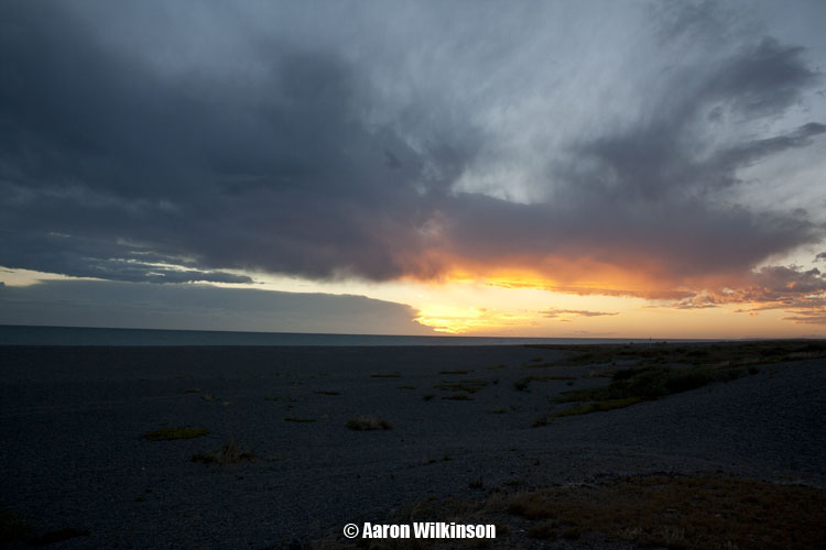
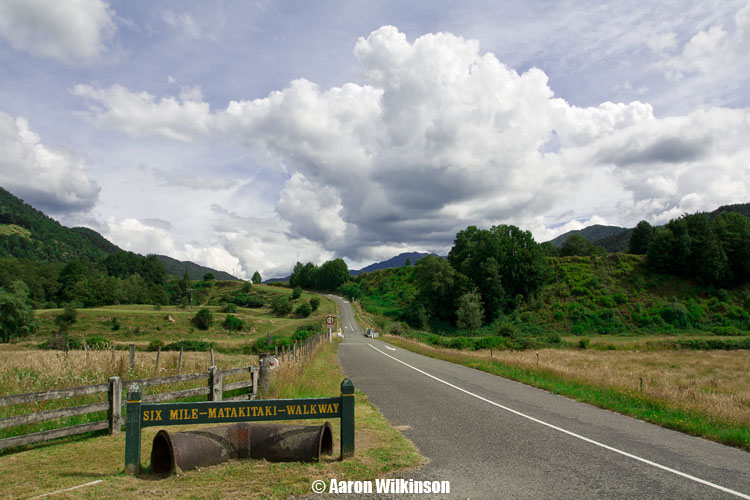
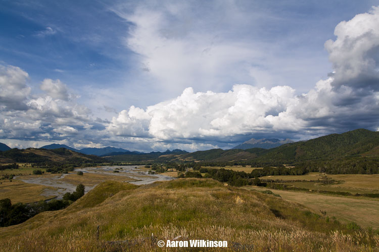
This event looked quite possible about 4 or 5 days out by going through weather models. Very cold air (-28°C 500mb) was dragged over the South Island from an initial frontal zone, the surface wind did change southwesterly with this front in the morning but I was hoping it would die out in the afternoon and then give a clearance with some sun for a time which sort’ve happened. For a brief moment doubt did creep in as the southwesterly front and cloud / rain did seem to hang around a bit longer then I thought it would, I always seem to have a moment of doubt at times on storm days as thunderstorms need unique factors to come together for them to happen.

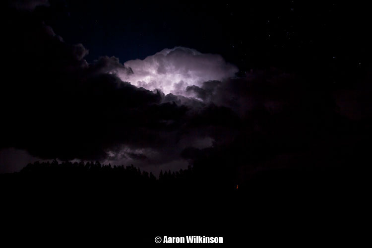
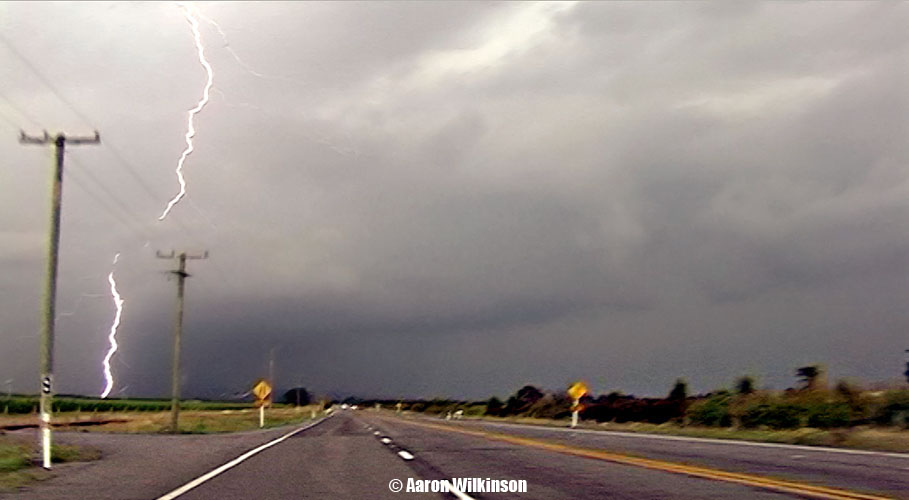
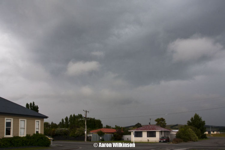
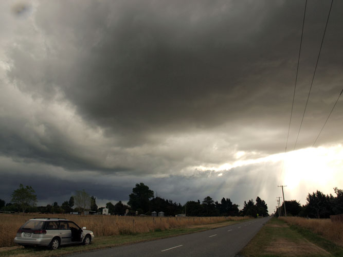
The southwesterly didn’t totally die out but it did ease a fair bit with the sun coming out around 5pm, then in the evening around 7pm a trough I was expecting came up with an invigorated south to southwesterly airflow delivering thunderstorms! And would you believe I was stuck at work……………Nooooooo!!!….. However! Luckily Steven Burrows was covering North Canterbury and Jason Tippet / Mike Stewart were covering areas west and south of Christchurch. Steve seemed to be in the best spot for these storms that moved through although Jason and Mikey did get to see some lightning going off. I was in the Spreydon area at the time of the storm and observed a flash or two and heard some thunder, the storm while not overly active above the city it did class as a thunderstorm and Christchurch itself hadn’t really seen a storm in ages. In the first photo below Steve actually observed a short lived funnel coming out of this small cumulus cloud near Kaiapoi while heading north, unfortunately he couldn’t get his camera out in time.

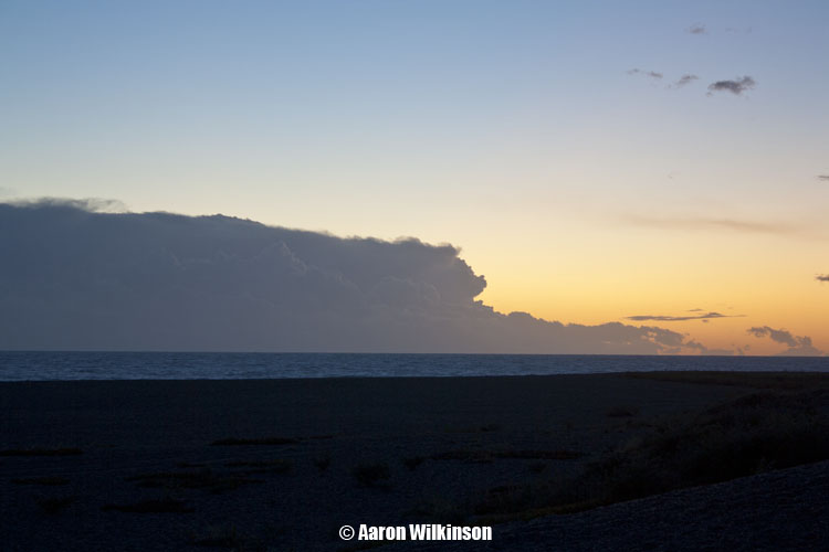
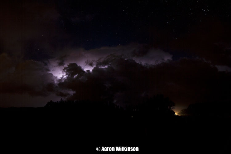
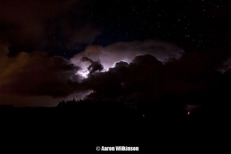
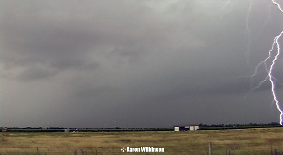
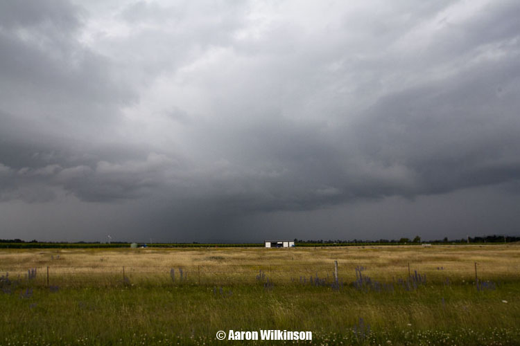
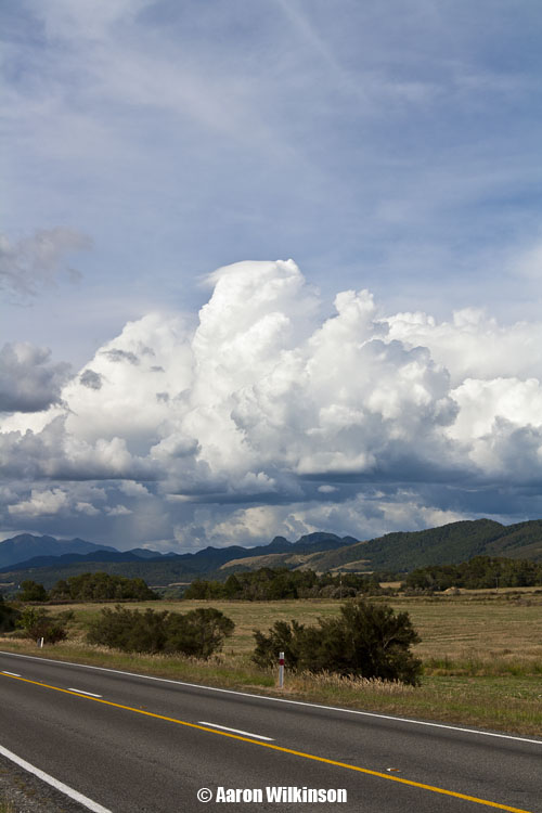
The next 5 shots here saw Steve just north of Rangiora, he observed a number of Cg’s here which he filmed. The third photo below shows a cloud base which Steve saw rotating, so that’s pretty cool! The last photo is looking south with some mammatus hanging out of the back of the Cb.

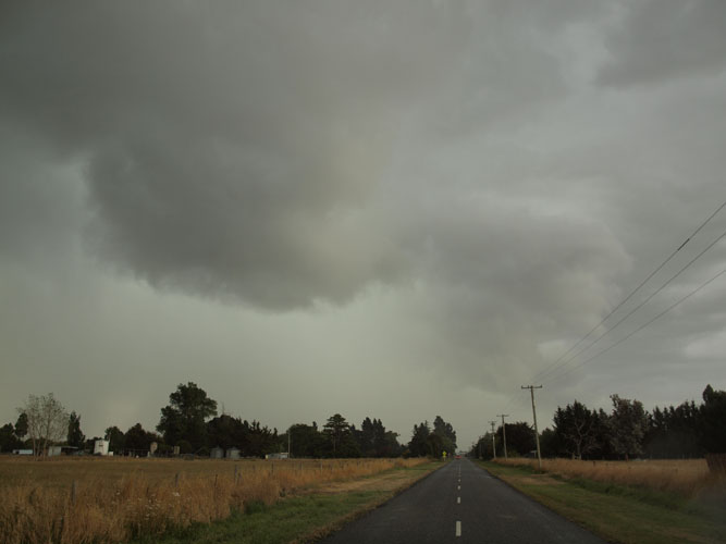
As the storm moved north Steve drove up towards Greta Valley and saw more lightning on the way, the storm did move quite quickly though and he decided to end the chase there. I was gutted being stuck at work but glad these guys got out there to see what was going on.

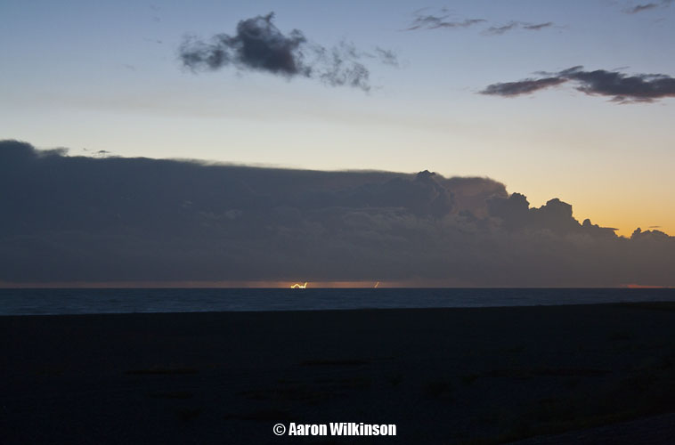
When looking at satellite images I saw a nice line of Cb’s off the coast of Westport develop about the time I finished work (8.30 – 9pm), I figured at the time it would be a fantastic chance to do some evening / night time lightning photography but no way could I get there. A month later I saw this (click here) image appear in a weather photo gallery run by Metservice, someone out there was thinking the same idea as me! Wicked shot Francis Carmine.

Patience pays off

Very cold upper air was due to come over the South Island this evening (-27°C 500mb), once again a key ingredient at times for thunderstorms. This combined with a surface southwesterly wind change brought a risk of storms along the South Islands east coast.

I went over to Mikey’s place to say we should go out and wait for thunderstorms, they were always going to be very coastal so the Banks Peninsula area is a good bet as it juts out and often catches these storms as they move up the coast in certain situations. It acts as a trigger to and causes orographic lifting helping the storms as I believe it did this night. We also called Jason Tippet out in Kaiapoi so he came out and met up with us, once again don’t normally like to chase with that many but these guys generally are always super keen to go after something so put the option out there. Mikey took his own car however as he said he might go back if things didn’t look like happening, unfortunate for him as he left and things did happen! You have to have patience sometimes.

Steve went out in his car separately and sat nearer the Selwyn River mouth like we did on the 18th November 2011. Jase, Mikey and me decided to go for Birdlings Flat. There was a thunderstorm that had developed just off the coast of Birdlings Flat a little earlier in the evening around 7pm but we weren’t there then unfortunately arriving an hour or so later. Once we arrived nothing looked terribly exciting, but I was content to wait as a southwesterly change I was expecting hadn’t come through yet. The evening colours on the hills produced by the setting sun did look rather nice though.

Around 9.30pm Mikey decided to go home as he wanted to have an early night with work in the morning, Steve sitting out near the Selwyn also decided to go home. Still, Jase and me were willing to wait longer. I turned on the AM radio not long after as a Cb offshore from Timaru at a guess came into view with areas of cloud clearing. Sferics started to fire on the radio so things were looking up, I was pretty confident it was this Cb we were looking at but it wasn’t dark enough yet to see any lightning. Not long after though we started to see a few flashes and little bolts coming out the bottom of the cloud! I set up my DSLR to see if I could capture a few of these flashes, a bit hard with there still being so much ambient light about. I would have to crank up the iso, open the aperture then hand trigger the shutter and hope I had enough speed to get a few of these suckers. Fortunately I did! Only little tiny lightning bolts but hey that’s pretty cool, a nice big positive Cg would’ve been nice but oh well. I got a little bit of video around this time aswell.

As things started to get dark the sferics died down and things weren’t looking very good. We actually started to head back towards Christchurch as even I thought it was over, on the way back before Motukarara Jason noted that some dark cloud edges were building outside to the south. Curious I pulled over and man he was right, we headed back towards Birdlings flat but didn’t go to far. I wanted to keep out of the rain to try and get some lightning photos, I can’t remember where we stopped exactly. I set up all excited as I am when these situations come upon me, lightning started going off and I tried to get some photographs. Unfortunately there weren’t any bolts coming out of the cloud, plenty of IC lightning (sheet lightning) but that was it. It didn’t last all that long either, the cloud quickly headed off over the Peninsula and that was our opportunity gone. I didn’t have time to video at this point as I was more concentrated on photography. Still I got 2 or 3 okish shots, here they are. Briefly the last 2 shots look ok but I’m not entirely happy with them, I won’t bother going over the technical jargon why. I had to play with the files to even get them looking like this so yeah they aren’t anything amazing in my view but it’s something that you guys can see here. The first shot I don’t mind, even if there isn’t any big bolts anywhere. You can also see the Southern Cross in this photo.

There is a car about to come around the corner in the third shot hence the bright light in the bottom right hand corner.

As it looked like it had come and gone we started heading home around 11.50pm. We noted distant flashes still coming from the cloud as it went into the distance but nothing we could make use of, I dropped Jason off at his car and headed back to my place. On the way I could see lightning flashes as it headed offshore, but now it was more visible having cleared Banks Peninsula slightly. I thought I should give it a shot and set up again at an overbridge close to home. Amazingly I got a few more lightning photo’s! Darn annoying moon was in the way though! Grr, or does it add to the image? You decided, I’m not a fan of it being there, distracts from the lightning! Nice with the city lights in the foreground though.

So all in all a bit of fun had on this chase. Moral of this story is be patient, and then when you think it’s time to give up be a little more patient!!

Thunderstorm over the Amuri Plains

There always seems to be some factor with thunderstorms that could possibly ruin the chances of storms happening, this could be anything from low cloud cover, high cloud cover, a southerly coming through too late, not enough surface moisture or not enough surface temperature for example.

On this day the main thing I was worried about was high cloud cover hindering afternoon temperatures from rising enough, the upper air wasn’t particularly cold (-14°C at 500mb) but there was good surface moisture. I knew there was a risk of thunderstorms happening somewhere in North Canterbury most likely but stayed at home till I was sure things looked good. A look at the nrfa website for this day when data came out around 2pm showed good temperatures in the Amuri basin, this was quite positive. A look at satellite images showed a band of high cloud over the South Island running north to south which was just west of Amuri, another good sign as it let the sun in.  I left a little bit later then I should have though, I think due to the trip we took to Springs Junction only 3 days before I was weary of going too far for not much perhaps but thinking about it I should’ve just shot off as soon as I saw development on the radar at 2pm! Oh well, I still got some good rumbles of thunder and saw some quite impressive Cg’s in the time I was out.

I left home about 2.50pm and headed pretty much the only way you can into North Canterbury, state highway 1 heading north! I was hoping to get into Amuri where this storm initially developed but didn’t end up going that far. I turned on the AM radio in the car south of Amberley and this storm was going nuts! Sferics going off constantly, while going through Amberley I saw a big Cg come out ahead of the storm which I don’t get to see to much with storms in Canterbury, my guess is big positive strikes! I got my video camera out and started recording, I didn’t see much till I got nearish Waipara when another big Cg came out of the cloud. Was awesome as I hadn’t really seen good lightning in quite a while!

I pulled over to the left down a side road and set up just south of Waipara. Took some photographs and heard some thunder, I wasn’t there to long as rain started falling 10 minutes later so I had to start moving back south again. While there though a big Cg went off which would’ve been only 1km away at the most, the sound of the thunder cracked big time and was wicked!! You can here and see it below in the video, at first I thought I just missed this lightning bolt on the video camera but while editing the clip for this report realised I’d just caught it!! Yikes is all I can say! The video stills for both strikes below, touched up a bit.

When the rain started to fall I headed south and got back to Amberley, I sat there for a while and heard a few more rumbles of thunder but that was it pretty much. The storm slowly lost it’s punch.

I met up with Steve in Saltwater Creek as he left strait after work but unfortunately he was too late by that stage, we thought the clouds looked promising at times but no more was to happen. A quick chase but the thunder was pretty cool!

I got a txt from a friend Richard who lives in the Amuri area at 4pm regarding the storm around 3pm, he said “Just had a massive storm, 47mm in 1 hour! But lightning hit our internet dish! Non stop thunder too!”. So it certainly must’ve been exciting times in Amuri that day!

Nelson Lakes thunderstorms

Things were getting serious with hardly any thunderstorm opportunities in Canterbury, we would have to start looking further afield to feed our hunger.

A slack pressure gradient was sitting over the South Island, looking at weather models inland areas of the upper South Island showed promise with good low level moisture and convergence. Warm afternoon temperatures would turn the atmosphere unstable. A brief summary of this day to us was that we didn’t encounter any storms, they were a little further to the east from our position between Springs Junction and Murchison in an area where the roading network is not very good so it made it hard going to get any storms really. It was still a fun day out though with friends seeing the sights. Got some nice photographs to so thought I’d put something up to keep the content flowing on this site.

On this trip we had Steve, Jason Tippet, Mike Stewart and myself. We left Christchurch around 11am heading north, our aim to get to Springs Junction then go further north if things looked good. Conditions were nice and warm once we got to Springs Junction about 2pm and cumulus clouds appeared over the hills.

While interesting we headed further north to Murchison and down the Matakitaki valley, we saw a nice looking cloud brew up and get big but it moved to the east where we couldn’t get to. While there we found this neat little power station called “Six Mile”. Didn’t know this place existed but it is a hydro electric power station that was opened in 1922 and kept running all the way through to 1975, neat little place and just shows what you can discover if you get out there.

It was now nearing 5.30pm so we started to head back, on the way clouds looked good around Maruia so we stopped for a while and I took some further photographs of cumulus congestus over the hills.

We started to head back to Christchurch around 7pm, we should’ve hung around atleast an hour longer as these clouds going by radar and satellite pictures look to of grown bigger and pushed into this area. Whether there was any lightning I’m not sure of, the weatherzone lightning overlay didn’t show anything in this area around 8pm. It won’t pick up everything so if anything did happen it would’ve been quite limited perhaps. I’m a little perplexed as to why we had left, after the long day maybe we were all ready to go? I think if I was sitting there by myself I would’ve been content to just sit back and relax while the evening wore on, I might do that next time provided I don’t have other commitments. It was cheaper going as a group though even I’ll admit, $25 each for the return trip. Good value for a day out sight seeing, who knows…. maybe next time we’ll actually get some storms??