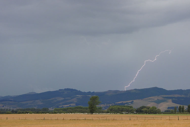
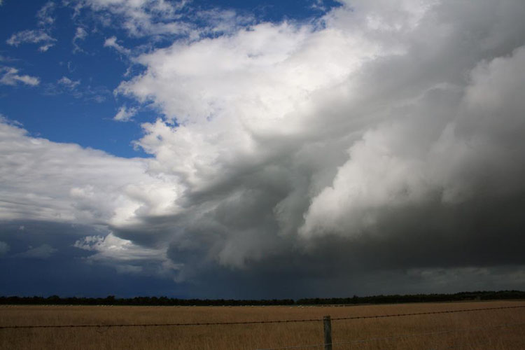
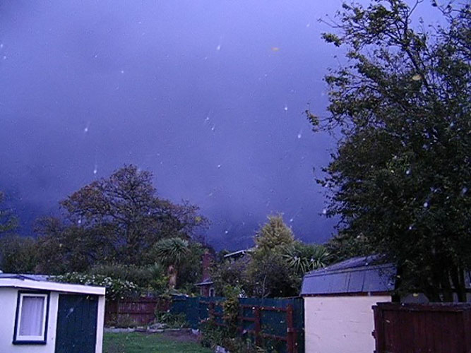
2011 was not a good year for thunderstorms in Canterbury! To be
honest it hasn’t really been that good in a while apart from a reprieve
in 2009. Oh the pain, had to go after anything that looked possible.
Would you believe Christmas Day was the only good day in 2011, why did
it have to be Christmas Day! I couldn’t just abandon the family could I?
I didn’t this time, but who knows in future if it looks good enough.
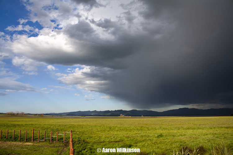
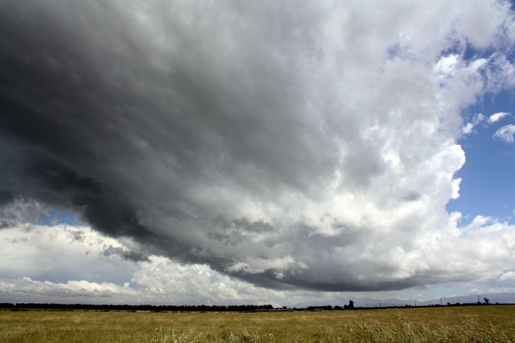
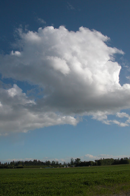
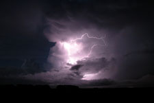
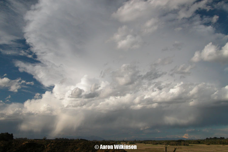
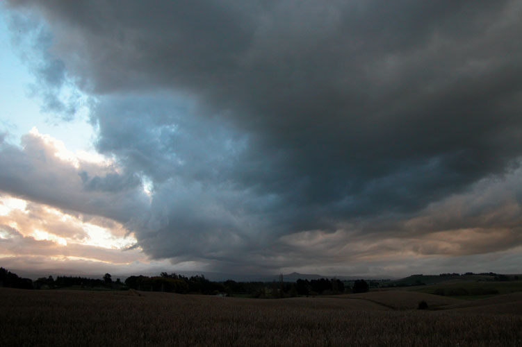
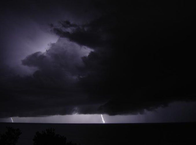
Those storms on xmas day happened mainly down towards Fairlie as a
result of surface heating and moisture creating an unstable atmosphere,
also good surface convergence on the foothills down there. I’ll include
two photos at the end of this report showing the cumulonimbus clouds as
they started to fire taken from me back up in Christchurch looking over
the back fence!
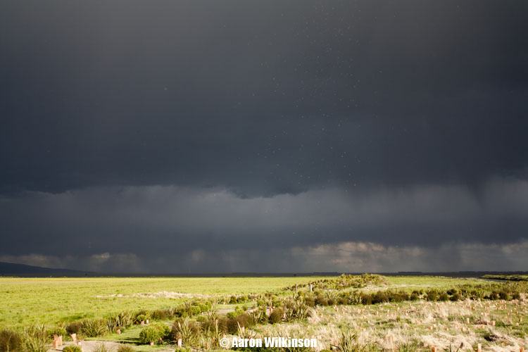
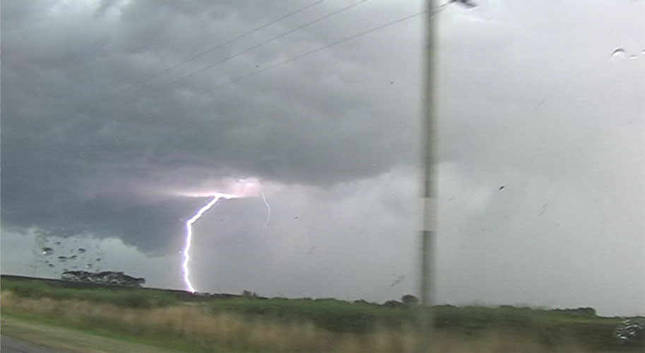
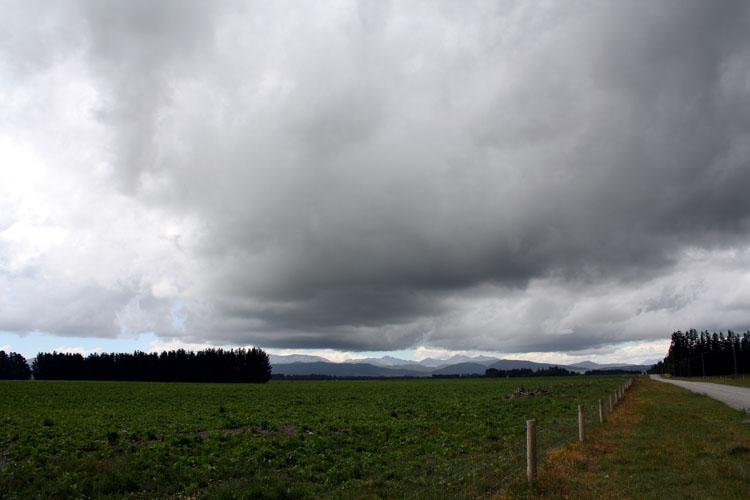
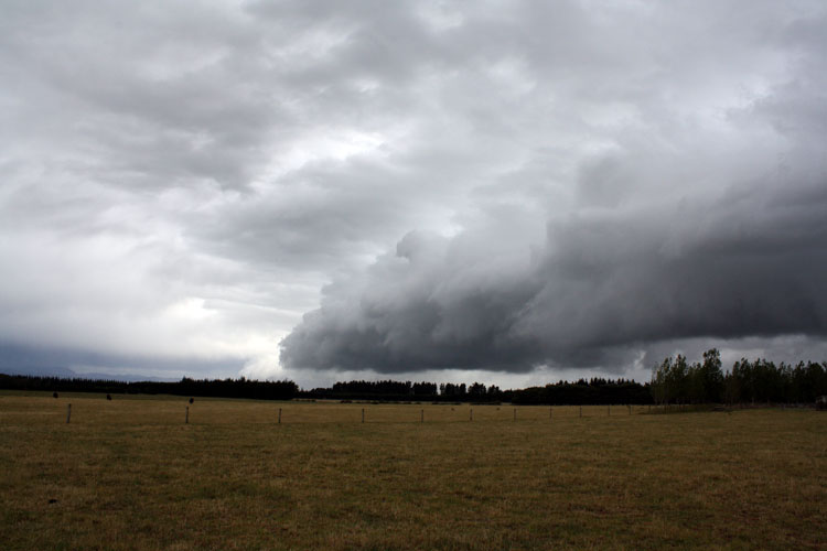
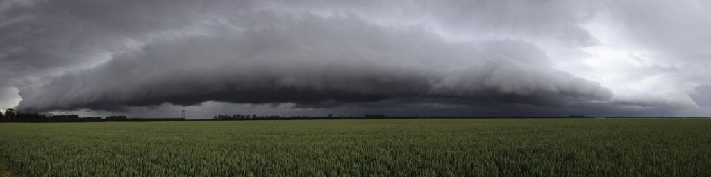
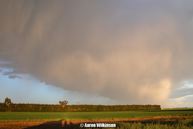
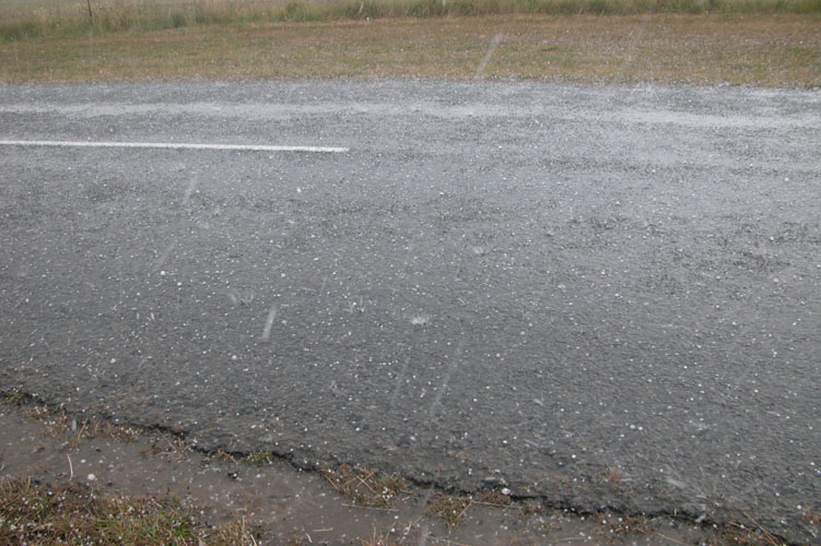
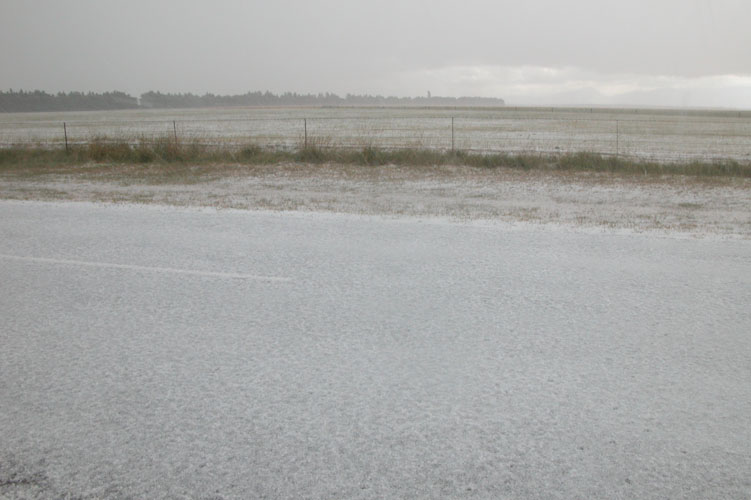
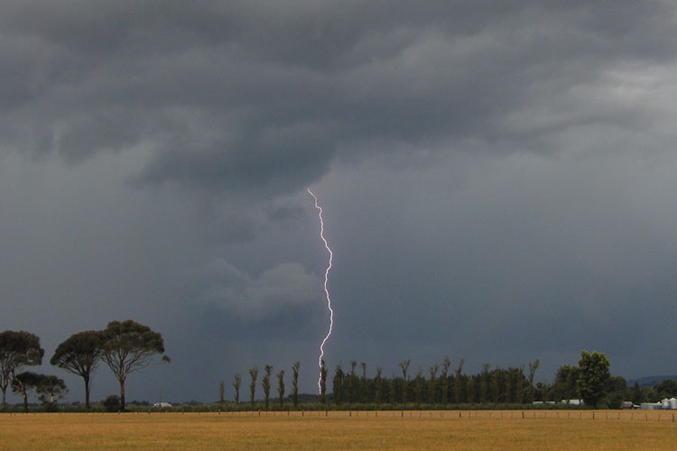
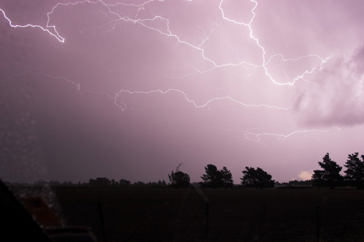
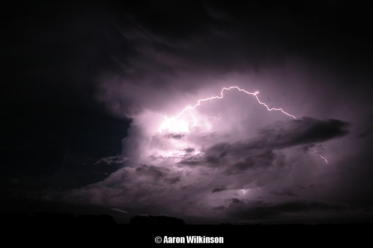
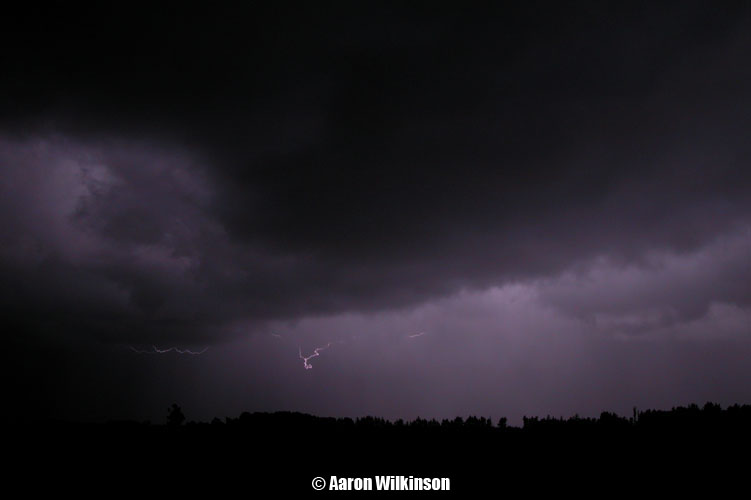
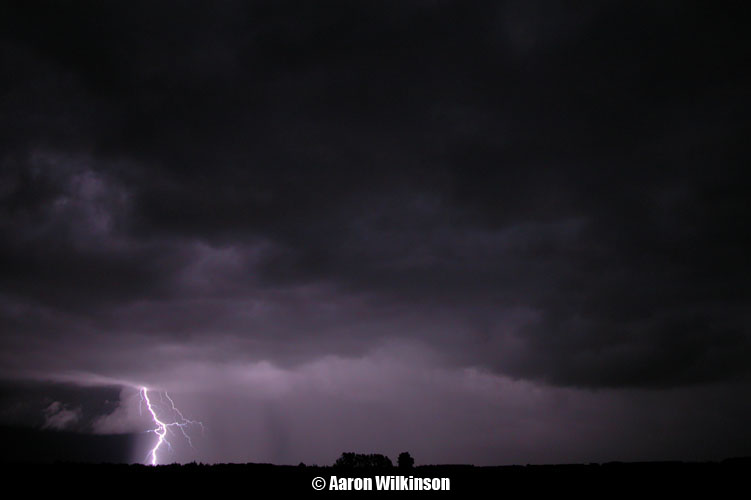
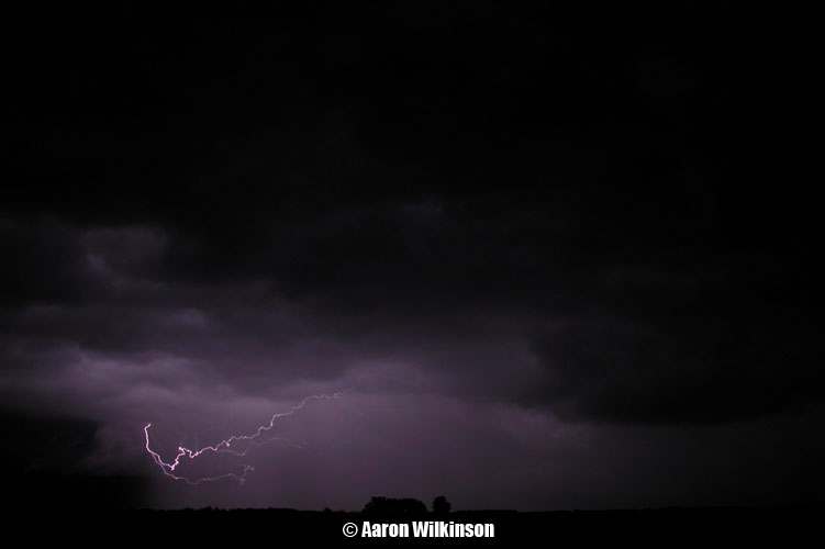
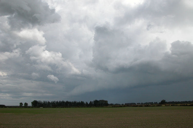
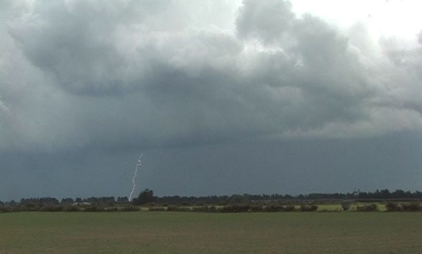
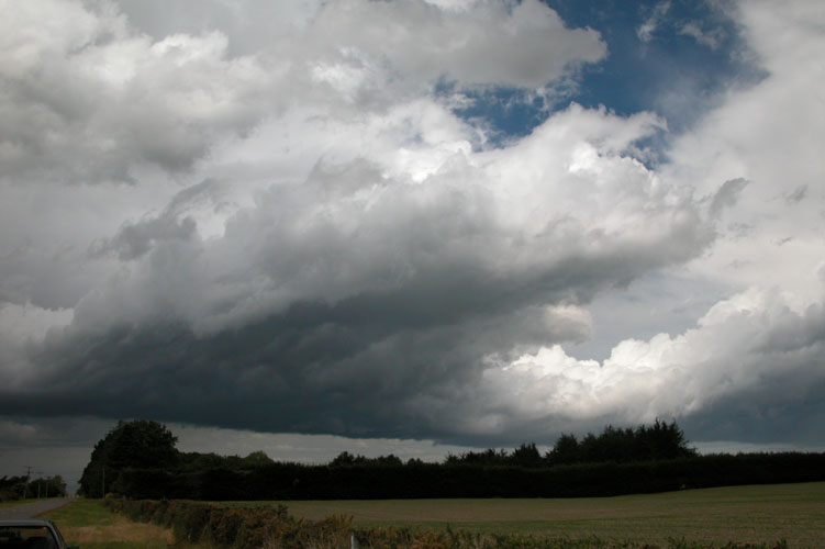
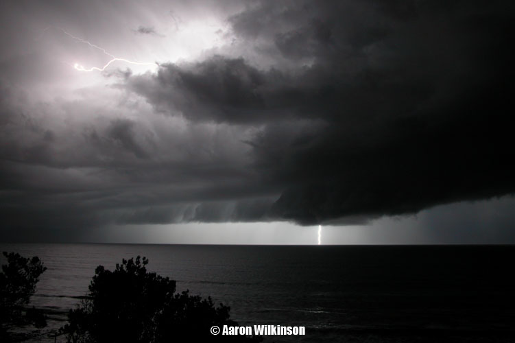
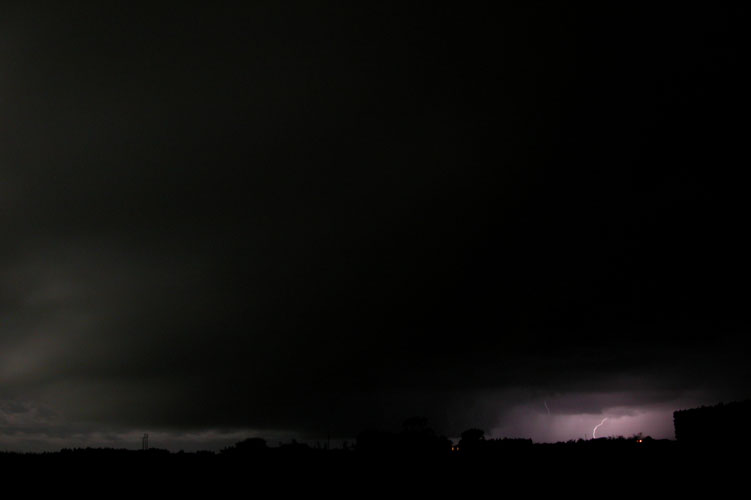
So back to this day in November, as I said we went after anything and
this storm wasn’t great at all really. Saw one lightning strike and
heard one lot of thunder, that was it and I got the only bolt on video.
Hooray! not….. The upper air (500mb) was cold at around -25 to -26 °C.
Surface conditions were not very favourable being northwesterly and
drying it out, however sometimes you will get storms just on the coast
south of Banks Peninsula as fronts move up from the southwest in these
conditions. This is what I was counting on as a southwesterly wind
change was moving up, the best timing going by the models was just after
6pm so Steve and me set up at the Selwyn River mouth of all places
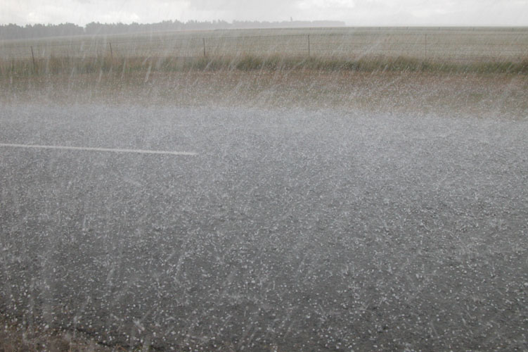
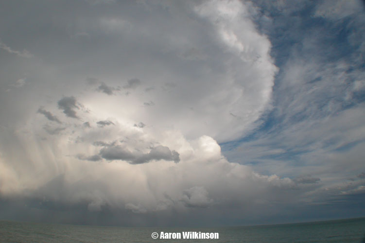
around then and watched a dark cloud brew.
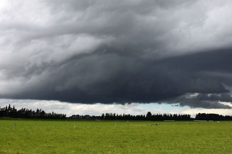
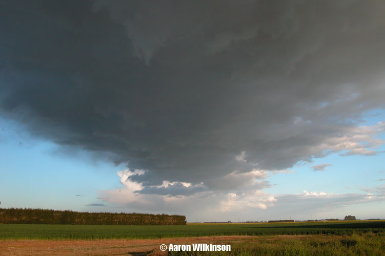
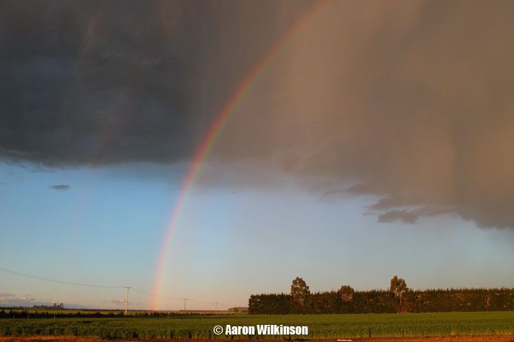
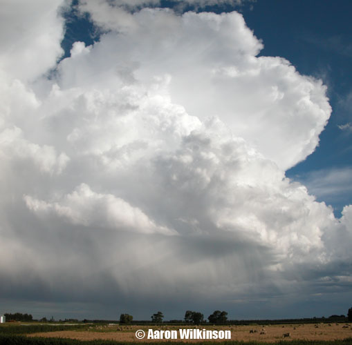
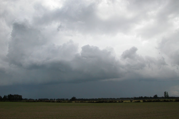
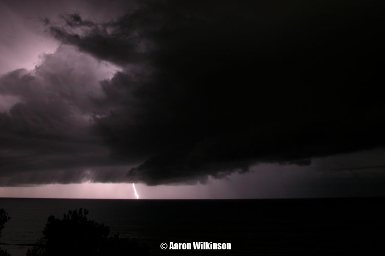
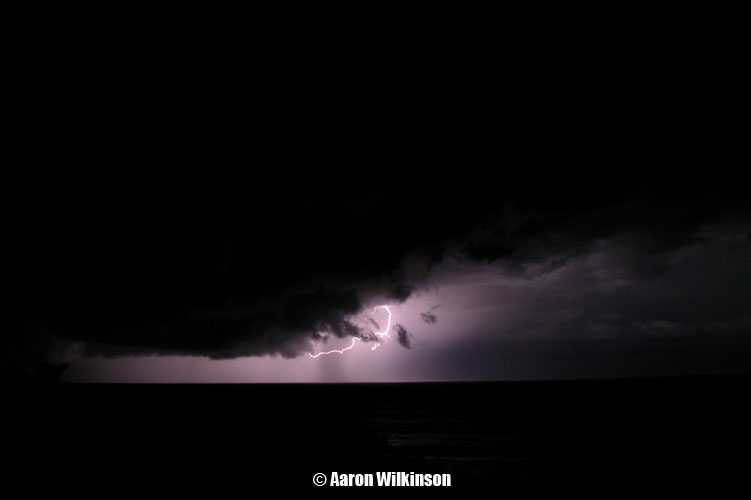
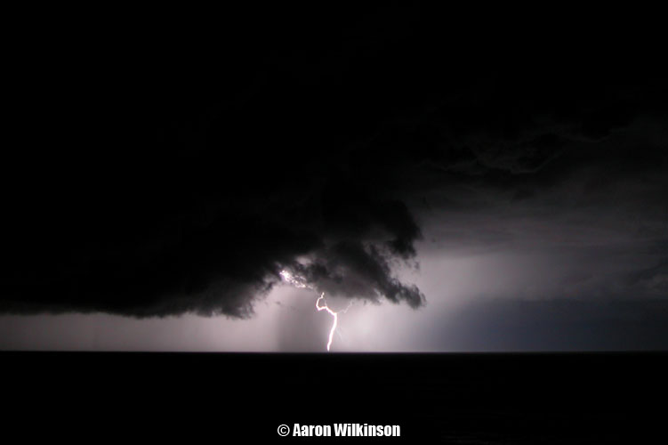
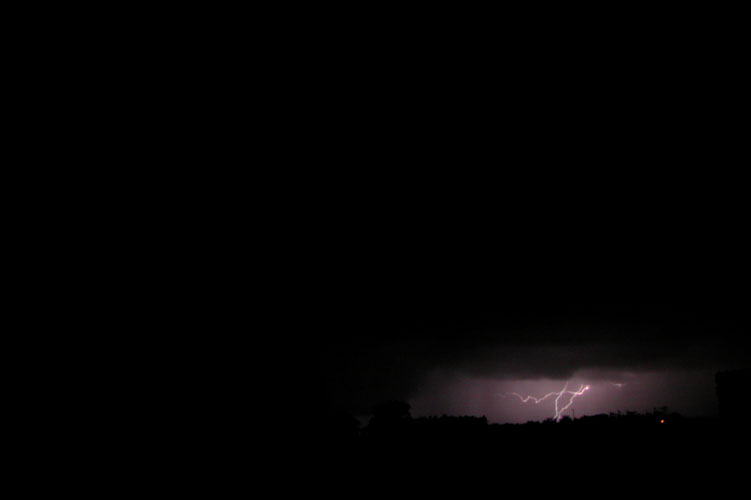
It was quite high based but looked photogenic with the mouth of the Selwyn in the foreground. Not long after a break in the clouds to the west let the sun in and bam the ground was lit up amazingly bright, the clouds became very dark looking with this contrasty situation upon us. Made for some nice looking photo’s and this is about the time the lightning bolt shot out.
In the last photo above it looks like I might have dust on the lens or sensor but infact it was all these bugs flying around in groups! And that was it! Atleast we didn’t have to go far, oh how sad the times are when I cover a report such as this. But it was a brief thunderstorm, atleast we got out there as it could’ve developed into something a bit more but this time it wasn’t to be.
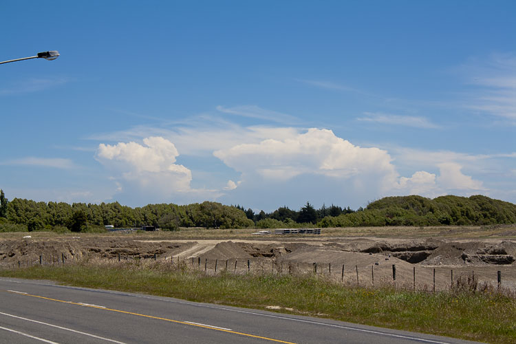
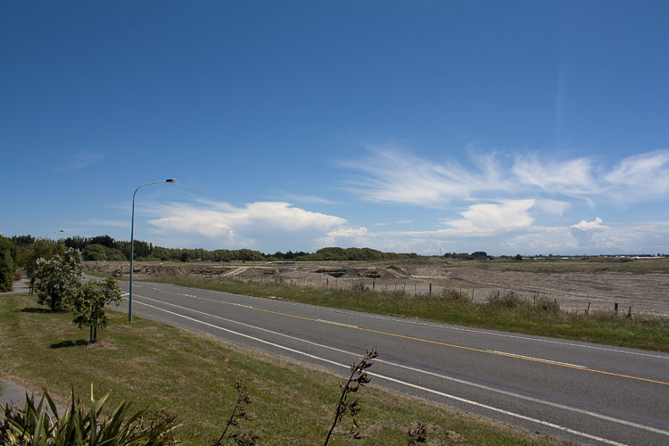
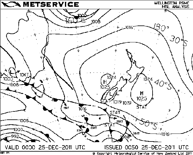
And here are the storms that appeared on Christmas Day with associated MSLP maps. A bit odd happening in the middle of an anticyclone but it can happen if conditions suit.
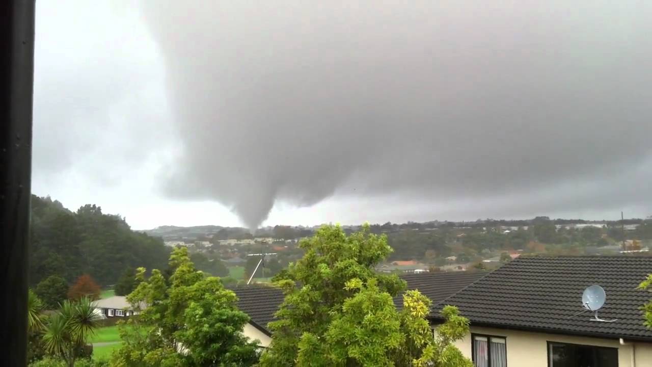
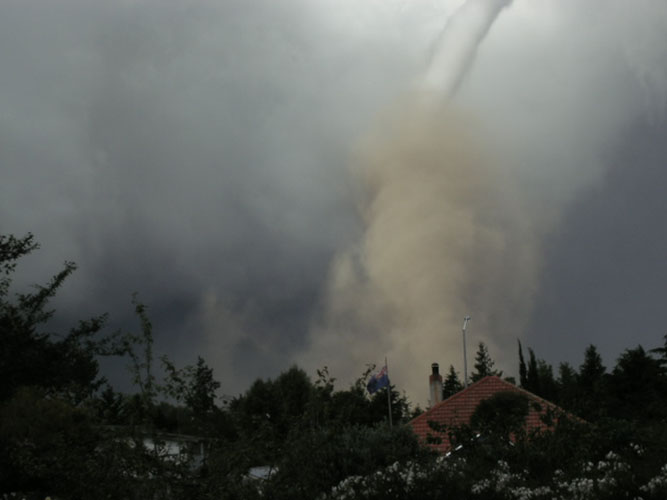
Normally I’ll only report on chases I have been on however this event was quite extreme so thought it was worthwhile including here, sadly this tornado was fatal and injured many others.
A low in the Tasman Sea directed a series of troughs over the North Island on this day, model data was suggesting at 3pm NZST for Auckland:
Li’s of -2.5 CAPE around 600 Winds speeds near the surface looked okish, directional wise shear wasn’t great. Upper level shear (wind speeds) were lacking a bit to. Model data suggested 19 knot NNE winds at 975mb getting up to 24 knot northerlies at 800mb, the wind tilting around to the NNW above 700mb and sticking to speeds of between 25 to 30 knots for the rest of the profile.
The tornado occurred at about 3pm when surface temperatures were 19 °C and dewpoints 18 °C, the cloud base was therefore quite low which is good when tornadoes are concerned. There was a weather balloon sounding around 11am at Whenuapai (Auckland). It showed:
Li of -2.33 CAPE of 486 and total totals of 51.7 SWEAT Index of 216.6 It also showed 20 knot NNE winds at 950mb and 25 knot NNW winds at 750mb. Winds were similar in the sounding to the model for the upper atmosphere, the wind peaked at 35 knots however at 300mb from the northwest.
Yes while this is unstable (not majorly unstable mind you), the shear profile on the sounding and in the model data didn’t scream tornadoes were going to happen by any means. A good indication of possible tornadoes is the SWEAT index, here’s some figures as follows:
SWEAT values +250 indicate a potential for strong convection. SWEAT values +300 indicate the threshold for severe thunderstorms. SWEAT values +400 indicate the threshold for tornadoes.
We had a SWEAT figure of 216.6, going by the table above it doesn’t exactly make you think tornadoes are possible. Still, there is one more contributing factor to this tornado that tipped the balance it seems which would’ve been the local geography in the area with the winds getting twisted around much like water when it flows around a boulder in a river, it forms an eddy on the other side. This seems to be a major factor to the way some tornadoes form in New Zealand.
Metservice have a write up here which has a more indepth look at what happened on this day.
I’m not a big expert on tornadoes by any means but understand some basics, so if anyone would like to make a more informed comment please get in touch, I can send you alot of model data I saved at the time.
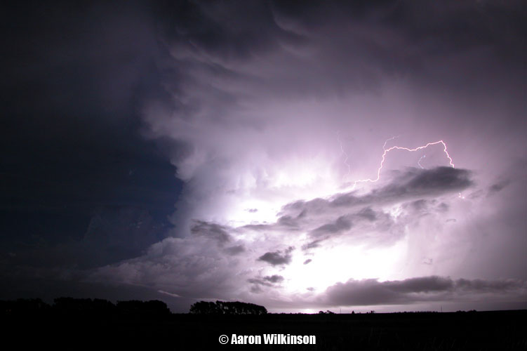
2010 was a very slow year for thunderstorms in Canterbury, I could see in the models potential for thunderstorms on this day however so after work headed south with a friend Mike and we set up near Ladbrooks south of Christchurch awaiting the front moving in. The timing was good in that we were both free to chase when the front arrived. The West Coast of the South Island got some interesting weather in March 2010 also with a tornado reported in Murchison the same day as these storms that moved through Canterbury, it hit there at 1.30pm in the afternoon. The very next day a tornado hit just southeast of Greymouth in Marsden at 3.45pm on the 25th March, so goes to show the weather can be quite interesting in New Zealand at times.
So, back to the chase. Me and Mike set up around 6.30pm near Ladbrooks and took a few snaps of the approaching gust front.
We observed some lightning from this location, as the southerly started to hit we thought it best to be on the move back towards Christchurch so we could keep ahead of the storm. I took another photo as the gust front moved over us from a spot not far from where we started. And here’s a lightning frame taken from video footage, still south of Christchurch at this time.
Overall I didn’t take too many photos chasing this time round as rain was falling quite often after this point on. We did video alot though so a chase summary video is available at the bottom to watch.
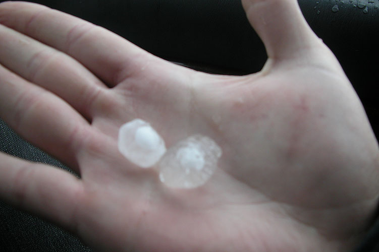
We went back towards Christchurch heading through Halswell then Cashmere, then drove up the port hills to the summit road to watch the storm as it headed over Lyttleton Harbour then off to the northeast beyond the coast. We saw some small hail had fallen on the tops of the port hills a bit earlier but nothing very big, pea sized perhaps. Mikey and me also saw a fair few more lightning strikes during this time and that’s about all the can be said really. Nothing amazing about this storm chase from our point of view but as always it was good to be out there.
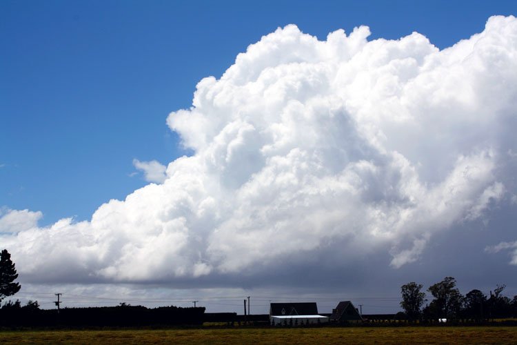
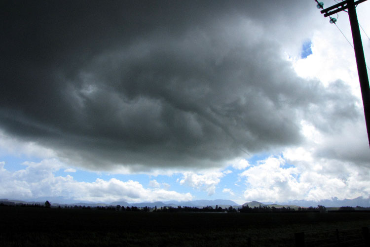
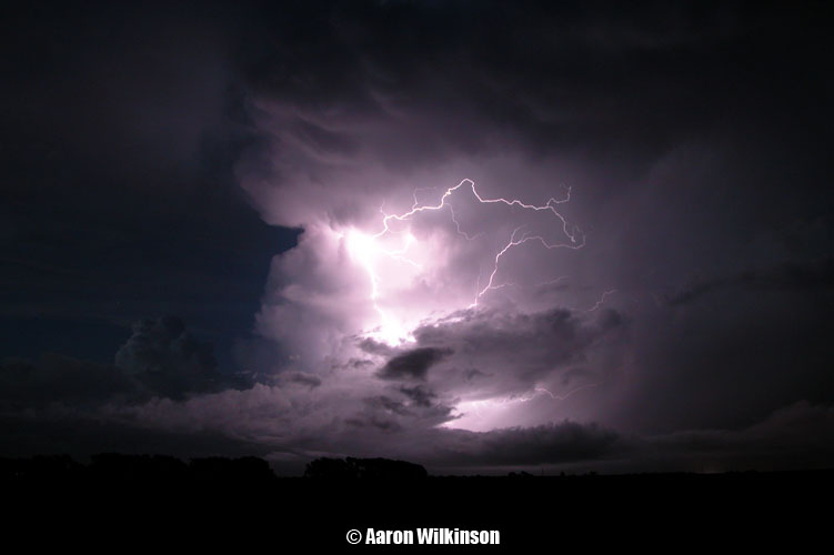
A great set up was on the cards! Very cold air (-27C 500mb) was moving over the South Island dragged up by a front which moved over the night before. A surface trough moved through in the afternoon and thunderstorms were the result!
There were some features about this day that did make it better then other days, there was a good northeasterly wind before the southwesterly came through giving a good convergence and provided good surface moisture, there was no cloud cover to hinder convection so things developed very nicely. I couldn’t say looking first off the shear was fantastic but these storms did form on the edge of a jetstream in the upper levels so that would’ve helped development, and of course the very cold upper air which meant hail!
This all developed on a Monday and normally I would be at work! But luckily I talked my boss in to letting me take a half day of annual leave, he let me so it was all systems go! Steve scrambled to get the afternoon off aswell which he managed so we met up then headed inland to begin the chase! By this stage a Cb had already blown up with it’s anvil hung over the city but as the main change hadn’t come through yet we figured there was more to come which there certainly was, we saw some mammatus as we headed out down Straven Road.
Once out west onto the plains we saw further development and took some photographs, we would’ve been out somewhere near Horarata.
Things looked promising and we stuck on a cloud that got quite dark and
big. We slowly followed it north and lightning did start to happen along
with some hail which started falling, not huge but something. Still,
the southwesterly change we were expecting hadn’t arrived yet so we were
wondering. While exciting looking we decided to head south as we could
see a meaty looking line moving up from the south on radar and this was
we suspected the main front coming through, Metservice had also just put
out a severe thunderstorm warning for this line / cell we could see on
the radar to the south so it made sense to go after it.
This is where the chase went all wrong for us and I still cringe that we made the wrong decisions this day. While on the way to the cell further south we got a txt from another storm chaser friend Ben that a funnel had formed near Waddington out’ve the dark cloud we were initially on!!! We turned round and started heading back to where we originally were, but on the way it became clear we couldn’t catch this cell to the north as it was now too far north. So there we were in the middle of these two cells with clear sunny skies above us! Realising the cell to the north was to far north we headed back south again and waited for the second line to come through, unfortunately by this stage we didn’t experience any lightning or thunder. The gust front looked quite good but for some reason the cell had run out of steam.
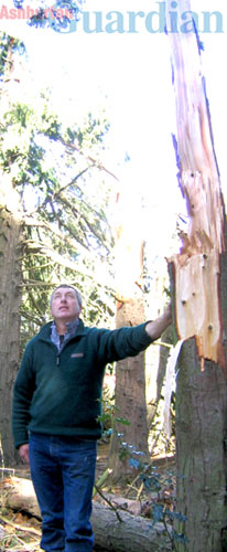
Still, the chase was ok and atleast we were out there. Even gave some footage to TVNZ and appeared on the news the next evening regarding the storm to the south which dropped big hail in the Methven area. Worse was to come though, a few days passed and then an article appeared in the Ashburton Guardian about that big thunderstorm to the south. It mentions that a farmer saw a tornado estimated at around 80 to 90 metres wide in the Methven area around 4pm. Going back we realised we were right on que to see this storm and were about 15km from crossing the Rakaia Gorge when we turned back to try and get the funnel to the north, if we had’ve just stayed on course and kept going south we possibly would’ve seen this tornado and got the big hail that fell that day. It was unfortunate we missed it but I did learn from that situation, I tell ya. Here is the article and picture of the trees it damaged. Twister slices through farm, By Susan Sandys – December 17 2009 A twister ripped through the Methven farm of Ross and Adrienne Richards on Monday, damaging buildings, slicing huge trees and cutting a swathe through crops. “We were incredibly lucky really. You can see the line it has taken, it’s just missed the house,” said Mr Richards as he assessed the damage on his property yesterday. The twister was accompanied by spectacular lightning and preceded a ferocious hailstorm, which caused more than $1 million damage to crops on farms throughout Methven, Lyndhurst and Mayfield. A digger operator working on Mr Richards’ farm at the time witnessed the small tornado. “It was collecting everything in its path,” he said. He estimated its width to be 80 to 90 metres, and it had cut a path through crops the length of the farm, doing more damage than the hail. “You can see one part of the paddock (of crop) lying one way and the other part lying the other way,” he said. The worker said he had seen twisters before. “You get them in the harvest, but you only get wee ones when the weather changes, but this was very, very wide and very, very strong,” he said. Mr Richards did not see the twister, and almost could not believe one had hit his farm, but had no other feasible explanation for the damage. About half a dozen 20-metre tall trees in a plantation had been topped to a third of their size, while surrounding trees were unscathed. Nearby a garden shed was flattened, a hay shed had its roof lifted off and large hay bales tossed outside. Two huge 130-year-old macrocarpas were felled. A 40-metre high Wellingtonian was cut to two thirds of its height, and the weight of its trunk pierced into the lawn near the Richards’ home, partly burying itself. Mr Richards said he had lost about 20 trees. He had been working in the farm’s woolshed when the storm hit, and said the sound of the wind and hail had been deafening. Adrienne and their two sons Bryce, 14, and Douglas, 11, had been inside the house, staying away from windows.
Pictured: Methven farmer Ross Richards surveys the path a twister took through a plantation on his farm. – Photo Susan Sandys
Ben got some photos of the funnel near Waddington so here they are, and I’ll include some video he took of it when he was out in the video section below.
Steven Graham got a fantastic Panorama of the southern thunderstorm line that moved through, a nice big gust front!
TV One news report below which appeared the next evening (15th December) and a chase summary video from me and Steve. When the TV One news item screened they or me for that matter hadn’t heard about the tornado by that stage. I’ve included footage from Ben Rodriguez at the end of the chase summary video when he was observing the funnel cloud, the auto focus must’ve been on while he was filming hence the back and fourth at times.
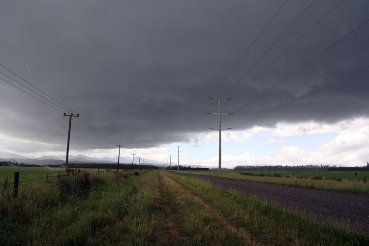
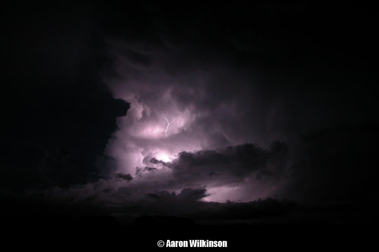
A fairly normal thundery set up today with a front moving over the
South Island during the morning then cold upper air moving over in the
afternoon with a surface convergence acting as a trigger. This day could
have been better if it wasn’t for a gusty surface northwesterly about
north of Rakaia that dried the air out a bit, where this convergence
formed near Ashburton there wasn’t any surface northwesterly but it
wouldn’t have been to far up in the atmosphere and didn’t let these
clouds reach their full potential.
Even though things didn’t look very good with a gusty northwesterly in
Christchurch we headed south anyway mid afternoon with the hope it might
drop out and something would develop near Ashburton, that is pretty
much what happened. Things developed late and around 5.30 or 6pm it went
quite still, hardly any wind and it was very pleasant. A good sign that
we were in the convergence zone. Cumulus started to develop then formed
into a line heading out to sea.
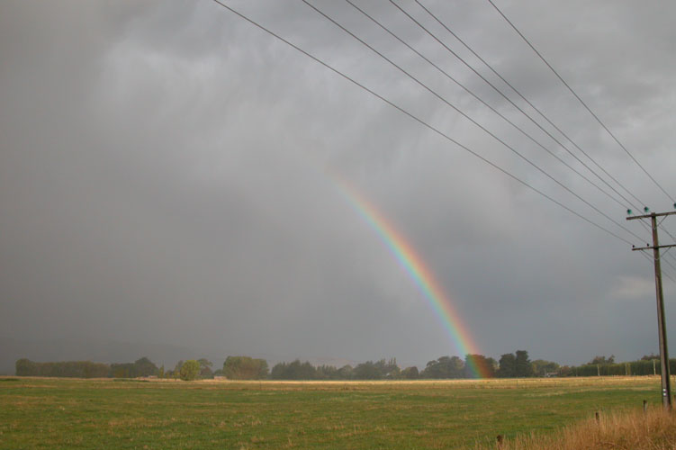
We repositioned slightly and ended up at the intersection of Singletree and Fairfield Road judging by one of my photographs, we were definitely on Singletree Road anyway…. This convergence line started to produce a shower and also some small hail. And low and behold one rumble of thunder came from up in the cloud somewhere, lol. This report isn’t one where there was a terrifying storm bearing down on us, the reason I put it up is first of all, to atleast give this site some more content! And second (probably more importantly), this small convergence line produced some great photos! The lighting and time of day, the rain and clouds make some of my other photos which come from full on thunderstorms look worthless. And normally I would consider powerlines a nuisance when photographing thunderstorms but in this instance the light created a visual feast!
This is the last report I would use my trusty Nikon 5700 digital camera, it was a great camera and used with good hands amazing photos could be made.
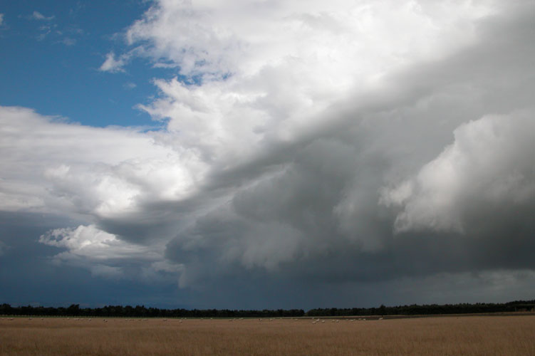
It was a long time waiting but a good setup was finally on the way and alot of us Christchurch chasers were free! I put the word out to a few storm enthusiast friends to come over as they wanted to do a group chase, and then we headed out when things looked good. Most of the time as bad as it may sound I don’t like to do group chases as I don’t want to have to make decisions for others while in the field, if it’s just me I can deal with my own decisions whether they end up being fruitful or if nothing happens at all then I don’t have to worry whether others might be let down etc..
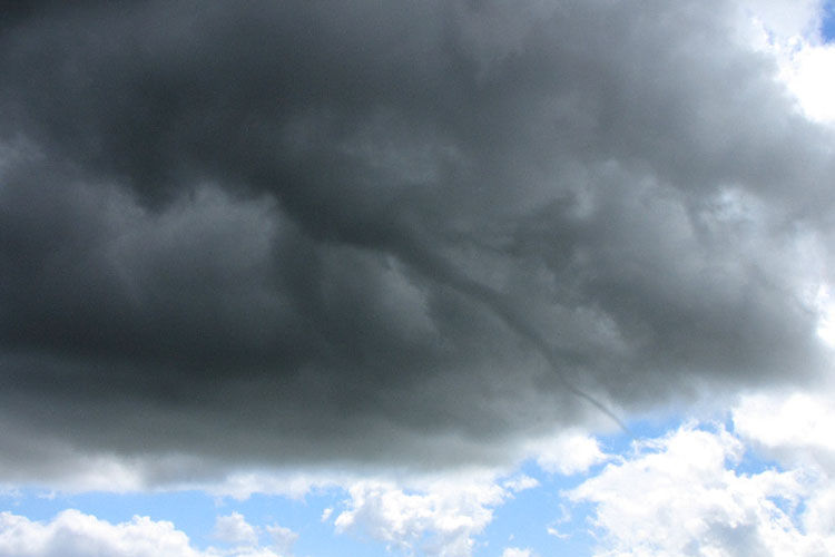
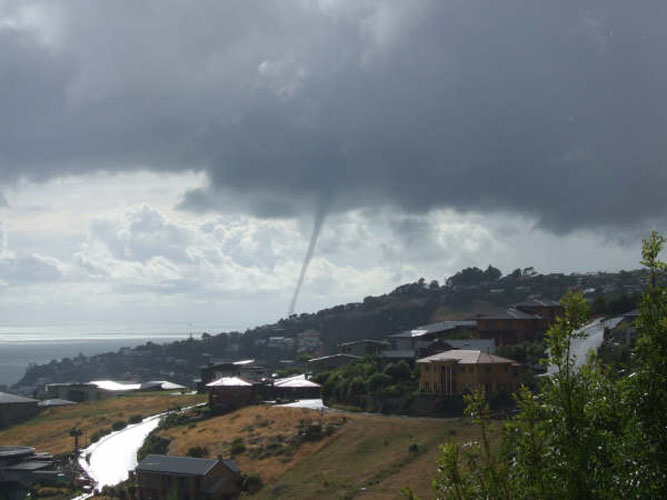
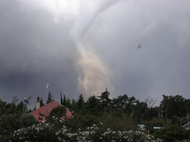
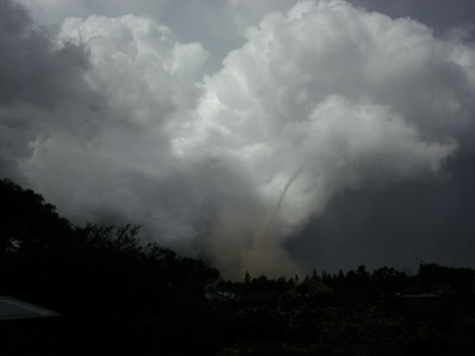
Convection started off quite early on this day, the main trigger (a convergence) we were expecting wasn’t due till the afternoon however the air was unstable once the surface temperature got up enough in the morning. Banks Peninsula acted as a trigger and a cumulonimbus cloud formed around 10am which then produced quite an amazing looking waterspout! My cousin Lanie Astley who lives up on the Port Hills managed to snap this shot of it, it went down into the water just off Scarborough. There are quite a few other great photos of this event and a search on the internet may reveal others. We gathered around midday then headed up to the top of Kennedys Bush Road to see what was going on over the plains.
We couldn’t deduce much at this stage and briefly thoughts of missing the main event of the day started to creep in, was the thunderstorm that happened in the morning it?? But we thought of course more is to come, we headed back to my place and had a look at the weather radar and saw some development south of the Rakaia River and so that’s where we headed. Once near the Synlait Milk factory in Dunsandel the clouds started looking really good, we turned off the main highway and followed a road around the back of the factory when a funnel came into view! All of us terribly excited by this jumped out of the car and started photographing it and videoing. I didn’t have the tape on my video camera at the right spot unfortunately and missed videoing most of it apart from a little bit as it dissipated towards the end. Stephen Burrows managed to get a photo of it though but it quickly became rain wrapped and we had to jump back in the car.
Here’s a “link” to a video Andrew Massie took of the funnel while out chasing with us.
After the funnel had looked to of died we decided to move further southwest, an interesting aspect of these initial storms was in a way at the surface they were moving from northeast to southwest which is a very unusual track for storms in Canterbury to take. Most of the time they will move southwest to northeast. From memory an eventual southwesterly change moved through pushing this system to the north later on in the day. We crossed the Rakaia river then headed south a bit more before going inland and set up waiting for further action, the skies did look quite thundery. Eventually a wall of hail looked to form and started moving towards us, even the sheep in the paddocks near by knew something was up as on mass they all started heading for the shelter of the hedges.
The hail got closer and closer then started falling pinging off the car everywhere, it seemed to go on for quite a while and was relentless. It also got quite big, some of the biggest hail I’ve been in while out chasing in Canterbury up to around 2cm in size.
The roads near the end of this event became quite white and when we drove off driving became difficult for a time.
We drove south after this to just north of Ashburton where we waited around for a bit at a rest area, other people looked to have the same idea to as the weather conditions made driving quite treacherous. Not much seemed to be happening so we started to make the journey home, on the drive north we could see a storm had developed just south of Christchurch and looked to be moving over the city. Steven Graham went out and managed to capture a few photos of lightning with his digital camera at the time which are superb!
Mike Stewart and Jason Tippet who were following us in their car for most of the chase arrived back to Christchurch and the streets were flooded near Mike’s place in Addington! Especially the intersection of Lincoln and Wrights Roads. A memorable chase for us all that day with a funnel sighted and big hail!!
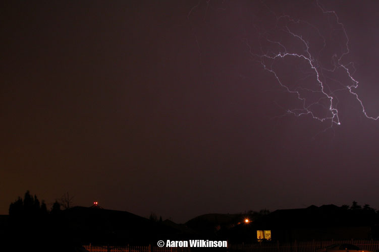
I was almost going to pass on 2008 all together and not put anything up but thought I had to put something, even if it was just one photograph. This storm was it!
This thunderstorm that moved through on Thursday, 3rd July 2008 was quite unexpected. Canterbury doesn’t get that many thunderstorms in general, and not often at night. Least of all in winter! But that’s what happened this night. I saw a small southwesterly trough was due around 9 or 10pm when these storms developed but immediately discounted it as I just didn’t think anything would happen at this time of year and nothing had happened in such a long time so why would tonight be any different? Goes to show the weather can surprise you.
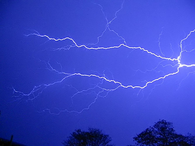
The amazing thing with this storm and it was noted by quite a few people around Christchurch was you could hear it coming. The reason being was the hail, it slowly got closer and closer and we wondered what was going on with this roar getting gradually louder. Hail would’ve been upwards of 10mm in size but because it was so still before hand the sound travelled quite well, imagine a big wall of hail bouncing off tin roofs in the still of the night getting closer and closer. That would’ve been part of the reason for the roaring sound. 2007 and 2008 were pretty slow years in Canterbury for storms and when you’ve been out’ve the picture for that long you get a little slack, I didn’t have my video camera charged so didn’t get any video unfortunately. I literally got only one photo of any thunderstorm type situation for 2008 and it was of lightning from this storm!! There were some other bolts that went off but bad timing meant I didn’t get any others. So here it is, the one photo of 2008 of some lightning, in Canterbury, in winter, at night!???
2007 was not a very good year for thunderstorms in Canterbury, only
got out to chase two times and this is the only day that resulted in a
set of thunderstorms for us. The thumbnail for this day may allude to a
spectacular thunderstorm of some sorts but for us it was fairly average
where we chased just south of Christchurch. Sometimes storms that aren’t
always powerful can be quite photogenic. In town there were reports of
surface flooding in quite a few areas, I’ll put a story below that
appeared in The Press about the storms that moved through.
Being a Sunday me and Steve were both free, we headed just south of
Christchurch and got set up near Burnham to await the southwesterly
change coming up around 1pm. We saw some lightning and heard thunder but
it wasn’t overly exciting, atleast it was something I spose! A nice
inverted u shaped gust front moved over. Steven Graham was also out just
south of Templeton and managed to get some lighting on his DSLR camera
using a fisheye lens, unfortunately it was quite faint but hey better
then nothing once again.
After this gust front moved through nothing felt exciting but we saw some development a little closer to the coast so moved east / southeast. A more direct southerly wind change moved through and with it brought quite a nice looking gust front, there was no thunder associated with this front but it did look good. Steve’s image is to the left and mine the right, by this stage Steve had got a Canon DSLR camera and it does provide a better quality image in this instance. After that we went home and the day was over, a long wait was to set in until any other storms occurred near us again. Not until winter 2008!
Sudden storm sweeps into Christchurch By ARWEN HANN – The Press | Monday, 19 March 2007
Heavy rain and hail lashed Christchurch yesterday as thunderstorms swept up the South Island.
The severe weather arrived at noon, with thunder and lightning, accompanied by heavy rain and hailstones up to 10mm in diameter, and strong wind gusts.
The rain caused surface flooding across much of the city, including Eastgate Mall where the main lights had to be switched off while staff worked with mops to clean up. Dan Fish, from Left Hand Path tattoo parlour in Linwood Avenue, said he and his staff had managed to continuing working, despite water coming into the shop.
“It wasn’t too bad. We were clearing it up with mops and towels, anything we could find really,” he said. “It wasn’t a lot of water, but it seemed to come in waves when a car or a bus went past the shop.” Fish said it would be a day or two before he would know whether water had seeped under the floorboards, causing any damage. Lightning strikes caused power breaks around Springston, Rolleston and Woodend, with some areas without power for nearly four hours. Fierce winds on Lyttelton Harbour capsized a small yacht, forcing its occupants to swim to shore.
The single-masted trailer-sailer had left the Charteris Bay yacht club before the southerly hit, overturning the vessel not far from shore. Several people in motor boats helped the owners pull the yacht to shore at the eastern end of Charteris Bay. No-one was seriously hurt.
MetService lead forecaster John Crouch said the bad weather had been predicted in line with a southerly change. Most of the thunderstorms had formed north of Ashburton before moving over Christchurch in front of the southerly winds. Crouch said two or three thunderstorms had formed very close to each other, producing heavy rain and hailstones up to 10mm in diameter. The bad weather extended over most of Canterbury, with Christchurch experiencing thunderstorms, hail, heavy rain and gusty winds at noon. Further storms were expected near Darfield. Christchurch International Airport had escaped relatively unscathed. Today was forecast to be fine after clearing overnight, but with cold southerly winds.
A Christchurch City Council spokeswoman said the downpour had caused some flooding, mainly where leaves had blocked drains. However, there were only minor problems and most areas had cleared quickly, she said.
Looking at weather models I could see potential for thunderstorms on
this day 4 days before it happened but unfortunately I was rostered to
work and I couldn’t do anything about it! I would’ve headed south and
possibly encountered this tornado that happened in Waimate but what can
you do! Still tried my best though and finished work as soon as I could
to go out chasing as the front hit just south of Christchurch around
5.30pm.
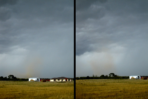
We didn’t get a tornado where we were chasing but we did get a vortex
type feature called a gustnado. A gustnado isn’t formed by the same
principles as a a regular tornado, they have more in common with whirly
whirlies but just on a massive scale typically forming on the gust front
of thunderstorms. I happened to be videoing in the right place at the
right time and you can see this thing form and grow then blow apart, it
was rather short loved but am rather pleased with it. The video
definitely gives a better idea of it with the footage speed increased.
Here’s a comparison shot Steve took showing it forming and then when it’s got a bit bigger.
After this gust front moved through we headed south for a bit but it just seemed like all we got was rain and nothing more so we started to head back home. As we thought it might be over we went to KFC to get a twister combo each in Hornby, then as we were sitting in the restaurant we saw a flash to the south so we were off again around 7pm as a new cell moved up. The twister combo proved to work it’s magic once again! Me and Steve continued to chase for the next hour or so before going home, we videoed some lightning and the skies at times did look threatening. Steven Graham took a photo of the approaching gust front in Templeton and then went out later around 8pm and got a few lightning photos from inside his car which are pretty cool. I tried around 8pm aswell but had no luck, it was hard with still a fair bit of ambient light about and lightning being not frequent, also areas of rain.
Still the main event of the day was the tornado in Waimate of course, I believe it was about 1 or 2pm in the afternoon. Li’s were showing to be around -4 to -5 which is big figures for New Zealand, cape a little more modest around 550 but models have a bit more of a hard time dealing with New Zealand conditions due to it’s narrow land mass but they are getting better. Golf ball sized hail looks to of fallen this day aswell, this cloud system appears to of been a low toped supercell similar to it’s American cousins. A lady by the name of Laura Chamberlain got some magnificent photos of it, here they are courtesy of Steven Williams.
Here’s an article which appeared on stuff.co.nz about the Tornado, a bit long but thought it was informative:
March 8, 2006 By JOHN KEAST Stuff.co.nz – Wellington, New Zealand
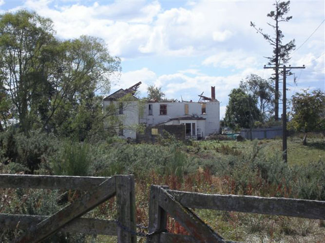
A brutal twister left a family of five homeless as it carved a destructive 1.6km path through rural properties south-east of Waimate, in South Canterbury, yesterday afternoon.
The tornado ripped the heart out of a 23-room historic property, uplifted mature trees and sent farm animals flying. “It was exactly like that Twister movie,” said Waimate resident Laura Chamberlain. “It probably took about 40 seconds from the time it started coming out of the clouds to the time it hit the ground. “It kept coming further and further towards the ground, then it touched the ground and started sucking everything up – grain silo, sheep. They got sucked up and spat out.”
The historic Downlands homestead destroyed by the tornado was rented from Charles and Dorothy Ruddenklau by the Fahey family of five. Denise Fahey had left the two-storey property just 15 minutes before the 40m-wide twister carved off most of the top floor and stripped bare a tall douglas fir before crossing farmland and carting a boat more than 50m. Before it hit the Ruddenklau property, the tornado shredded two implement sheds owned by Lester and Francis Paul, who live 1km from Downlands.
Chamberlain had found a shaken black kune kune pig that had been sucked into the tornado and lifted across to another paddock. “I was out having a look, standing out on the side of the road asking a guy if he needed a hand,” she said. “He said, `My sheep are dead and I’ve lost my pig’. The next minute, I could hear the pig oinking. He was stuck in a tree and came out from under it. It was unreal, totally unbelievable. I’ve never seen anything like it.”
No-one was injured in the freak wind, but police believe if anyone had been in the two-storey house they would have been sucked out as though they were tissue paper. The homeless family members – too distressed last night to talk – are staying with friends, and a big community effort has begun. Francis Paul said she heard a call on the radio-telephone before the twister hit. A voice said: “Have you got thunder? I think it’s coming your way.” There were a few spots of rain, then hail the size of golf balls, and finally a ghastly noise. Paul said she picked up her two-year-old granddaughter, Emma, as dust and debris began to fly. She tried to ring neighbours, but the power was off. She managed to reach her husband on a cellphone. As she spoke, sheep and calves ran towards fences. “I thought they would run through the fences. I can’t describe it. There was a boom. I can’t describe it,” she said. The twister, slanting in from the north-east, toppled a silo and shore off fence posts as it pushed flying tin against them. Then it crossed paddocks, dumping debris, knocked the centre out of a stand of macrocarpas and headed for Downlands, built in 1868. It sucked the roof off, exposing upstairs rooms and vacuuming their contents. It flattened foliage around the house and took all the branches off a tall douglas fir. Charles Ruddenklau said the future of Downlands was not known but he was grateful the family renting it was away when the vicious wind struck. He said the house had been his family since the 1900s. Ruddenklau said the tornado twisted off tall chimneys in its path. “I can’t get my head around it. If it had been a fire, yes, but this family (renting the property) is devastated,” Ruddenklau said.
Sergeant Mike van der Heyden, of the Waimate police, said the close-knit Waimate community was working overtime to look after the displaced family and to protect the homestead. The local Rotary club was guarding the property and fire volunteers had taken out and stored the family’s furniture. Waimate resident Steve McGirr said he saw whispy white cloud against a black background before the twister formed. He said the whispy cloud kept turning over and growing in size. “And then I realised it was a twister. It got fatter and suddenly, whoomph, it went orange from bottom to top. That must have been when it touched down. I thought it was out near Morven, but it was just here ( south of Waimate),” he said. McGirr said he was so worried he called the school to warn it of the tornado. “I was scared,” he said.
Waimate District Council building inspector Greg Adams said he was working near Waimate when he saw lightning and dust forming in the air. “I got my phone out to take a picture. I must have been 4km or 5km away when I saw it,” he said. “It sounded like continual thunder, and then I felt this pressure. It must have been the air pressure. I could feel it in my head. It was pressure building up. And then it disappeared,” he said.
Waimate Mayor John Coles said there were initial reports that more twisters might follow, but that did not happen. He said the local civil defence operation worked perfectly, and he praised the efforts of all who had made offers of help.
Long-time residents said this was the first tornado to hit the area. On March 10 last year, a tornado tore through Greymouth, leaving buildings wrecked, power cut and stunned residents in tears.
Cold air aloft had been sitting over the South Island since yesterday, on the 4th January there was a late night thunderstorm that had come up the coast south of Christchurch. On that day me and Steven Graham went out late afternoon / evening and saw some Cb’s but nothing seemed to really fire so we went home as it started to get dark and we thought chances had all but gone. Around 2am a thunderstorm did happen where we were but unfortunately I would’ve been asleep!
The very next evening however was a repeat and this time we were prepared to stay out and wait till something happened, it was a good thing we did! This time I chased with Steven Burrows.
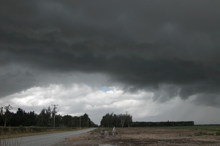
I finished work around 4.30pm and Steve came over, we then headed south down state highway one. The decision was made to drive inland behind Ashburton and have a look around but nothing much seemed to be happening at this point, we then did what now seems to be a tradition on storm chases if we can. KFC in Ashburton was the ticket for a feed and we got a twister combo each, twisters and thunderstorms go together right? Haha, maybe it provided the edge we needed as this night proved to be one of best night time lightning shows I’ve ever seen in Canterbury. We then went back inland behind Ashburton and sat there for a while looking at all the nice big clouds going up, unfortunately they didn’t seems to be all that active despite looking great. Steve and me did hear some distant rolls of thunder. There was one main cloud gathering some steam so we focused on that and followed it to the coast at which point it headed offshore, it didn’t seem to do alot.
Sitting on the coast near the Ashubrton river mouth darkness slowly began to develop as time pushed on, hope was fading of any new cells developing as we figured the land would lose it’s energy / heat from the sun of the day. However, all of a sudden an easterly or northeasterly surge developed around 9.40pm and a cloud inland started to brew. We didn’t move strait away but kept an eye on it, by 9.50pm it was the obvious choice to chase this developing cell so we were off inland as it got bigger and bigger, I took a photo of the developing cloud before we went on a little further.
Somewhere half way between the Ashburton River mouth and Ashburton itself we set up as the cloud looked ready to pop, then flash! We sat here in this position for a little while photographing this amazing thunderstorm.
The photogenic aspects of the cloud seemed to disintegrate a little after about 20 minutes so Steve suggested we move closer to the storm to get underneath it, we were on the move and travelled for about 20 minutes to get inland behind Ashburton. The thunderstorm continued to deliver a great show on the way there which I filmed, once in location I got some further great lightning photos but perhaps not as spectacular as our first spot. Some lightning bolts were amazing but they were so bright they overexposed my shots and rendered them useless, didn’t take photos in RAW back then but even then there would’ve only be so much I could do. Me and Steve stayed in this spot for around 40 minutes, heard alot of thunder and saw alot of lightning. Even met up with a local that came down to view the show going on.
The storm seemed to be losing strength after 40 minutes so we moved off following it in some sense although it was hard to figure out it’s exact movement being it was dark and we didn’t have access to any online data, look for the flashes was our only option. There was alot of hail on the road at one point which was cool although we never experienced any hail falling during this chase.
The only options to cross the Rakaia River are near the coast and near the gorge so we travelled towards the coast to cross there then went north and towards home around midnight. One of the best night time thunderstorms I might ever chase in Canterbury, especially because it was slow moving and we got to stick with it for quite a while. Hopefully at some point in the future I get to go after one of these storms again. Enjoy the video below!
The weekend of the 12th and 13th November 2005 showed promise to be a thundery one in Canterbury. Thunderstorms occurred on both days however we didn’t have much luck with the ones that occurred on the Sunday due to a mixture of us being in slightly the wrong place and they weren’t as vigorous as the ones on Saturday. So here’s a report for the Saturday storms.
We had been keeping an eye on the weather models and saw potential on these days. As the days drew near it appeared Sunday was the slightly better chance to us but infact Saturday turned out better, go figure? Metservice put out a thunderstorm warning in the morning on Saturday which read:
“Severe Convection/ Thunderstorm Outlook Valid to: 12:00 am 13 Nov 2005 NZDT Issued at: 9:15 am 12 Nov 2005 NZDT
The air mass is expected to cool aloft this afternoon in the wake of a frontal band crossing the area this morning. Afternoon heating and an onshore convergent wind flows are expected to lead to scattered showers and thunderstorms in Canterbury and eastern Otago and also in Southland.
Thunderstorms are expected to be the most vigorous in Canterbury and this gives rise to the potential for isolated hail possibly as large as 25mm. Therefore, a moderate rise of severe thunderstorms is depicted on the map for mainly inland Canterbury. These storms are expected to drift towards the coast after having developed inland.”
This can be a good situation for Canterbury, you often get a frontal band which crosses over the South Island coming up from the south or southwest. Sometimes the surface winds can go southwesterly but then die down once the band clears, then you get a clearance (some heating from the sun) with light winds or perhaps even a northeasterly may develop awaiting a trough which comes up a bit later in the day. Sometimes the surface winds might not even change to the southwest as was the case this day with the initial frontal band.
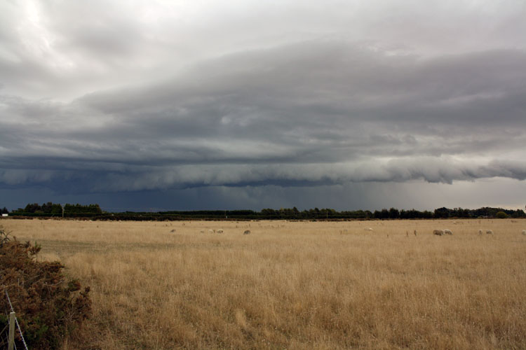
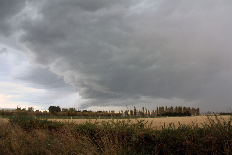
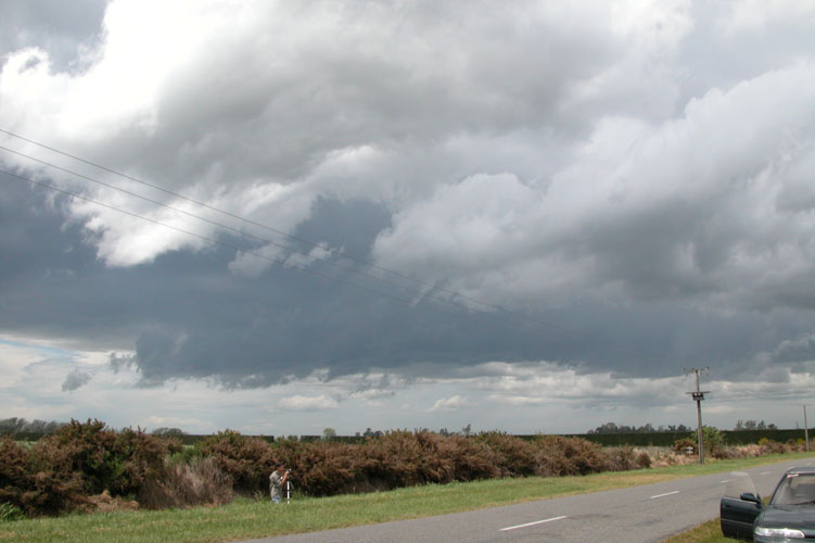
So as the clearance developed behind the initial front the sun came out and this provided much needed heating, dewpoints were up around 11 degrees with temperatures around 20 to 22 degrees. Enough to create an unstable atmosphere with the upper air cooling. Stephen Burrows and myself headed south towards Dunsandel then went inland, we set up and watched a nice cell developing infront of us which was producing a gust front.
We observed lightning from where we were and although we didn’t experience any hail on this chase there could well have been some within the core of this cell in the photos above. As the gust front neared the winds picked up quite a bit, we measured sustained wind gusts up to 59kph which is a 7 on the Beaufort scale, near gale. The front part of the gust front seemed to break off from the cell as well.
We left after the gust front went over and chased the storm northeast travelling through to Lincoln and just beyond. We experienced some moderately heavy rain but nothing to rave about, saw some nice lightning bolts which I recorded on video. As the storm moved offshore we observed some lightning coming out the back of it and saw some ok’ish mammatus coming out of the anvil as it slowly went into the distance.
We knew this day was coming, Stephen Burrows and myself saw in the
models very cold air due over New Zealand this particular weekend and
with it brought the potential of thunderstorms. As the day grew near we
were more certain then ever, some situations just stick out like a sore
thumb and you know thunderstorms are going to happen.
A southwesterly change was due in the evening somewhere down south, we
left Christchurch about midday and headed all the way down to Oamaru.
The plan, to wait there and then chase the storm as it headed north up
the coast. Once there we went to McDonalds in Oamaru for some tea and
then had a look around the area, the skies did look unstable and things
were fairly calm. It wasn’t majorly warm or anything but the upper air
coming in was very cold so it didn’t matter to some extent if the
surface temperature was a little cool, sea surface temperatures would’ve
been enough to help the convection. The storm motions allowed them to
come on land as they headed up the coast aswell.
We headed to a lookout which tourists often use to see penguins coming up the beach at the end of the day on the southeastern side of Cape Wanbrow, we did indeed see some of these critters coming ashore and shimmying up the hill into the bush where their burrows / nests are. Nothing much looked like happening at this point but it would be a great place to come back to when things started coming up from the south. We headed back to Oamaru to scout for different locations and found a lookout overlooking Oamaru and sat there for a while till things looked like heating up. As it got darker we noticed some distant flashes that looked to be coming from a thunderstorm that might’ve actually popped up somewhere inland behind Timaru, it looked relatively weak thinking about it but it did bring doubts for a brief time that maybe the action would start firing further north. Steve noted that behind us it looked like something was coming up from the south, we couldn’t see overly well behind us due to Cape Wanbrow being in the way so we drove back to the lookout we were at previously.
When we arrived there things started looking serious, we could see this dark edge forming and coming up from the south. Something had to start firing soon and then boom! Lightning! Cg’s and Ic’s started shooting out of the cloud, it wasn’t majorly active but it was moderately frequent. I was trying to manage my video camera and digital camera at the same time but still managed to do okay.
Steve also got a few shots of lightning, this one here is the same as my second one from the right above except he caught the second Cg that came down at that point in time.
As the gust front got closer we had to get on the move, we drove around the other side back to the lookout above Oamaru. We continued to see some flashes and hail started falling up to 13mm in size but it was too much above us at this point, with the hail falling we couldn’t really do any photography either. We could see the storm was now moving so we were off back north to Christchurch! We managed to chase this thing back through Timaru and perhaps just beyond, at this point the storm seemed to leap frog us perhaps due to this cell dying, then another cell developed just south of Christchurch as the surface southwesterly change moved through. At some point along the way north of Oamaru I managed to get a few more lightning photos but they were a little distant, still you’ve got to try. Also managed to get infront of the gust front at one point and took a photograph of lightning within the cloud lighting it up, a little hair raising at times as I was conscious about the fact lightning is very dangerous and this storm was right infront of us.
At one point when we stopped at St Andrews just south of Timaru and lightning was going off overhead. I got my video camera out and Steve tried to do some photography. Some lightning must’ve gone off strait overhead and for a brief moment Steve felt static in the air, I managed to capture the moment he feels it on video however I had an external microphone and I forgot to switch it to on so the video is silent!! Arghh, so all you see is him putting his hands in the air slightly and backing away from his camera. So that was literally a hair raising experience!! I didn’t feel anything for some reason however.
After we went through Timaru the lightning seemed to die down and we didn’t really see any more for the rest of the chase home to Christchurch. Christchurch most certainly did get a thunderstorm though as the southwesterly change moved through, hail up to golf ball size was reported in Burwood which is about 4cm across. Huge!! Makes you wonder if we should’ve just stayed in Christchurch eh? haha. But it is the way it is, we got some great photo’s and had alot of fun along the way. Here is some movie stills taken by Jon who was filming the wild skies in North Linwood at the time, quite amazing seeing some large hail illuminated by lightning flashes as it falls.
And a photo here showing the size of the hail he got.


